Sainte-Opportune-du-Bosc
Appearance
From Wikipedia, the free encyclopedia
This is an old revision of this page, as edited by Ksnow (talk | contribs) at 18:23, 14 November 2013 (→Population). The present address (URL) is a permanent link to this revision, which may differ significantly from the current revision.
Place in Normandy, France
Sainte-Opportune-du-Bosc | |
|---|---|
 | |
| Country | France |
| Region | Normandy |
| Department | Eure |
| Arrondissement | Bernay |
| Canton | Beaumont-le-Roger |
| Intercommunality | Beaumont-le-Roger |
| Government | |
| • Mayor (2008–2014) | Simonne Pimont |
Area 1 | 8.07 km2 (3.12 sq mi) |
| Population (2008) | 628 |
| • Density | 78/km2 (200/sq mi) |
| Time zone | UTC+01:00 (CET) |
| • Summer (DST) | UTC+02:00 (CEST) |
| INSEE/Postal code | 27576 /27110 |
| Elevation | 97–150 m (318–492 ft) |
| 1 French Land Register data, which excludes lakes, ponds, glaciers > 1 km2 (0.386 sq mi or 247 acres) and river estuaries. | |
Sainte-Opportune-du-Bosc is a commune in the Eure department in Haute-Normandie in northern France.
History
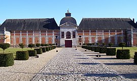
In 935 a big battle between William I, Duke of Normandy and Robert II took place near the town. The battlefield was called Champ-de-Bataille later and in the 17th century the Marshall of Créqui built a castle there.[1]
The Château du Champ de Bataille was owned by the Harcourt family and has formal gardens designed by Le Nôtre.
Population
| Year | Pop. | ±% |
|---|---|---|
| 1962 | 148 | — |
| 1968 | 145 | −2.0% |
| 1975 | 141 | −2.8% |
| 1982 | 192 | +36.2% |
| 1990 | 278 | +44.8% |
| 1999 | 334 | +20.1% |
| 2008 | 628 | +88.0% |
-
Château du Champ-de-Bataille
-
Detail of the garden of the castle
See also
References
- ^ Château du Champ-de-Bataille (french)
Wikimedia Commons has media related to Sainte-Opportune-du-Bosc.
Hidden categories:
- Articles with short description
- Short description is different from Wikidata
- Pages using infobox settlement with image map1 but not image map
- Pages using infobox settlement with no coordinates
- Pages using infobox French commune with unknown parameters
- France articles requiring maintenance
- Commons category link from Wikidata
- All stub articles
- Pages using the Kartographer extension


