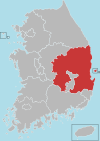
Seongju County
Appearance
Seongju
성주군 | |
|---|---|
| Korean transcription(s) | |
| • Hangul | 성주군 |
| • Hanja | 星州郡 |
| • Revised Romanization | Seongju-gun |
| • McCune-Reischauer | Sŏngju-gun |
 Location in South Korea | |
| Country | |
| Region | Yeongnam |
| Administrative divisions | 1 eup, 9 myeon |
| Area | |
| • Total | 616.28 km2 (237.95 sq mi) |
| Population | |
| • Total | 51,028 |
| • Density | 82.8/km2 (214/sq mi) |
| • Dialect | Gyeongsang |
Seongju County (Seongju-gun) is a county in North Gyeongsang Province, South Korea. This largely agricultural area is located immediately west of the metropolitan city of Daegu.
Lotte Skyhill Seongju Country Club (36°02′58″N 128°13′34″E / 36.049359°N 128.226223°E) was selected as the location for the deployment of Terminal High Altitude Area Defense (THAAD) system in July 2016.[1][2]
Seongju County is famous for its production of oriental melons. Farms in the county comprise about 70% of total oriental melon production in the country.[3]
Twin towns – sister cities
 Gwanak-gu, South Korea (2005)
References
- ^ "THAAD's new home will be golf course in South Korean mountains". STARS AND STRIPES. September 30, 2016.
- ^ Kang Seung-woo (13 July 2016). "Seongju confirmed as site for THAAD". The Korea Times. Retrieved 15 September 2016.
- ^ "韓国農水産食品-チャメ(マクワウリ)[Kankoku Nōsui-san shokuhin - chame (makuwauri)]". www.atcenter.or.jp (in Japanese). Korea Agro-Fisheries Trade Corporation. Retrieved 2018-09-17.
External links
35°55′09″N 128°16′59″E / 35.919119°N 128.283019°E


