
Shramkivka


Shramkivka (Ukrainian: Шрамківка) is an urban-type settlement in Cherkasy Oblast, Ukraine.
History
Modern Shramkivka was formed on the basis of four ancient cossack little villages - khutors: Shramkivka, Polubotkivka, Shelykhovka and Ivanivka.
According to one of versions here in 1660 at khutor Polubotivka was born Ukrainian hetman Pavlo Polubotok).
-
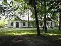 The village library, building of 1930s
 -
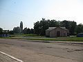 The center of Shramkivka
 -
 The center of Shramkivka
 -
 The school in Shramkivka


50°08′00″N 32°08′00″E / 50.1333333433°N 32.1333333433°E
This article about a location in Cherkasy Oblast is a stub. You can help Wikipedia by expanding it. |