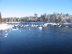
Simojoki
Appearance
You can help expand this article with text translated from the corresponding article in Finnish. (December 2009) Click [show] for important translation instructions.
|
| Simojoki | |
|---|---|
 Simojoki river in Ranua | |
 | |
| Physical characteristics | |
| Source | |
| • location | Simojärvi at Ranua |
| • elevation | 176 m (577 ft) |
| Mouth | |
• location | Bothnian Bay at Simo |
| Length | 193 km (120 mi) |
| Basin size | 3,160 km2 (1,220 sq mi) |
Simojoki is a river of Finland in the region of Lapland. It flows for 193 kilometres (120 mi) into the Bothnian Bay at Simo.
See also
65°37′N 025°03′E / 65.617°N 25.050°E
