
Singleton, Winston County, Mississippi
Singleton, Mississippi | |
|---|---|
 Singleton, Mississippi Location within the state of Mississippi | |
| Coordinates: 33°11′20″N 88°51′25″W / 33.18889°N 88.85694°W | |
| Country | United States |
| State | Mississippi |
| County | Winston |
| Elevation | 292 ft (89 m) |
| Time zone | UTC-6 (Central (CST)) |
| • Summer (DST) | UTC-5 (CDT) |
| GNIS feature ID | 687705[1] |
Singleton is a ghost town in Winston County, Mississippi, United States.
Singleton was located approximately 13 mi (21 km) northeast of Louisville.
The settlement had a post office and two churches. The population of was 75 in 1900.[2]
References
- ^ U.S. Geological Survey Geographic Names Information System: Singleton (historical)
- ^ Rowland, Dunbar (1907). Mississippi: Comprising Sketches of Counties, Towns, Events, Institutions, and Persons, Arranged in Cyclopedic Form. Vol. 2. Southern Historical Publishing Association. p. 669.
Municipalities and communities of Winston County, Mississippi, United States | ||
|---|---|---|
| Cities | 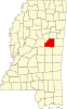 | |
| Towns | ||
| Unincorporated communities | ||
| Ghost towns | ||
| Indian reservation | ||
| Footnotes | ‡This populated place also has portions in an adjacent county or counties | |
This United States ghost town-related article is a stub. You can help Wikipedia by expanding it. |