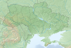
Skole Beskids National Nature Park
| Skole Beskids National Nature Park | |
|---|---|
| Ukrainian: Сколівські Бескиди | |
 Skole Beskids National Nature Park | |
| Location | Lviv Oblast, Skole Raion |
| Nearest city | Skole |
| Coordinates | 49°12′N 23°13′E / 49.2°N 23.21°E |
| Area | 35,684 hectares (88,177 acres; 357 km2; 138 sq mi) |
| Established | 1999 |
| Governing body | Ministry of Ecology and Natural Resources (Ukraine) |
| Website | http://skole.org.ua/ |
Skole Beskids National Nature Park (Ukrainian: Сколівські Бескиди) covers the Skole Beskids Range of the Carpathian Mountains on the western edge of Ukraine. It was created in 1999 to protect the beech and beech-fir forests of Carpathians, and to provide for environmental, ecological, aesthetic, educational and recreational uses. The park is in the administrative districts of Skole, Drohobych, and Turka in Lviv Oblast.[1]
Topography
The terrain is mountainous, with the park divided into the valleys of both the Stryi River and the Opir River. Altitude above sea-level is 600 to 1,260 meters.[2] The highest point in the boundaries is Mount Parashka.[3] The mountain range runs northwest to southeast, with peaks formed by river cuts between them.

The geology of the range is deep-sea sedimentary rocks of the Cretaceous and Paleogene ages - known as flysch - composed of sandstones, siltstones, argillites, limestones, and marls.[4]
Climate and ecoregion
The climate of Skole Beskids is Humid continental climate, warm summer (Köppen climate classification (Dfb)). This climate is characterized by large seasonal temperature differentials and a warm summer (at least four months averaging over 10 °C (50 °F), but no month averaging over 22 °C (72 °F).[5][6] In the park, the average temperature in January is −6 °C (21 °F), and 16 °C (61 °F) in July. Average precipitation is 800–1,100 millimetres (31–43 in) per year. There are frequent thaws in the winter, and average snow depth is 39 centimetres (15 in).[3]
Flora and fauna
Most of the site is forested, on gravely soils. The highest altitudes are spruce-fir-beech forest, much of it over 100 years old. Over 635 species of vascular plants have been recorded in the park, 204 vertebrate animals, 18 species of fish, 9 amphibians, 6 of reptiles, 121 species of birds, and 50 of mammals.[3]
Public use

Historically, the area has been known for health resorts and tourism, due to the mild climate and outdoors activities. The park continues this today with over 20 recreation and boarding houses in its territory. Services offered by the park include horse excursions, ecological tours, and guided tours up Mount Parashka.[1]
See also
References
- ^ a b "National Nature Park Skole Beskids" (in Ukrainian). Official Park Site. Retrieved January 10, 2019.
- ^ "Skole Beskyds National Nature Park". Encyclopedia of Ukraine. Retrieved June 2, 2019.
- ^ a b c "Skole Beskyds Park - Data" (in Ukrainian). Skole Beskyds (official park site). Retrieved June 2, 2019.
- ^ "Skole Beskyds Park - Landscape" (in Ukrainian). Skole Beskyds (official park site). Retrieved June 2, 2019.
- ^ Kottek, M., J. Grieser, C. Beck, B. Rudolf, and F. Rubel, 2006. "World Map of Koppen-Geiger Climate Classification Updated" (PDF). Gebrüder Borntraeger 2006. Retrieved September 14, 2019.
{{cite web}}: CS1 maint: multiple names: authors list (link) CS1 maint: numeric names: authors list (link) - ^ "Dataset - Koppen climate classifications". World Bank. Retrieved September 14, 2019.


