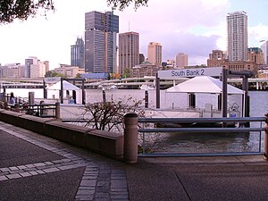
South Bank ferry wharf
South Bank 1 & 2 | |||||||||||
|---|---|---|---|---|---|---|---|---|---|---|---|
 | |||||||||||
| General information | |||||||||||
| Location | South Brisbane | ||||||||||
| Coordinates | 27°28′34″S 153°01′20″E / 27.4761°S 153.0222°E | ||||||||||
| Owned by | Brisbane City Council | ||||||||||
| Construction | |||||||||||
| Accessible | Yes | ||||||||||
| Other information | |||||||||||
| Fare zone | 1 (TransLink) | ||||||||||
| Services | |||||||||||
| |||||||||||
South Bank 1 & 2 is a ferry wharf in the suburb of South Brisbane used by the CityCat on the Brisbane River.
Location
They are located in the South Bank Parklands near the Queensland Cultural Centre. They provide the closest transport access point to the Streets beach, the Wheel of Brisbane and the Maritime museum. It is also close to the Queensland Performing Arts Centre and the Griffith University conservatorium. The western end of the Victoria Bridge is close to the wharves.
Description
The wharves comprise two separate piers joined at one end in a 'U' shape with the open arms ending in pontoons, each with one docking station. Pontoon 1 lies upstream of pontoon 2 and CityCats coming downstream tie up at pontoon 1 while those coming upstream tie up at pontoon 2. There is no separate passenger waiting area for these wharves. However, tree shaded benches are present along the promenade that runs by the head of the piers. This terminal is used only by the CityCat service.
In January 2011 both wharves sustained a moderate damage during the devastating floods.[1] They were repaired and reopened on 14 February 2011.[2][3]
South Bank 3
South Bank 3 | |||||||||||
|---|---|---|---|---|---|---|---|---|---|---|---|
 | |||||||||||
| General information | |||||||||||
| Location | South Brisbane | ||||||||||
| Coordinates | 27°28′47″S 153°01′30″E / 27.4798°S 153.0250°E | ||||||||||
| Owned by | Brisbane City Council | ||||||||||
| Other information | |||||||||||
| Fare zone | 1 (TransLink) | ||||||||||
| Services | |||||||||||
| |||||||||||
South Bank 3 is a ferry wharf in South Brisbane used by the CityFerry.
In January 2011 the wharf sustained a moderate damage during the devastating floods[4] but was repaired and reopened on 14 February 2011.[5][6]
References
- ^ "List: CityCat, CityFerry terminal damage". Brisbane Times. January 20, 2011. Retrieved 27 January 2011.
- ^ "CityCat service set for fast return". Brisbane Times. February 1, 2011. Retrieved 2 February 2011.
- ^ "January 2011 flood event - CityCat and CityFerry services". Brisbane City Council. Retrieved 14 February 2011.
