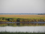
Spanish Moss Trail
| Spanish Moss Trail | |
|---|---|
| Length | 14.9 mi (24.0 km) |
| Location | Beaufort County, South Carolina, United States |
| Trailheads | Seabrook Port Royal |
| Use | Cycling, Walking, Hiking, Jogging, Inline Skating |
| Difficulty | Easy |
| Season | Year round |
The Spanish Moss Trail is a partially built rail trail in northern Beaufort County, South Carolina. Following the path of the former Port Royal Railroad on a right-of-way now owned by Beaufort-Jasper Water and Sewer Authority, it follows a north–south path from Seabrook to Port Royal while passing through Burton and Beaufort. It is a paved 12-foot-wide path utilized for walking, jogging, cycling, and inline skating. As of December 2012, just under one mile of the trail had been finished along the most densely populated section of the trail in the City of Beaufort. Once completed, the distance of the main trail currently will be 14.9 miles (24.0 km).[1] It is a contributing segment of the East Coast Greenway. A second phase of the Spanish Moss Trail could extend for an additional 10.1 miles (16.3 km) to Yemassee.
Construction of the rail trail began in summer of 2012, with the first segment opening later that year. [2]

