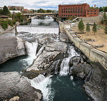
Spokane Falls


Spokane Falls is the name of a waterfall and dam on the Spokane River, located in the central business district in downtown Spokane, Washington. The city of Spokane was also initially named "Spokane Falls".
History
The Native American name for the Spokane Falls was "Stluputqu", meaning "swift water". The falls was once the site of a large Spokane people village.[1]
Features
The falls consists of an Upper Falls and a Lower Falls. The Upper Falls is the site of the Upper Falls Dam, a diversion dam constructed in 1920 that directs the water into the Upper Falls intake on the south channel of the Spokane River. The Upper Falls Power Plant incorporates a Francis turbine capable of generating 10 MW. The Lower Falls is the site of a second diversion dam, the Monroe Street Dam. Completed in 1890, it was the first dam built on the Spokane River and is currently the longest-running hydroelectric generation facility in Washington state. Its Kaplan turbine has a generating capacity of 14.82 MW.
Management
Both Upper Falls and Lower Falls dams are operated by the power company Avista.
References
- ^ Majors, Harry M. (1975). Exploring Washington. Van Winkle Publishing Co. p. 110. ISBN 978-0-918664-00-6.
External links
47°39′42.6″N 117°25′28.4″W / 47.661833°N 117.424556°W
