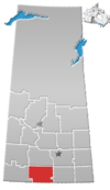
St. Victor, Saskatchewan
Appearance


St. Victor, or Saint Victor, is a Fransaskois community in the Rural Municipality of Willow Bunch No. 42. In 2006, it had a population of 43 people. It previously held the status of village until February 26, 2003.[1] St. Victor is located 37 km south of the Town of Assiniboia 10 km east of Highway 2.
Demographics
Canada census – St. Victor, Saskatchewan community profile
| Population |
|---|
| Land area |
| Population density |
| Median age |
| Private dwellings |
| Median household income |
Attractions
See also
References
- ^ "Restructured Villages". Saskatchewan Ministry of Municipal Affairs. Archived from the original on March 25, 2008. Retrieved February 10, 2008.
- ^ "2006 Community Profiles". 2006 Canadian Census. Statistics Canada. August 20, 2019.
- ^ "2001 Community Profiles". 2001 Canadian Census. Statistics Canada. July 18, 2021.


