Sveti Rok
Appearance
Sveti Rok | |
|---|---|
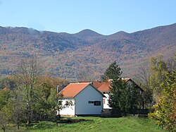
 A farm near Sveti Rok and Velebit Mountain. | |
| Coordinates: 44°21′41″N 15°39′13″E / 44.361368°N 15.653636°E | |
| Country | Croatia |
| County | Lika-Senj County |
| Municipality | Lovinac |
| Population (2001) | |
| • Total | 292 |
| Time zone | UTC+1 Central European Time |
Sveti Rok is a small village in the Lovinac municipality, in Lika–Senj County, Croatia. Sveti Rok has a population of 292. The majority of the population are Croats.
History
Until 1918, Sveti Rok (named Sanct Roch before 1850) was part of the Austrian monarchy (Kingdom of Croatia-Slavonia after the compromise of 1867), in the Croatian Military Frontier, Likaner Regiment N°I.[1] The village named after Saint Roch.
Notable people
See also
References
- ^ Handbook of Austria and Lombardy-Venetia Cancellations on the Postage Stamp Issues 1850-1864, by Edwin MUELLER, 1961.

