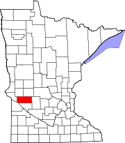
Swift Falls, Minnesota
Appearance
Swift Falls, Minnesota | |
|---|---|
| Coordinates: 45°23′56″N 95°25′26″W / 45.39889°N 95.42389°W | |
| Country | United States |
| State | Minnesota |
| County | Swift |
| Elevation | 1,119 ft (341 m) |
| Time zone | UTC-6 (Central (CST)) |
| • Summer (DST) | UTC-5 (CDT) |
| Area code | 320 |
| GNIS feature ID | 652954[1] |
Swift Falls is an unincorporated community in Swift County, in the U.S. state of Minnesota.[1]
Geography
Swift Falls is located along the Chippewa River.[2] The community contains the Swift Falls Park.[3]
History
A post office called Swift Falls was established in 1873, and remained in operation until 1910.[4]
A tornado touched down in Swift Falls on July 14, 2009, destroying several buildings.[5]
References
- ^ a b "Swift Falls". Geographic Names Information System. United States Geological Survey, United States Department of the Interior.
- ^ Upham, Warren (1920). Minnesota Geographic Names: Their Origin and Historic Significance. Minnesota Historical Society. p. 542.
- ^ "Swift Falls Park". Swift County, MN. Retrieved 10 August 2015.
- ^ "Swift County". Jim Forte Postal History. Retrieved 9 August 2015.
- ^ "Tornado touchdowns reported in west-central Minn". MPR News. Retrieved 10 August 2015.


