Túrkeve
Túrkeve | |
|---|---|
 Calvinist church in Túrkeve | |
| Country | |
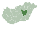
| County | Jász-Nagykun-Szolnok |
| District | Mezőtúr |
| Area | |
| • Total | 236.52 km2 (91.32 sq mi) |
| Population (2011) | |
| • Total | 9,008[1] |
| • Density | 38.1/km2 (99/sq mi) |
| Time zone | UTC+1 (CET) |
| • Summer (DST) | UTC+2 (CEST) |
| Postal code | 5420 |
| Area code | 56 |
Túrkeve is a town in Jász-Nagykun-Szolnok county, in the Northern Great Plain region of Hungary.[1]
Geography
It covers an area of 236.52 km2 (91.32 sq mi).[1]
Demographics
According to the 2011 census, the total population of Túrkeve was 9,008, of whom there were 87.8% Hungarians and 2.4% Romani by ethnicity. 12.2% did not declare their ethnicity, excluding these people Hungarians made up 100% of the total population.[1] In Hungary people can declare more than one ethnicity, so some people declared a minority one along with Hungarian.[2]
Túrkeve is one of the least religious town in Hungary, 56.7% of the population was irreligious, while 17.9% was Hungarian Reformed (Calvinist) and 4.4% Roman Catholic.[1]
Travel
There used to be a railway (link to the Hungarian Wikipedia page) connecting Mezőtúr and Túrkeve, owned by MÁV. However, due to low ridership, this was closed in the 1960s, and the track was removed thereafter. With the closure of the only rail line between Túrkeve and any other city, the other form of transport is through road, including a daily bus service.

Notable people from Túrkeve
- Alexander Finta (1881-1958), Hungarian-American artist
- Alexander Korda (1893-1956), Hungarian-British film producer
- Zoltan Korda (1895-1961), Hungarian-American film director
- Vincent Korda (1897-1979), Hungarian-British art director
International relations
Túrkeve is twinned with:
 Auchel, France
 Salonta (Nagyszalonta), Romania
 Velykyi Bychkiv (Nagybocskó), Ukraine
References
External links
- Official site in Hungarian
47°06′N 20°45′E / 47.100°N 20.750°E


