Template:POTD/2010-09-14
Appearance
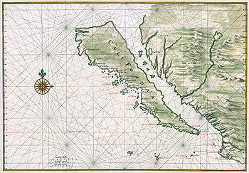
A c. 1650 map showing the Island of California, a long-held European misconception, dating from the 16th century, that California was not part of mainland North America but rather a large island separated from the continent by a strait now known instead as the Gulf of California. The belief persisted until the expeditions of Juan Bautista de Anza in 1774–76.Map: Johannes Vingboons; Restoration: Lise Broer
| This picture of the day has been featured on Portal:Geography. |

