
Troškūnai
This article needs additional citations for verification. (April 2016) |
Troškūnai | |
|---|---|
City | |
 Centre of Troškūnai | |
 Coat of arms | |
 Troškūnai Location of Troškūnai | |
| Coordinates: 55°35′10″N 24°52′10″E / 55.58611°N 24.86944°E | |
| Country | |
| Ethnographic region | Aukštaitija |
| County | |
| Municipality | Anykščiai district municipality |
| Eldesrhip | Troškūnai eldership |
| Capital of | Troškūnai eldership |
| First mentioned | 1696 |
| Granted city rights | 1956 |
| Population (2011) | |
| • Total | 451 |
| Time zone | UTC+2 (EET) |
| • Summer (DST) | UTC+3 (EEST) |
Troškūnai () is the second smallest city in Lithuania. It is located 14 km (8.7 mi) west form Anykščiai.
History
The birthplace of Lithuanian lexicographer and writer Konstantinas Sirvydas is nearby the city. The city was established in 1696 by Władysław Sokołowski, who brought there Bernardines, founded a church and a monastery. Recently the buildings were returned to the Bernardine monks, who established the International Centre of Youth there.
On July 10, 1941, local Lithuanian collaborators killed 8 or 9 Jewish men on the premises of the local school. In mid-July 1941 5-6 Jewish men were shot at the Jewish cemetery by Troškūnai members of the Lithuanian Activist Front.[1] In August, 1941, the remaining Jews of Troškūnai (about 200 people) were transported by white armbanders to the Panevėžys ghetto. There on August 23, 1941, they were murdered along with Jews from the city of Panevėžys and its surrounding areas in a mass execution.[2]
Gallery
-
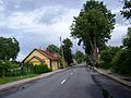
 Entering from Traupis
 -
 Entering from Vaidlonys
 -

-
 Church belfry
 -
 Cultural center
 -
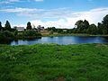 Pond behind the church
 -
 Monastery
 -
 Railway Station


References

| International | |
|---|---|
| National | |
This Lithuanian location article is a stub. You can help Wikipedia by expanding it. |