
Ugashik, Alaska
Ugashik, Alaska | |
|---|---|
 Location of Ugashik, Alaska | |
| Country | United States |
| State | Alaska |
| Borough | Lake and Peninsula |
| Area | |
| • Total | 248.7 sq mi (644.1 km2) |
| • Land | 233.9 sq mi (605.9 km2) |
| • Water | 14.7 sq mi (38.2 km2) |
| Elevation | 30 ft (9 m) |
| Population (2000) | |
| • Total | 11 |
| • Density | 0.0/sq mi (0.0/km2) |
| Time zone | UTC-9 (Alaska (AKST)) |
| • Summer (DST) | UTC-8 (AKDT) |
| Area code | 907 |
| FIPS code | 02-80100 |
| GNIS feature ID | 1411486 |
Ugashik is a census-designated place (CDP) in Lake and Peninsula Borough, Alaska, United States. The population was 11 at the 2000 census.
Geography
Ugashik is located at 57°32′3″N 157°16′8″W / 57.53417°N 157.26889°WInvalid arguments have been passed to the {{#coordinates:}} function (57.534143, -157.268870)Template:GR.
According to the United States Census Bureau, the CDP has a total area of 248.7 square miles (644 km2), of which, 233.9 square miles (606 km2) of it is land and 14.8 square miles (38 km2) of it (5.93%) is water.
The Village is located on the eastern shore of the Ugashik River some 6 miles (9.7 km) and 20 miles (32 km) by river from the village of Pilot Point, Alaska. The proximity to the salmon-rich waters of Ugashik Bay and available fresh water supply made it suitable as a location for a salmon cannery, Alaska Packers which operated until 1957. A family-owned company, Briggs Way Cannery, opened in 1962, and runs to this day. It is currently known as Ugashik Wild Salmon Co and is continued on by the second generation of family and fishermen.
Demographics
As of the censusTemplate:GR of 2008, there were 12 people, 7 households, and 2 families residing in the CDP. The population density was 0.0 people per square mile (0.0/km²). There were 35 housing units at an average density of 0.1/sq mi (0.1/km²). The racial makeup of the CDP was 18.18% White, 0% Native American, and 79.8 from two or more races, Alaska Native being one of them.
There were 7 households out of which none had children under the age of 18 living with them, 28.5% were married couples living together, and 71.4% were non-families. 42.9% of all households were made up of individuals and one had someone living alone who was 65 years of age or older. The average household size was 1.57 and the average family size was 2.00.
In the CDP the population was spread out with 0% from 18 to 24, 18.2% from 25 to 44, 72.7% from 45 to 72, . The median age was 50 years. For every 100 females there were 120.0 males. For every 100 females age 18 and over, there were 120.0 males.
The median income for a household in the CDP was $28,750, and the median income for a family was $35,417. Males had a median income of $0 versus $0 for females. The per capita income for the CDP was $12,530. There were no families and 10.0% of the population living below the poverty line, including no under eighteens and none of those over 64.
References
External links
Municipalities and communities of Lake and Peninsula Borough, Alaska, United States | ||
|---|---|---|
| Cities | 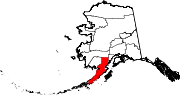 | |
| CDPs | ||
| Ghost town | ||