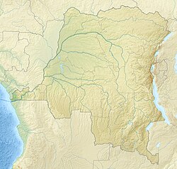
Upoto
Appearance
Upoto | |
|---|---|
 Upoto Mission Building | |
| Coordinates: 2°08′27″N 21°29′40″E / 2.14082°N 21.49432°E | |
| Country | Democratic Republic of the Congo |
| Province | Mongala |
| Elevation | 399 m (1,309 ft) |
Upoto was a village on the right bank of the Congo River, now a district of Lisala in the Mongala province of the Democratic Republic of the Congo.[1]
History
Captain Hanssens of the International Association of the Congo founded the Upoto station, on the right bank of the Congo above the confluence of the Mongala River, in June 1884.[2] A military post was founded there in 1888–1889 by a Belgian expedition led by Francis Dhanis.[3]
Notes
- ^ Upoto Geonames.
- ^ Bartholomew 1885, p. 47.
- ^ Coosemans 1946.
Wikimedia Commons has media related to Upoto.
Sources
- Bartholomew, John George (1885), "International Congo Association : Lists of its 45 Stations", Scottish Geographical Magazine, 1 (1–3), The Scottish Geographical Society: 47–49, doi:10.1080/14702548508553946, retrieved 2020-08-31
- Coosemans, M. (20 May 1946), "MILZ (Jules-Alexandre)", Biographie Belge d'Outre-Mer (in French), vol. I, Académie Royale des Sciences d'Outre-Mer, pp. 697–701, retrieved 2020-08-30
- "Upoto", Geonames.org, retrieved 2020-08-31

