
Urayamaguchi Station
Urayamaguchi Station 浦山口駅 | |
|---|---|
 Urayamaguchi Station in August 2012 | |
| General information | |
| Location | 3895 Arakawakuna, Chichibu, Saitama (秩父市荒川久那3895) Japan |
| Operated by | Chichibu Railway |
| Line(s) | Chichibu Main Line |
| Connections |
|
| History | |
| Opened | 1930 |
| Passengers | |
| FY2000 | 318 daily |
Urayamaguchi Station (浦山口駅, Urayamaguchi-eki) is a railway station on the Chichibu Main Line in Chichibu, Saitama, Japan, operated by the private railway operator Chichibu Railway.[1]
Lines
Urayamaguchi Station is served by the Chichibu Main Line from Hanyū to Mitsumineguchi, and is located 63.8 km from Hanyū.[1] It is also served by through services to and from the Seibu Chichibu Line.
Station layout
The station is staffed and consists of a single side platform serving a single bi-directional track.[2]
-
 The station platform in February 2008
 -
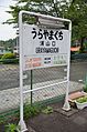 The station sign in June 2012


Adjacent stations
| « | Service | » | ||
|---|---|---|---|---|
| Chichibu Main Line | ||||
| Kagemori | Local | Bushū-Nakagawa | ||
| Paleo Express: Does not stop at this station | ||||
| Chichibuji: Does not stop at this station | ||||
History
Urayamaguchi Station opened on 15 March 1930.[1]
Passenger statistics
In fiscal 2000, the station was used by an average of 318 passengers daily.[1]
Surrounding area

See also
References
- ^ a b c d Terada, Hirokazu (July 2002). データブック日本の私鉄. Japan: Neko Publishing. p. 193. ISBN 4-87366-874-3.
{{cite book}}: Unknown parameter|trans_title=ignored (|trans-title=suggested) (help) - ^ Kawashima, Ryozo (January 2011). 日本の鉄道 中部ライン 全線・全駅・全配線 第10巻 上越・秩父エリア. Japan: Kodansha. p. 28/88. ISBN 978-4-06-270070-2.
{{cite book}}: Unknown parameter|trans_title=ignored (|trans-title=suggested) (help)
External links
Wikimedia Commons has media related to Urayamaguchi Station.
- Urayamaguchi Station information (Saitama Prefectural Government) Template:Ja icon
- Urayamaguchi Station timetable Template:Ja icon