User:Changjej/BulgokMountain
| Bulgok Mountain | |
|---|---|
| Highest point | |
| Elevation | 345 m (1,132 ft) |
| Coordinates | 37°20′36″N 127°08′26″E / 37.343208488473°N 127.14065551758°E |
| Geography | |
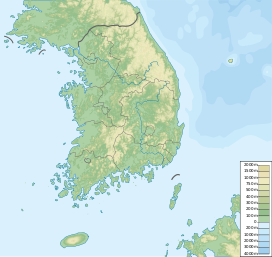
| Location | Between Seongnam Gyeonggi-do and Gwangju. |
Bulgok Mountain is 345m[1] high mountain between Seongnam Gyeonggi-do and Gwangju, Korea. The name of Mountain is same with other mountain at Gyeonggi-do Yangju so it would be confusing.
There is a story that the name of mountain is become Bulgok because there were some temple site in the mountain. And also Jeongja-dong residents considered this mountain as holy mountain and had a ritual for a mountain spirit so that this mountain is also called as Mt.Seongduck or Mt.HyoJong.[2]
Mt.Bulgok serve as citizen's resting area. They are at the southernmost of Seongnam green belt and they are between Jeongja-dong and Gumi-dong. There is a hang gliding take-off run at southwest and northeast.
Mt.Bulgok is designated trail with Mt.Youngjang by Seongnam. Its top which has 345m aptitude is near to Sunae,Jeongja,Gumi-dong. Mt.Bulgok is the mountain that is receiving lots of love from Budang citizens. [3]
Handed down Story
[edit]Mt.Bulgok's name is said to be originated from temple sites. Because some people in Jeongja-dong believed Mt.Bulgok is holy and had a ritual for a mountain spirit, it was called Mt.Seongduck. (In Hanja, seong means holy and duck means virtue.) Gol-An temple is writing their name as 骨安寺, but their name looks like just Korean name. Mt.Bulgok is called by the name that related to Buddhism like other mountains' name in Bundang.
Hiking Course Information
[edit]Mt.Bulgok's hiking course is 5.6km long and it requires about 2hours half for each course. It has many rest area and athletic facilities for meditation. There are 129 places to take some rest. As the starting point of Seongnam's ridge line, citizens' access is quite often.
At Sunae, Buljeong, Jeongja, Gumi you can start the climbing. The roads that are connected behind the Korea Land and Housing Corporation is tough. The slope is high and rocky.[4]
Related
[edit]References
[edit]- ^ Altitude of this mountain is not accurate. Every reporters report different altitude. Now there are reported different altitude for this mountain. 313m, 325m, 335m, 344m, 345m. At here, we adopted the highest altitude.
- ^ Referenced from some contents that are recorded in Korean book, 향토문화대전(HyangtoMunhwaDaejeon).
- ^ Yoon, Sangdon (June 22, 2009). "Seongnam Mt.Bulgok&Mt.Youngjang". Seoul News Paper.
{{cite web}}: Check date values in:|date=(help) - ^ Yoon, Sangdon (June 22, 2009). "Seongnam Mt.Bulgok&Mt.Youngjang". Seoul News Paper.
{{cite web}}: Check date values in:|date=(help)

