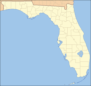
User:Ebyabe/Googley maps/FL-NHLs
Appearance
National Historic Landmark
[edit]| Landmark name | Image | Date listed | Locality | County | Description | |
|---|---|---|---|---|---|---|
| 4 | Cape Canaveral Air Force Station | April 16, 1984 | Cocoa 28°29′20″N 80°34′40″W / 28.488889°N 80.577778°W |
Brevard | The East Coast space launch facility of the U.S. Department of Defense, and adjacent to the Kennedy Space Center | |
| 11 | Fort Mose Site | October 12, 1994 | St.Augustine coord|29.927689|-81.325169|name=Fort Mose Site|type:landmark}} |
St. Johns | First free black settlement legally sanctioned in what would become the United States. Slaves from the British colonies of South Carolina and Georgia escaped here during the early to mid 18th century, making this a precursor to the Underground Railroad. | |
| 16 | Freedom Tower | October 6, 2008 | Miami 25°46′48″N 80°11′23″W / 25.78°N 80.189722°W |
Miami-Dade | The original headquarters and printing facility of the Miami News & Metropolis newspaper; later made a memorial to Cuban immigration to the U.S. | |
| 19 | Ernest Hemingway House | November 24, 1968 | Key West 24°33′04″N 81°48′03″W / 24.551179°N 81.800903°W |
Monroe | A home of author Ernest Hemingway | |
| 22 | Llambias House | April 15, 1970 | St.Augustine coord|29.887907|-81.310969|name=Llambias House|type:landmark}} |
St. Johns | Built in the late 18th century, and part of the St. Augustine Town Plan Historic District | |
| 27 | Mud Lake Canal | September 20, 2006 | Flamingo 25°10′26″N 80°56′17″W / 25.174°N 80.938°W |
Monroe | Prehistoric long-distance canoe canal | |
| 30 | Pensacola Naval Air Station Historic District | December 8, 1976 | Pensacola 30°20′52″N 87°17′50″W / 30.3478°N 87.2972°W |
Escambia | Opened in 1914, as the first U.S. permanent naval air station, first Navy pilot training center, and first U.S. naval installation to send pilots into combat. | |
| 35 | San Luis De Talimali (formerly San Luis de Apalache) | October 15, 1966 | Tallahassee 30°26′57″N 84°19′12″W / 30.44909°N 84.319905°W |
Leon | A Spanish Franciscan mission was built here in 1633 in the descendent settlement of Anhaica, capital of Apalachee Province. It was abandoned and destroyed in 1704 to prevent use by the British. |
National Natural Landmark
[edit]| Name | Image | Date | Location | Description | |
|---|---|---|---|---|---|
| 2 | Big Cypress Bend | October 1966 | Collier, Monroe, & Miami-Dade counties 25°51′32″N 81°2′2″W / 25.85889°N 81.03389°W |
||
| 3 | Corkscrew Swamp Sanctuary | March 1964 | north of Naples 26°25′4.41″N 81°32′18.33″W / 26.4178917°N 81.5384250°W |
||
| 8 | Lignumvitae Key | October 1968 | Lignumvitae Key 24°54′7.18″N 80°41′57.56″W / 24.9019944°N 80.6993222°W |
||
| 10 | Osceola Research Natural Area | December 1974 | Columbia County | ||
| 13 | Reed Wilderness Seashore Sanctuary | November 1967 | Martin County 27°2′25.64″N 80°6′49.47″W / 27.0404556°N 80.1137417°W |
Florida State Parks
[edit]- Anclote Key Preserve State Park 28°11′35″N 82°51′04″W / 28.19306°N 82.85111°W
- Caladesi Island State Park 28°01′12″N 82°49′16″W / 28.02000°N 82.82111°W
- Cayo Costa State Park 26°40′19″N 82°14′49″W / 26.67194°N 82.24694°W
- Deer Lake State Park 30°18′14″N 86°04′44″W / 30.30389°N 86.07889°W
- Egmont Key State Park 27°35′10.5″N 82°45′41″W / 27.586250°N 82.76139°W
- Estero Bay Preserve State Park 26°23′49″N 81°51′34″W / 26.39694°N 81.85944°W
- Fakahatchee Strand Preserve State Park 26°00′00″N 81°25′01″W / 26.00000°N 81.41694°W
- Fort Foster 28°8′57″N 82°13′11″W / 28.14917°N 82.21972°W
- Indian Key State Historic Site 24°53′17″N 80°41′40″W / 24.88806°N 80.69444°W
- Lignumvitae Key State Botanical Park {coord|24|54|7.18|N|80|41|57.56|W|name=Lignumvitae Key SP}
- Mound Key Archeological State Park 26°25′20″N 81°51′55″W / 26.42222°N 81.86528°W
- River Rise Preserve State Park 29°51′36″N 82°36′19″W / 29.86000°N 82.60528°W
- San Pedro Underwater Archaeological Preserve State Park 24°51′48″N 80°40′46″W / 24.86333°N 80.67944°W
- Windley Key Fossil Reef Geological State Park 24°56′57″N 80°35′46″W / 24.94917°N 80.59611°W
- Yellow River Marsh 30°32′31″N 87°00′04″W / 30.54194°N 87.00111°W
map
[edit]Parks for which I need to get stamp in passport book. Parks to visit, already got all the stamps.
<noinclude> [[Category:Dynamic map templates|Florida State Parks]] </noinclude>

