Vaʻa-o-Fonoti
Va'a-o-Fonoti | |
|---|---|
District | |
 View of Uafato village at Fagaloa Bay | |
 Map of Samoa showing Va'a-o-Fonoti district. | |
| Country | |
| Time zone | -11 |

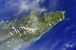
Va'a-o-Fonoti is a district on the north east coast of Upolu Island in Samoa, with a population (2001 Census) of 1,666, making it the least populated district in the country.
The district is 38 km² and consists of a main area around Fagaloa Bay with nine villages and a small coastal exclave about 10 km further northwest, with the village of Faleāpuna (pop. 582). The district includes areas with significant conservation and cultural values. Va'a-o-Fonoti geographical boundaries are surrounded by the larger district of Atua. The capital of Va'a-o-Fonoti is Samamea.[1]
The small settlement of Uafato is part of the Uafato Conservation Area, a project started by the villagers in the early 1990s, to protect their environment from logging. The area has gained a reputation in the last decade for woodcarving and traditional arts and crafts in Samoa.
Historical
Va'a-o-Fonoti was named within the district of Atua and established in the 16th century when, Fonoti - the victorious claimant to the Junior TuiAtua title - Tui Atua Faasavali rewarded the people of this part of Atua for their bravery in that war.[citation needed] The district name literally means "The longboat of Fonoti", denoting the bravery of the naval crews from this area during this war.[2] Later Tui Atua Faasavali lived in different parts of the back and tail of Atua.
The paramount title of the district is Talamaivao.
See also
References
- ^ "Fagaloa Bay - Uafato Tiavea Conservation Zone". UNESCO World Heritage. Retrieved 13 November 2009.
- ^ [1] The making of modern Samoa by Malama Meleisea, p.132
13°57′S 171°32′W / 13.950°S 171.533°W

