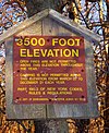
Vly Mountain
Appearance
| Vly Mountain | |
|---|---|
 | |
| Highest point | |
| Elevation | 3,529 ft (1,076 m) NGVD 29[1] |
| Prominence | 649 ft (198 m)[1] |
| Listing | Catskill High Peaks |
| Coordinates | 42°14.75′N 74°26.90′W / 42.24583°N 74.44833°W |
| Geography | |
| Location | Halcott, Greene County, New York |
| Parent range | Catskill Mountains |
| Topo map | USGS West Kill |
Vly Mountain is a mountain located in the town of Halcott, New York, United States in Greene County. The mountain is part of the Catskill Mountains. Vly Mountain is flanked to the northwest by Bearpen Mountain.
The north side of Vly Mountain drains into Little West Kill, thence into Schoharie Creek, the Mohawk River, the Hudson River, and into New York Bay. The east side of Vly Mtn. drains into West Kill, thence into Schoharie Creek. The south and west sides of Vly drain into Vly Creek, thence into Bush Kill, Dry Brook, the East Branch of the Delaware River, and into Delaware Bay.
Notes
- ^ a b "Vly Mountain, New York". Peakbagger.com. Retrieved 2010-05-24.
See also
External links
- Peakbagger.com: Vly Mountain
- Vly Mountain Hiking Information Catskill 3500 Club
- U.S. Geological Survey Geographic Names Information System: Vly Mountain

