
Wanghailou Subdistrict
Wanghailou Subdistrict
望海楼街道 | |
|---|---|
 Wanghailou Catheral, the namesake of the subdistrict, 2014 | |
.png) Location of Wanghailou Subdistrict in Hebei District | |
 Wanghailou Subdistrict  Wanghailou Subdistrict | |
| Coordinates: 39°09′28″N 117°12′10″E / 39.15778°N 117.20278°E | |
| Country | China |
| Municipality | Tianjin |
| District | Hebei |
| Village-level Divisions | 11 communities |
| Area | |
| • Total | 2.07 km2 (0.80 sq mi) |
| Elevation | 8 m (26 ft) |
| Population (2010) | |
| • Total | 86,401 |
| • Density | 42,000/km2 (110,000/sq mi) |
| Time zone | UTC+8 (China Standard) |
| Postal code | 300140 |
| Area code | 022 |
Wanghailou Subdistrict (simplified Chinese: 望海楼街道; traditional Chinese: 望海樓街道; pinyin: Wànghǎilóu Jiēdào) is a subdistrict located on the western side of Hebei District, Tianjin, China. It shares border with Hongshunli Subdistrict in its northwest, Ningyuan Subdistrict in its northeast, Guangfu Avenue Subdistrict in its southeast, and Dahutong Subdistrict in its southwest. In the year 2010, its population was 86,401.[1]
The subdistrict was named after Wanghailou (Chinese: 望海楼; lit. 'View Sea Building') Catherla that is located on the southwest of the subdistrict.[2]
Geography[edit]
Wanghailou subdistrict is on the eastern bank of Hai River.
History[edit]
| Year | Status | Under |
|---|---|---|
| 1954 - 1956 | 10 subdistricts:
|
3rd District, Tianjin |
| 1956 - 1958 | 7 subdistricts
|
Hebei District, Tianjin |
| 1958 - 1960 | 5 subdistricts
| |
| 1960 - 1962 | Xiaoguan Dajie People's Commune Dong Liujing Road People's Commune | |
| 1962 - 1963 | Xiaoguan Dajie Subdistrict Jinjiayao Subdistrict | |
| 1963 - 1966 | Xiaoguan Dajie Subdistrict Jinjiayao Subdistrict Dong Liujing Road Subdistrict | |
| 1966 - 1968 | Weidong District, Tianjin | |
| 1968 - 1990 | Hebei District, Tianjin | |
| 1990 - 2000 | Xiaoguan Dajie Subdistrict Dong Liujing Road Subdistrict |
|
| 2000 - present | Wanghailou Subdistrict |
Administrative divisions[edit]
In 2021, Wanghailou Subdistrict consisted of 11 residential communities, which are listed as follows:[3]
| Subdivision Names | Name Transliterations |
|---|---|
| 昆璞里 | Kunpuli |
| 昆云里 | Kunyuli |
| 乾华园 | Qianhuayuan |
| 金辰园 | Jinchenyuan |
| 振德里 | Zhendeli |
| 望海楼 | Wanghailou |
| 金钟家园 | Jinzhong Jiayuan |
| 中远里 | Zhongyuanli |
| 金田花园 | Jintian Huayuan |
| 金狮家园 | Jinshi Huayuan |
| 金兆园 | Jinzhaoyuan |
Gallery[edit]
-
 Tianjin Beiyang Hospital, 2006
 -
 Gangweilu Catheral, 2014
 -
 Jinjiayao Mosque, 2014
 -
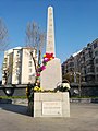 Monument of 17 Tianjin Martyrs, 2018


References[edit]
- ^ "China: Tiānjīn Municipal Province (Districts and Townships) - Population Statistics, Charts and Map". www.citypopulation.de. Retrieved 2022-11-05.
- ^ a b 中华人民共和国政区大典:天津市卷 (in Chinese). 中国社会出版社. 2020.
- ^ "2021年统计用区划代码和城乡划分代码". www.stats.gov.cn. Retrieved 2022-11-23.