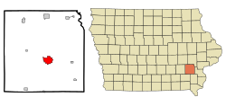
Washington, Iowa
Washington, Iowa | |
|---|---|
| Motto: The Cleanest City in Iowa | |
 Location of Washington, Iowa | |
| Country | |
| State | |
| County | Washington |
| Area | |
| • Total | 4.8 sq mi (12.6 km2) |
| • Land | 4.8 sq mi (12.6 km2) |
| • Water | 0.0 sq mi (0.0 km2) |
| Elevation | 761 ft (232 m) |
| Population (2000) | |
| • Total | 7,047 |
| • Density | 1,454.3/sq mi (561.5/km2) |
| Time zone | UTC-6 (Central (CST)) |
| • Summer (DST) | UTC-5 (CDT) |
| ZIP code | 52353 |
| Area code | 319 |
| FIPS code | 19-82335 |
| GNIS feature ID | 0462686 |
Washington is a city in and the county seat of Washington County, Iowa, United States.Template:GR It is part of the Iowa City, Iowa Metropolitan Statistical Area. The population was 7,047 at the 2000 census.
History
Washington was the location of the first county hospital built west of the Mississippi River. Founded in 1912 in a basement and originally named Washington County Hospital, it is now named Washington County Hospitals & Clinics (WCHC) as of 1998. The original 3 story building was torn down in the summer of 2006 to build a new hospital, despite some local objections.[citation needed]
Geography
Washington is located at 41°18′0″N 91°41′21″W / 41.30000°N 91.68917°WInvalid arguments have been passed to the {{#coordinates:}} function (41.299941, -91.689175)Template:GR.
According to the United States Census Bureau, the city has a total area of 12.6 km² (4.8 sq mi), all land.
Demographics
As of the censusTemplate:GR of 2000, there were 7,047 people, 2,928 households, and 1,903 families residing in the city. The population density was 1,454.3 people per square mile (561.0/km²). There were 3,132 housing units at an average density of 646.3/sq mi (249.3/km²). The racial makeup of the city was 95.20% White, 0.57% African American, 0.11% Native American, 0.35% Asian, 0.04% Pacific Islander, 2.72% from other races, and 0.99% from two or more races. Hispanic or Latino of any race were 4.71% of the population.
There were 2,928 households out of which 27.7% had children under the age of 18 living with them, 53.8% were married couples living together, 8.6% had a female householder with no husband present, and 35.0% were non-families. 30.9% of all households were made up of individuals and 16.7% had someone living alone who was 65 years of age or older. The average household size was 2.31 and the average family size was 2.88.
In the city the population was spread out with 22.8% under the age of 18, 7.2% from 18 to 24, 24.9% from 25 to 44, 21.6% from 45 to 64, and 23.5% who were 65 years of age or older. The median age was 42 years. For every 100 females there were 85.1 males. For every 100 females age 18 and over, there were 82.8 males.
The median income for a household in the city was $36,067, and the median income for a family was $44,497. Males had a median income of $29,961 versus $20,706 for females. The per capita income for the city was $18,145. About 5.4% of families and 9.3% of the population were below the poverty line, including 16.3% of those under age 18 and 5.7% of those age 65 or over.
Community
Located at the center of Washington, surrounded by the business district, is a public square. A central park features a unique type of fountain.[1]
References
- ^ "Washington IA History - Presented by Village Profile". Retrieved September 2008.
{{cite web}}: Check date values in:|accessdate=(help)

