
Westerbach
| Westerbach | |
|---|---|
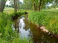
 The Westerbach beneath the Klotzenmühle | |
| Location | |
| Location | Bavaria, |
| Reference no. | DE: 247722 |
| Physical characteristics | |
| Source | |
| • location | confluence of Querbach and Huckelheimer Bach in Huckelheim |
| • coordinates | 50°07′39″N 9°14′27″E / 50.127549°N 9.240843°E |
| Mouth | |
• location | in Schöllkrippen in the Kahl |
• coordinates | 50°05′10″N 9°14′41″E / 50.086234°N 9.244710°E |
| Length | 6.3 km [1] |
| Basin features | |
| Progression | Kahl → Main → Rhine → North Sea |
| River system | Rhine |
The Westerbach is a right tributary of the Kahl in the northern Spessart in Lower Franconia, Bavaria, Germany.
It is 6,3 km (3,9 mi) long and begins at the confluence of Querbach and Huckelheimer Bach in Westerngrund. The Querbach rises in the Arzborn, a small opening in the mountainside on the Hoher Querberg, northeast of Huckelheim, near the border between Hesse and Bavaria. In Schöllkrippen the Westerbach empties in the Kahl.
The Westerbach is with Sommerkahl, Reichenbach and Geiselbach one of the largest tributaries of the Kahl.
Tributaries
- Querbach (left headstream)
- Huckelheimer Bach (right headstream)
- Hombach (right)
- Dörnsenbach (right)
- Schulzengrundbach (left)
- Herzbach (left)
- Kreuzbach (left)
- Schneppenbach (right)
- Betzenbach (right)
References
- ^ GeoinformationsSystem des Bayerischen Landesamtes für Umwelt
-
 the Arzborn (Spring of Querbach)
 -
 between Unterwestern and Schneppenbach


Wikimedia Commons has media related to Westerbach.
This article related to a river in Bavaria is a stub. You can help Wikipedia by expanding it. |