Wickham Heights
Appearance

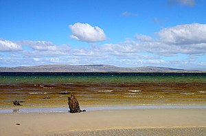
The Wickham Heights (Spanish: Alturas Rivadavia [1]) are a rugged chain of mountains on East Falkland in the Falkland Islands. They include the island group's highest peak, Mount Usborne, Mount Wickham and are partly contiguous with No Man's Land. The slopes of Wickham Heights feature numerous stone runs, some of them extending up to 5 km.
The Wickham Heights are in the northern portion of East Falkland, running east and west, and rising in some places to a height of nearly 2000 ft. They form the "spine" of the East Falkland, north of Lafonia.
Rivers and streams such as the Malo River and San Carlos River spring in the Wickham Heights.
- This article incorporates text from a publication now in the public domain: Chisholm, Hugh, ed. (1911). Encyclopædia Britannica (11th ed.). Cambridge University Press.
{{cite encyclopedia}}: Missing or empty|title=(help) (Falkland Islands)
51°43′S 58°41′W / 51.72°S 58.68°W
