
Woodstock, Vermont: Difference between revisions
Falcon8765 (talk | contribs) m Reverted edits by 75.67.87.141 to last revision by SmackBot (HG) |
→Sites of interest: added F.H. Gillingham & sons |
||
| Line 116: | Line 116: | ||
==Sites of interest== |
==Sites of interest== |
||
* [http://www.billingsfarm.org/ Billings Farm & Museum] |
* [http://www.billingsfarm.org/ Billings Farm & Museum] |
||
* [http://gillinghams.com/ F.H. Gillingham & Sons] |
|||
* [http://www.coveredbridgesite.com/vt/lincoln.html Lincoln Covered Bridge, built in 1877] |
* [http://www.coveredbridgesite.com/vt/lincoln.html Lincoln Covered Bridge, built in 1877] |
||
* [[Marsh-Billings-Rockefeller National Historical Park]] |
* [[Marsh-Billings-Rockefeller National Historical Park]] |
||
Revision as of 22:48, 7 January 2010
Woodstock, Vermont | |
|---|---|
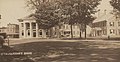
 The village downtown | |
 | |
| Country | United States |
| State | Vermont |
| County | Windsor |
| Chartered | 1761 |
| Area | |
| • Total | 44.6 sq mi (115.6 km2) |
| • Land | 44.5 sq mi (115.3 km2) |
| • Water | 0.1 sq mi (0.2 km2) |
| Elevation | 1,132 ft (345 m) |
| Population (2000) | |
| • Total | 3,232 |
| • Density | 72.6/sq mi (28.0/km2) |
| Time zone | UTC-5 (Eastern (EST)) |
| • Summer (DST) | UTC-4 (EDT) |
| ZIP code | 05091 |
| Area code | 802 |
| FIPS code | 50-85975Template:GR |
| GNIS feature ID | 1462272Template:GR |
Woodstock is a town in and the shire town[1] (county seat)Template:GR of Windsor County, Vermont, in the United States. As of the 2000 census, the town population was 3,232. It includes the villages of Woodstock, South Woodstock and Taftsville. Popular with tourists, Woodstock is noted for its scenic beauty and pristine historic architecture.
History

Chartered by Governor Benning Wentworth on July 10, 1761, the town was a New Hampshire grant to David Page and 61 others. It was named after Woodstock in Oxfordshire, England, as an homage to both Blenheim Palace and its owner, George Spencer, 4th Duke of Marlborough. The town was first settled in 1768 by James Sanderson and his family. [2] In 1776, Major Joab Hoisington built a gristmill, followed by a sawmill, on the south branch of the Ottauquechee River. [3]
Although the Revolution slowed settlement, Woodstock developed rapidly once the war ended in 1783. The Vermont General Assembly met here in 1807 before moving the next year to the new capital at Montpelier. Falls in the Ottauquechee River provided water power to operate mills. Factories made scythes and axes, carding machines, woolens and flour. There was a machine shop and gunsmith shop. Manufacturers also produced furniture, wooden ware, sashes and blinds, carriages, harness, saddles, trunks and leather. By 1859, the population was 3,041. [4] The Woodstock Railroad opened to White River Junction on September 29, 1875, carrying freight and tourists. The Woodstock Inn opened in 1892. [5]
The Industrial Revolution helped the town grow prosperous, which it remains, although the economy is now largely driven by tourism. Woodstock has the 20th highest per-capita income of Vermont towns as reported by the United States Census, and a high percentage of homes owned by non-residents. The town's central square, called the Green, is bordered by restored late Georgian, Federal Style, and Greek Revival houses. The cost of real estate in the district adjoining the Green is among the highest in the state.[citation needed] The seasonal presence of wealthy second-home owners from cities such as Boston and New York has contributed to the town's economic vitality and livelihood, while at the same time diminished its accessibility to native Vermonters.[original research?]
A well-known Christmas commercial for Budweiser beer was shot mostly in the area of the village of South Woodstock. It features the Clydesdale horses pulling the brewer's dray.
-
 Street scene in 1906
 -
 Town center c. 1905
 -
 Snowy night in 1940


Geography
According to the United States Census Bureau, the town has a total area of 44.6 square miles (115.6 km2), of which, 44.5 square miles (115.3 km2) of it is land and 0.1 square miles (0.3 km2) of it (0.22%) is water. The Ottauquechee River flows through the town.[6]
Woodstock is crossed by U.S. Route 4, Vermont Route 12 and Vermont Route 106. It borders the towns of Pomfret to the north, Hartford to the northeast, Hartland to the east, Reading to the south, and Bridgewater to the west.
Demographics
As of the censusTemplate:GR of 2000, there were 3,232 people, 1,388 households, and 877 families residing in the town. The population density was 72.6 people per square mile (28.0/km2). There were 1,775 housing units at an average density of 39.9/sq mi (15.4/km2). The racial makeup of the town was 98.08% White, 0.40% Black or African American, 0.22% Native American, 0.62% Asian, 0.25% from other races, and 0.43% from two or more races. Hispanic or Latino of any race were 0.80% of the population.
There were 1,388 households out of which 26.4% had children under the age of 18 living with them, 52.7% were couples living together and joined in either marriage or civil union, 8.1% had a female householder with no husband present, and 36.8% were non-families. 29.7% of all households were made up of individuals and 11.3% had someone living alone who was 65 years of age or older. The average household size was 2.24 and the average family size was 2.79.
In the town the population was spread out with 20.7% under the age of 18, 4.9% from 18 to 24, 23.9% from 25 to 44, 31.7% from 45 to 64, and 18.8% who were 65 years of age or older. The median age was 45 years. For every 100 females there were 94.0 males. For every 100 females age 18 and over, there were 90.6 males.
The median income for a household in the town was $47,143, and the median income for a family was $57,330. Males had a median income of $33,229 versus $26,769 for females. The per capita income for the town was $28,326. About 4.3% of families and 6.4% of the population were below the poverty line, including 8.3% of those under age 18 and 3.7% of those age 65 or over.
Education
Sites of interest
- Billings Farm & Museum
- F.H. Gillingham & Sons
- Lincoln Covered Bridge, built in 1877
- Marsh-Billings-Rockefeller National Historical Park
- Middle Covered Bridge, built in 1969
- Taftsville Covered Bridge, built in 1836
- Town Hall Theatre
- Woodstock Historical Society & Dana House Museum
Notable residents


- Fred C. Ainsworth, army surgeon and adjutant general
- Ivan Albright, artist
- Franklin S. Billings, governor of Vermont
- Franklin S. Billings, Jr., judge
- Frederick H. Billings, lawyer, financier and railroad president
- Richard M. Brett, conservationist and author
- Sylvester Churchill, journalist
- Jacob Collamer, politician
- George Dewey, admiral
- Elon Farnsworth, attorney general of Michigan
- Robert Hager, television journalist
- Charles Marsh, congressman
- George Perkins Marsh, environmentalist
- Joseph A. Mower, general
- Hiram Powers, sculptor
- Origen D. Richardson, politician
- Laurance Rockefeller, financier and owner of the Woodstock Inn
- Otis Skinner, actor
- Andrew Tracy, congressman
- Gwen Verdon, dancer and actress
- Peter T. Washburn, governor of Vermont
- Hezekiah Williams, congressman
- Daphne Zuniga, film and television actress
References
- ^ Title 24, Part I, Chapter 1, §15, Vermont Statutes. Accessed 2007-11-01.
- ^ Hayward's New England Gazetteer of 1839
- ^ A. J. Coolidge & J. B. Mansfield, A History and Description of New England; Boston, Massachusetts 1859
- ^ A. J. Coolidge & J. B. Mansfield, A History and Description of New England; Boston, Massachusetts 1859
- ^ Virtual Vermont -- Woodstock, Vermont
- ^ DeLorme (1996). Vermont Atlas & Gazetteer. Yarmouth, Maine: DeLorme. ISBN 0-89933-016-9
External links
- Town of Woodstock, Vermont
- The Norman Williams Public Library
- Marsh-Billings-Rockefeller National Historical Park
- Woodstock Area Chamber of Commerce
Municipalities and communities of Windsor County, Vermont, United States | ||
|---|---|---|
| Towns | ||
| Villages | ||
| CDPs | ||
| Other communities | ||