Xia Lingka
Appearance
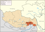
Xia Lingka is a village in the east of the Tibet Autonomous Region of China with a latitude (DMS) of 29° 23' 60N and a longitude of 97° 42' 0E . It lies at an altitude of 4326 metres (14,196 feet).
The village is located 29.8 miles east of the village of Goyu and 27 miles east of Baixoi. Xia Lingka lies 9.8 miles south of Zhong Lingka.
See also
29°23′N 97°42′E / 29.383°N 97.700°E

