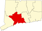
Yalesville, Connecticut
Yalesville | |
|---|---|
| Coordinates: 41°29′37″N 72°49′25″W / 41.49361°N 72.82361°W | |
| Country | United States |
| State | Connecticut |
| County | New Haven |
| Elevation | 95 ft (29 m) |
| Time zone | UTC-5 (Eastern) |
| • Summer (DST) | UTC-4 (Eastern) |
| GNIS feature ID | 212303[1] |
Yalesville is an unincorporated community in Wallingford, New Haven County, Connecticut, United States. Variant names are First Falls and Tyler's Mills.[1]
History
A Committee to locate a mill at the first falls on the Quinnipiac River between Wallingford and Meriden was held in September, 1686. In 1704 the mill was sold to William Tyler, and the community became known as Tyler's Mills. The mill and surrounding lands were sold to Charles Yale around a hundred years later, and the name of the village became Yalesville.
In 1695, Yalesville residents grew tired of having to take a canoe across the river, so a bridge was built adjacent to the residence of Roswell Yale, in what is now Yalesville. In about 1800, the current bridge over the Quinnipiac River was built. At the same time, the first school was constructed in Yalesville. The Yalesville Elementary School, now named Mary Fritz Elementary School, is the second one built on the site.
Geography
Yalesville is located in the northwestern portion of Wallingford.
The Quinnipiac River and Wharton Brook run through Yalesville.


