Zabzugu
Appearance
Zabzugu | |
|---|---|
District Capital | |
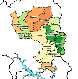
Location of Zabzugu in Northern region | |
| Coordinates: 9°17′N 0°22′E / 9.283°N 0.367°E | |
| Region | Northern Region |
| District | Zabzugu-Tatale District |
| Elevation | 505 ft (154 m) |
| Population (2013) | |
| • Total | — |
| Time zone | GMT |
| • Summer (DST) | GMT |
Zabzugu is a small town and is the capital of Zabzugu-Tatale district, a district in the Northern Region of north Ghana. It has a nucleated settlement and less populated. Most of the people there are farmers and their main produce is Yam. It is known Zabzugu Senior High School.[1]


