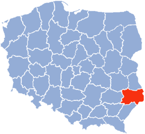
Zamość Voivodeship
Appearance

Zamość Voivodeship (Template:Lang-pl) was a unit of administrative division and local government in Poland in years 1975–1998, superseded by Lublin Voivodeship.
Capital city: Zamość
Major cities and towns (population in 1995):
- Zamość (66,300)
- Biłgoraj (26,400)
- Tomaszów Lubelski (21,200)
- Hrubieszów (20,200)
See also
50°43′14″N 23°15′31″E / 50.720556°N 23.258611°E

