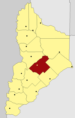
Zapala Department
Appearance
Zapala | |
|---|---|
Department | |
 | |
| Country | Argentina |
| Province | Neuquén |
| Capital | Zapala |
| Area | |
• Total | 5,200 km2 (2,000 sq mi) |
| Population | |
• Total | 35,806 |
| • Density | 6.9/km2 (18/sq mi) |
| Important cities | Zapala |
Zapala is a department located in the center of Neuquén Province, Argentina.
Geography
The Department limits with Confluencia Department at the East, Añelo Department at the northeast, Picún Leufú Department at southeast, Catán Lil Department at southwest and Picunches Department at northwest.
