Zyryanka (river)
Appearance
| Zyryanka | |
|---|---|
 | |
| Native name | Зырянка (Russian) |
| Physical characteristics | |
| Source | |
| • coordinates | 65°12′24″N 147°43′22″E / 65.206785°N 147.722890°E |
| Mouth | Kolyma |
• coordinates | 65°49′25″N 150°46′33″E / 65.823613°N 150.775935°E |
| Length | 299 km (186 mi) |
| Basin size | 7,310 km2 (2,820 sq mi) |
| Basin features | |
| Progression | Kolyma→ East Siberian Sea |
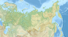
The Zyryanka (Russian: Зырянка) is a river in Yakutia, Russia. It is a left tributary of the Kolyma. It is 299 kilometres (186 mi) long, and has a drainage basin of 7,310 square kilometres (2,820 sq mi).[1]
See also
References
- ^ "Река Зырянка in the State Water Register of Russia". textual.ru (in Russian).


