Allgood, Alabama
- "Allgood" redirects here. This is also a common name for the plant Aristolochia rotunda.
Allgood, Alabama | |
|---|---|
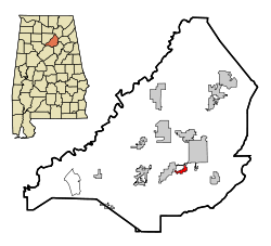
 Location in Blount County and the state of Alabama | |
| Country | United States |
| State | Alabama |
| County | Blount |
| Area | |
| • Total | 1 sq mi (2.7 km2) |
| • Land | 1 sq mi (2.7 km2) |
| • Water | 0 sq mi (0 km2) |
| Elevation | 787 ft (240 m) |
| Population (2007)[1] | |
| • Total | 712 |
| • Density | 629/sq mi (233/km2) |
| Time zone | UTC-6 (Central (CST)) |
| • Summer (DST) | UTC-5 (CDT) |
| ZIP code | 35013 |
| Area code | 205 |
| FIPS code | 01-01396 |
| GNIS feature ID | 0113021 |
Allgood is a town in Blount County, Alabama, United States. At the 2000 census the population was 629. According to the 2005 U.S. Census estimates, the town had a population of 693. [1] The mayor of Allgood, Alabama, is Nell Payne. Until mid-2008, the "Welcome to Allgood" sign on the outskirts of the town had an upside-down 'G'; This error has since been corrected by the mayor.
The mayor, Gene Armstrong, recently made headlines following the passage of H.B. 56 when he stated ""We managed in the past without illegal immigrants to pick the tomatoes here, and I haven't heard anyone say that if we sent them all home nobody would be left to do that work. When you have 9 percent unemployment, I think that some people who might not have wanted those jobs previously might reconsider."
Geography
Allgood is located at 33°54′15″N 86°30′59″W / 33.90417°N 86.51639°W (33.904216, -86.516428)Template:GR. According to the U.S. Census Bureau, the town has a total area of 1.0 square mile (2.6 km2), all of it land.
Demographics
2000 Census data
As of the censusTemplate:GR of 2000, there were 629 people, 189 households, and 140 families residing in the town. The population density was 606.6 people per square mile (233.5/km²). There were 198 housing units at an average density of 190.9 per square mile (73.5/km²). The racial makeup of the town was 83.94% White, 0.32% Black or African American, 0.48% Native American, 12.08% from other races, and 3.18% from two or more races. 43.40% of the population were Hispanic or Latino of any race.
There were 189 households out of which 40.7% had children under the age of 18 living with them, 62.4% were married couples living together, 8.5% had a female householder with no husband present, and 25.9% were non-families. 18.5% of all households were made up of individuals and 7.4% had someone living alone who was 65 years of age or older. The average household size was 3.33 and the average family size was 3.80.
In the town the population dispersal was 30.7% under the age of 18, 14.8% from 18 to 24, 34.3% from 25 to 44, 15.4% from 45 to 64, and 4.8% who were 65 years of age or older. The median age was 28 years. For every 100 females there were 109.0 males. For every 100 females age 18 and over, there were 116.9 males. The median income for a household in the town was $29,583, and the median income for a family was $30,750. Males had a median income of $31,058 versus $25,486 for females. The per capita income for the town was $11,729. About 23.4% of families and 27.3% of the population were below the poverty line, including 33.9% of those under age 18 and 8.7% of those age 65 or over.
Water system controversy
The town received international press coverage when it posted a notice that residents who failed to "HAVE AN ALABAMA DRIVER'S LICENSE OR ALABAMA PICTURE ID CARD ON FILE AT THIS OFFICE" may lose water service. The notice is reported to be a reaction to an anti-illegal immigration bill, Alabama HB 56.[2]
References
- ^ "Annual Estimates of the Population for Incorporated Places in Alabama". United States Census Bureau. 2008-07-10. Archived from the original on 1 August 2008. Retrieved 2008-07-14.
{{cite web}}: Unknown parameter|deadurl=ignored (|url-status=suggested) (help) - ^ Pilkington, Ed (October 7, 2011), "Alabama immigration threat: prove your legal status or lose water supply", Guardian, London, retrieved 11 October 2011

