
Bắc Giang province
Bắc Giang province
Tỉnh Bắc Giang | |
|---|---|
From top, left to right: Skyline of Bắc Giang City, Ngọc Liễn Cathedral, Vĩnh Nghiêm Temple, Đinh Hương Tomb, and Vân Xuyên Temple. | |
 Seal | |
| Nickname(s): The homeland of Blue River and Black Mountain[1] | |
 Location of Bắc Giang within Vietnam | |
 | |
| Coordinates: 21°20′N 106°20′E / 21.333°N 106.333°E | |
| Country | |
| Region | Northeast |
| Capital | Bắc Giang |
| Subdivision | 1 city, 9 rural districts |
| Government | |
| • Type | Province |
| • Body | Bắc Giang People's Council |
| • Secretary of the Party | Dương Văn Thái |
| • Chairman of People's Council | Lê Thị Thu Hồng |
| • Chairman of People's Committee | Lê Ánh Dương |
| Area | |
| • Province | 3,895.89 km2 (1,504.21 sq mi) |
| Population (2023)[3] | |
| • Province | 1,922,740 |
| • Density | 490/km2 (1,300/sq mi) |
| • Urban | 272,649 |
| Ethnic groups | |
| • Vietnamese | 85.74% |
| • Nùng | 5.31% |
| • Tày | 3.27% |
| • Others | 5.68% |
| GDP[4] | |
| • Province | VND 88.259 trillion US$ 3.773 billion |
| Time zone | UTC+7 (ICT) |
| Area codes | 204 |
| ISO 3166 code | VN-54 |
| Vehicle registration | 13, 98 |
| Website | www |


.jpg)


Bắc Giang (Vietnamese: [ʔɓak̚˧˦ zaːŋ˧˧] ) is a province of Vietnam, located in the Northeast region of the country, and situated 50 kilometres (31 mi) to the east of Hanoi. The province covers 3,895.89 km2 (1,504.21 sq mi),[2] and, as of 2023, its population was 1,922,740 people.[3]
The province lies in the Red River Delta and is bordered by Quảng Ninh to the east, Lạng Sơn to the north, Thái Nguyên and the urban district of Sóc Sơn in the capital Hanoi to the west, and Bắc Ninh and Hải Dương to the south.
History[edit]
.jpg)
Bắc Giang's history is traced to the Hùng kings of the Hong Bang period, when Vietnam was known as Văn Lang. Bắc Giang was in the division of Võ Ninh.
During the Lê dynasty, the province was the prefecture of Bắc Hà. Following the ascent of the Nguyễn dynasty, it became the prefecture of Thiên Phúc in 1822, before becoming the prefecture of Đa Phúc during the time of Emperor Tự Đức. From 5 November 1889 to 9 September 1891, there existed the province of Lục Nam.[5] It comprised the districts of Bảo Lộc, Phượng Nhỡn, Lục Nam, Hữu Lũng (split from Lạng Giang and Bắc Ninh Province) and the district of Yên Bái (split from Lạng Sơn Province). In 1891 after the return of the districts of Bảo Lộc and Phượng Nhỡn back to Bắc Ninh province, Lục Nam was abolished and integrated into Đạo Quan Binh I.
The modern province of Bắc Giang was founded on 10 October 1895,[6] when it was created out of Bắc Ninh Province.[6] It initially comprised the prefectures of Lạng Giang and Đa Phúc and the districts of Kim Anh, Yên Dũng, Phượng Nhỡn, Việt Yên, Hiệp Hòa, Yên Thế and some small territories south of Lục Nam River. The province capital was Phủ Lạng Thương, which is now the city of Bắc Giang. In 1896, the prefecture of Đa Phúc and the Kim Anh District was returned to Bắc Ninh Province.
In March 1945, Japanese troops conducted multiple massacres of French prisoners of war in Bắc Giang province. Immediately after the surrender of the Bắc Giang garrison, they bayoneted 45 prisoners of war to death; four badly wounded men survived. On 11 March 22 prisoners were killed on the banks of the Cầu River. Thirteen more were killed in a similar fashion two days later. On 14 March, 14 French prisoners were executed behind a church.[7]
In 1950, during the Democratic Republic of Vietnam, Bắc Giang was put into the Confederation of Northern Vietnam (Vietnamese: Liên Khu Việt Bắc) by the communist Việt Minh and comprised seven districts: Hiệp Hoà, Lục Ngạn, Yên Thế, Lạng Giang, Việt Yên, Yên Dũng, Hữu Lũng.[8] On 22 February 1955, the Sơn Động District (Quảng Yên province) was incorporated into Bắc Giang Province. On 1 July 1956, upon the formation of the Autonomous Region of Northern Vietnam (Vietnamese: Khu Tự Trị Việt Bắc), the Hữu Lũng District was transferred to Lạng Sơn Province. On 21 January 1957, the districts of Sơn Động and Lục Ngạn were divided into the three districts of Sơn Động, Lục Ngạn and Lục Nam. On 27 October 1962, Bắc Giang merged with Bắc Ninh into the new Hà Bắc province, until it was re-partitioned on 1 January 1997 into its previous components.[citation needed]
The province's name was derived from the Sino-Vietnamese 北江, meaning "north of the river".
Geography[edit]
Bắc Giang lies in the Red River Delta. It borders Quảng Ninh to the east, Lạng Sơn to the north, Thái Nguyên and the urban district of Sóc Sơn in the capital Hanoi to the west, and Bắc Ninh and Hải Dương to the south. It comprises three land forms namely, the lowland or delta land, the midland and the mountainous region. While the midland areas are in the districts of Hiệp Hoà and Việt Yên, and the city of Bắc Giang, the mountainous districts are the Sơn Động, Lục Ngạn, Yên Thế, Tân Yên, Yên Dũng and Lạng Giang; the seven mountainous districts account for 72% of the area of Bắc Giang province.[9][10]
Of the total land area of the province, 123,000 hectares (300,000 acres) is agricultural land, 110,000 hectares (270,000 acres) is forest land, 66,500 hectares (164,000 acres) is residential and urban land and for other uses. The farmland in the province is good for intensive farming of rice, vegetable, and fruit crops, and bulb trees. There is scope for expanding land under forests. The produce from the forests has been estimated as 3.5 million m3 of wood and 500 million trees of bamboo and neohouzeaua.
Bắc Giang occupies an area of 3,827.45 square kilometres (1,477.79 sq mi),[11] which is 1.2% of the area of the whole country. According to statistics from 2000, 32.4% of the land is used for agriculture, while 28.9% is used for forestry, industry or is otherwise uncleared. The remainder comprises mountains, unexploited waterways and land used for miscellaneous purposes. The province is 50 kilometres (31 mi) from Hanoi and has a good network of roads such as the National Highways No. 1A, 31 and 279. It has railway lines from Bắc Giang to Hanoi, Lạng Sơn, Thái Nguyên, and mineral areas in Quảng Ninh by train.[9]
The terrain is moderately mountainous, lying between the high mountains to the north and the Red River Delta to the south. Although a large part of the terrain is mountainous most of it is not isolated. The region to the northern end of the province is mountainous uncleared forest. To the east and southeast of the province is Đông Triều and Mount Yên Tử, located within the Yên Tử Nature Reserve. The elevation of the province is mostly in the 300–900 metres (980–2,950 ft) range, with a maximum of 1,068 metres (3,504 ft) (Mount Yên Tử).[12] To the northeastern end of the province, along the border with Quảng Ninh there is the Khe Rỗ forest, spanning 71.53 km2, with a rich biodiversity.

Bắc Giang has a total of 347 km of rivers and springs, the three most prominent rivers are the Lục Nam, the Thương and the Cầu.[11] Apart from waterways, Bắc Giang has many lakes, including Cấm Sơn Lake and Khuôn Thần Lake; the area covered by ponds, lakes and lagoons is 16,300 hectares (40,000 acres).[13]Cấm Sơn Lake lies in the district of Lục Ngạn, which borders Lạng Sơn Province. It is 30 kilometres (19 mi) long and has a width varying from 200 metres (660 ft) up to 7 kilometres (4.3 mi). It has an area of 26 square kilometres (10 sq mi), but this can increase to 30 kilometres (19 mi) during monsoonal flooding. Khuôn Thần Lake has an area of 2.4 square kilometres (0.93 sq mi) and the centre of the lake has five small hilly islands surrounded by 20-year-old pine forests. Pedal and motor boating are both permitted on the lake. Ethnic minority hamlets are located on the shores of the lake. Approach route to the lake is from Bắc Ninh - 31 kilometres (19 mi), then to Bắc Giang - 51 kilometres (32 mi)), further to the Hoà River - 98 kilometres (61 mi) and finally arrive at Cấm Sơn Lake.[9][10][11] The highest flow in the Thương River is reported to be 64.4 m3/s and lowest flow is 12.9 m3/s.[14]
- Climate
The province has the dominant characteristics of the tropical, temperate climate zone of the Northern Plain. The temperature, humidity and rainfall vary over months and seasons. The climate in the province has been discerned in two distinct seasons - the hot, rainy season from May to September and the cold, dry season from November to March. The average temperature varies between 22–23 °C (72–73 °F); the maximum temperature recorded was 41 °C (106 °F) while the lowest temperature was 13 °C (55 °F). Humidity values are in the range of 73% to 87%. The average rainfall is reported to be 1,953 millimetres (76.9 in). The annual sunshine hours of 1,500 to 1,700 hours is good to grow tropical and subtropical trees. The average wind velocity is 2.1 metres (6.9 ft)/s and the average atmosphere pressure is 757.71 mmHg. Since the province is located away from Vietnam's eastern coast and the South China Sea (East Sea), the incidence of hurricanes and storms is rare, although whirlwinds and hailstorms are a localised phenomenon in a few mountainous districts.[10][14]
- Minerals
Bắc Giang had 63 registered mines in 2005 involved in mining 15 types of minerals such as coal, metal, industrial minerals, building materials. Important mines are the coal mines in Yên Thế, Lục Ngạn and Sơn Động districts, which have coal reserves of about 114 million tonnes (including anthracite, lean-coal, peat-coal); Dong Ri mine has 107.3 million tonnes that has potential for a large scale industrial development. Iron ore reserves (0,5 million tonnes) have been found in the Yên Thế district. Bronze ore reserves (100,000 tonnes) have been found in Lục Ngạn and Sơn Động districts. Three million tonnes of Kaolin reserves have been located in Yên Dũng. Large reserves of clay (360 million m3) are concentrated in Việt Yên, Lang Giang, Lục Nam, Yên Thế, and Hiệp Hoà districts, about 100 m3 are used to make fire-bricks. Gravel and conglomerates are in Hiệp Hoà and Lục Nam districts.[10]
- Avifauna
A joint survey of the multi-taxa inventory conducted in the Bắc Giang province by the Centre for Biodiversity and Conservation at the American Museum of Natural History, New York (CBC-AMNH) and the Institute for Ecology and Biological Resources, Hanoi (IEBR) has recorded 146 species of birds, including 61 species from Khau Rịa and Mt Pu Tha Ca and 105 species from Mt Tây Côn Lĩnh.[15]
Demographics[edit]
According to the General Statistics Office of the Government of Vietnam, the population of Bắc Giang province as of 2016 was 1,657,600 with a density of 430 persons per km2 over a total land area of 3,827.45 square kilometres (1,477.79 sq mi) of the province.[16] The male population during this period was 790,300,[17] with females accounting for 838,100.[18] The rural population was 1,473,000 against an urban population of 153,400.[19][20]
According to the census of 1 April 2009, the population was 1,555,720 with a density of 407 people/km2, 1.7 times the national average. There are 26 ethnic groups in the province - of these, ethnic Vietnamese comprised 88.1%, followed by Nùng people with 4.5%, Tày with 2.6%; Sán Chay people and Sán Dìu people, both with 1.6%, Hoa 1.2% and Dao people 0.5%.
Administrative divisions[edit]
Bắc Giang is subdivided into 10 district-level sub-divisions:
They are further subdivided into 16 commune-level towns (or townlets), 207 communes, and 7 wards.[21]
Table of local government divisions[edit]
Economy[edit]
Bắc Giang's land area is primarily dedicated to agriculture. The province is becoming known as a producer of fruit, particularly pineapples and lychees. Around a quarter of Bắc Giang's land area is devoted to forestry. Located 50 kilometres (31 mi) from Hanoi, the province is within both the Hanoi-Hải Phong-Quảng Ninh Economic Corridor, and the Nam Ninh-Lạng Sơn-Hanoi-Hải Phong-Quảng Ninh Economic Corridor. Before the province was formulated in 1997 and industrial development of the region was initiated, the GDP of the province was only US$170 with Agro-Forestry accounting for 55% and Industry hardly contributed. It was a poor economy with 90% of agricultural workers remaining below the poverty line. However, during the period 1997–2008, the province having launched several industrial projects in all its districts, 410 projects were launched with investment of US$23.174 billion that included 74 "Foreign Direct Investment" projects worth US$432.9 million. As a result, several economic farming models were introduced, which resulted in "Rural Economic Development", social consumer retail sales, and services got a boost, the poverty rate (2005 level) reduced to 17.78%, and textiles and garment exports accounted for about US$130 million, which was 76% of the province's export turnover.
Infrastructure such as National Highways and rural roads were substantially expanded, towns were better planned and beautified. Industrial parks, urban Areas-service and high-tech parks are being added. Key Industries like fertilizer, high technology, engineering, building materials, assembling automobiles, agricultural processing, forestry products, textiles and electric power generation are planned with the objective of achieving a GDP growth rate of 11-12% by 2020.[23] The province has the Bắc Giang Department of Industry and Trade established in 2008 by the Bắc Giang People's Committee, which unifies the Department of Industry and the Department of Trade and Tourism; this testifies to the importance given to promote industrial development of the province.[24]
Some of the economic indicators in respect of farming, agriculture and industrial production are the following. As against the national figure of 7592 of Agriculture, Forestry and Fishery cooperatives there are only agriculture cooperatives in the province.[25][26] There are 1786 farms as against the national number of 120,699.[27] The output value of agriculture produce at constant 1994 prices in the province was 3,491.7 billion đồngs against the national figure of 156,681.9 billion đồngs.[28] The province produced 569,400 tonnes of cereals as against the national production of 43.26 million tonnes[29] The per capita production of cereals in the district was 349.7 kilograms (771 lb) as against the national figure of 501.8 kilograms (1,106 lb) in 2007.[30]
In 2007, the industrial output of the province was only 3,868.3 billion đồngs out of the total national output of 1.47 million billion đồngs.[31]
- Thac Huong irrigation scheme
The Thac Huong Irrigation Scheme in the Yên Thế district, adjacent to Thái Nguyên province and west of Hanoi, was implemented in the early 20th century by the-then French colonial government. Construction of the irrigation scheme for utilization of the Cầu River was started in 1922 and operationalised in 1936. The irrigation system was built on the left bank of the river and envisaged irrigation to a total command area of 57,325 hectares (141,650 acres). Net irrigation provided was to an area of 28,500 hectares (70,000 acres) in Phú Binh (Thái Nguyên province), Việt Yên, Tan Yên, and Hiệp Hoà (in Bắc Giang Province). Additionally, a supply of potable drinking water was built into the system. Navigation was part of its beneficial uses as a transport route for shipment of rice and salt from Hai Phong to Thái Nguyên. The scheme, as built, has a concrete dam of 6.7 metres (22 ft) height and 100 metres (330 ft) length, known as the Thac Huong dam across the Cầu River. A head regulator on the canal is 36 metres (118 ft) in width and 6.5 metres (21 ft) in height. 10 branch canal intakes were provided, each with a capacity of 25m3/s. However, the energy dissipation arrangements of the dam have been damaged, several times since it was built, by floods and bombing raids. The Asian Development Bank (ADB) funded the rehabilitation project in 2000. Although restored after 1955, the project is facing water shortages and is unable to meet the demands for irrigation due to building of many projects in the upstream reaches of the river, over utilisation by industries and poor maintenance. Transbasin diversions have been implemented along with pumping from other streams to meet the water demands for irrigation and other uses of drinking water and industries.[32]
Lychee[edit]

Lychee is a dominant fruit crop of Bắc Giang Province. It is grown in an area of 20,275 hectares (50,100 acres) in this province, out of a total area of 35,352 hectares (87,360 acres) in the country and the production is reported to be 20,248 tonnes. This variety originated from Hải Dương province (Thanh Hà District) and is commercially cultivated in Lục Ngạn, Lục Nam and Yên Thế districts of the province, apart from other provinces in the country. According to the Research Institute of Fruits and Vegetables (RIFAV), 33 accessions have been identified as 33 cultivars [clarification needed] of lychee grown in different locations in home gardens and consolidated farms.[33]
Visitor attractions[edit]
Bắc Giang has many locations of interest to visitors. It has several monuments such as the Khe Rỗ Primitive Forest, Xương Giang, the Ancient Citadel, Cấm Sơn Lake, Đức La Pagoda and Thọ Hà Communal House.[9]
- Khe Rỗ Primitive forest
Khe Rỗ Primitive Forest, a virgin primitive forest is located in An Lạc commune, Sơn Động District. The forest is a protected and covers an area of 7,153 hectares (17,680 acres). The forest has rich biodiversity of flora and fauna. 236 species of trees, 255 tubers of valuable medical plants, 37 mammals, 73 species of birds and 18 species of reptiles (7 are considered rare and valuable) have been recorded in the forest. Many streams flow through the forest area.[9] The An Lạc commune has a newly developed Ecotourism program running out of several homestays to help preserve and share the cultural heritage of local ethnic minorities. Local families host visitors and prepare authentic dishes for them. Tours through the forest, passed waterfalls and lakes, and treks up Khau Tron Peak are available through local guides. CSDS (Center for Sustainable Development Studies), a non-profit NGO in Hanoi in conjunction with other organisations assists the locals to develop sustainable lifestyles through ecotourism.[34]
- Đức La Pagoda
The Đức La pagoda, located in the Trí Yên commune of Yên Dung district, was built in the 12th century and is well preserved. It was then the centre of the "Trúc Lâm Trinity" (King Trần Nhân Tông, Pháp Loa and Huyền Quang monks) who established a school of Buddhist preaching and founded the Trúc Lâm religious sect. The pagoda is set in the backdrop of the Co Tien Mountain range at the Phuong Nhon confluence. The pagoda is surrounded by an expanse of rice-fields, amidst villages and hamlets around green bamboo groves. The "99 Nham Bien Mountain range" is seen at a distance. The pagoda is built on a south-west axis and has four principal zones. The first zone has the Ho and Thieu Huong Buddhist pagodas. There are two Thap Dien niches where very large statues of Thien Wong, Dia Tang and Long Than are installed. The Thien Huong Palace, adjacent to this, is an exquisite structure, which has three horizontal panels and a gilded door. The first chamber of Buddha is the architectural legacy of the Lê dynasty. The second zone is separated from the first zone by a brick yard. Within this zone is a simple building built with wooden planks and decorated with natural scenes of sky and clouds. It is the first ancestral shrine, and a panel here has the inscription "Trúc Lâm ho thuong" (A rendezvous of the Trúc Lâm Trinity) in Chinese characters. This inscription is engraved above the three statues of the Trúc Lâm Trinity. The third zone has the two-roofed bell tower. The fourth zone is another ancestral shrine with two statues made in the architectural style of the Nguyễn dynasty. The Đức La pagoda is also an important training centre of Buddhism. The pagoda also has wooden printing blocks of Buddhist sutras.[9]
- Tho Ha Communal House
The Tho Ha Communal House, located in Tho Ha village, Việt Yên district, was built during the rule of King Lê Hy Tong. It was built in the form of the Chinese character cong and it is known as "the praise-giving house". It is built over a raised ground and is 27 metres (89 ft) long and 16 metres (52 ft) wide and approached from all sides by three grey stone steps. The roofs of the Communal House has an ancient crescent-shaped tiled roof that curves up like a scimitar sword blade. At the four corners, decorated with purple-burned glazed terra-cotta creatures of lion cubs are depicted. It has 22 levels engraved with dragons, clouds, and lion cubs. The communal house has 7 rooms built on 48 ironwood pillars. The roof frame is decorated with engravings of "ladies in long dresses wearing their hair in buns or turbans, riding phoenixes and dragons or dancing over the floating clouds". Polished blue stones decorate the floor of the house. It has a wooden entrance engraved and painted in gold which gives it an ancient ambience. There is also an inscription on a stone, which says that the Tho Ha Communal House was built out of contributions from local villagers.[9]
- ATK2
ATK is an abbreviation of "An Toàn Khu", which means "safe zone". It was primarily built by the Việt Cộng guerrillas during the war, in the period 1965–1972, against the Americans. This zone consists of a network of tunnels as defense works against any army attacks by bombs and guns. This has now been developed as a historical monument. [citation needed]
- Other sights
Other sights of interest in the province are: The Museum dedicated to Hoàng Hoa Thám and Đồn Phồn Xương in Yên Thế District; the Dinh Hương Tomb in Đức Thắng commune, Hiệp Hòa District, burial place of La Quý Hầu, a Lê dynasty noble and army officer; the historical region of Suối Mỡ and Đền Suối Mỡ in Lục Nam District; the Đức La Temple in Yên Dũng District; the ancient fort of Xương Giang; and the Cây Dã tree, believed to be more than 1000 years old, located in Tiên Lục commune, Lạng Giang District. Eight people are required to hold hands to span this tree's circumference.[35]
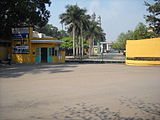
Gallery[edit]
-
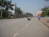
 An urban corner of Bắc Giang city.
 -
 Bắc giang City
 -
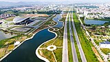
 Bắc Giang city innovates and develops
 -
 Intersection of Hùng Vương street and Đồng Sơn bridge
 -
 Bắc Giang innovation city
 -
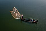 Fishing on the Thương River
 -
 Highlights of Bắc Giang city's infrastructure
 -
 Bắc Giang at night
 -
 Bắc Giang
 -
 Bắc Giang
 -
 Bắc Giang
 -
 Bắc Giang
 -
 Bắc Giang
 -
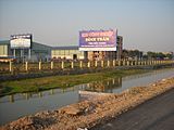
 Highway in Bắc Giang Province
 -
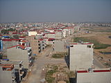
 Việt Yên
 -
 Việt Yên


References[edit]
- ^ "The land of Blue River and Black Mountain". Archived from the original on 6 March 2019. Retrieved 2 March 2019.
- ^ a b Biểu số 4.1: Hiện trạng sử dụng đất vùng Trung du và miền núi phía Bắc năm 2022 [Table 4.1: Current land use status in the Northern Midlands and Mountains in 2022] (PDF) (Decision 3048/QĐ-BTNMT) (in Vietnamese). Ministry of Natural Resources and Environment (Vietnam). 18 October 2023. – the data in the report are in hectares, rounded to integers
- ^ a b c General Statistics Office of Vietnam (2019). "Completed Results of the 2019 Viet Nam Population and Housing Census" (PDF). Statistical Publishing House (Vietnam). ISBN 978-604-75-1532-5.
- ^ "Tình hình kinh tế, xã hội Bắc Giang năm 2018". Cổng thông tin điện tử tỉnh Bắc Giang. Retrieved 10 May 2020.
- ^ "Bắc Giang" (in Vietnamese). Tangthuphathoc. Retrieved 25 August 2010.
- ^ a b "Giới thiệu sách: Địa chí Thành phố Bắc Giang" (in Vietnamese). Vanhoabacgiang. Archived from the original on 17 February 2017. Retrieved 25 August 2010.
- ^ "The 9th March 1945 onslaught". Association Nationale des Anciens Prisonniers et Internés d'Indochine. Archived from the original on 1 December 2006. Retrieved 7 June 2017.
{{cite web}}: CS1 maint: bot: original URL status unknown (link) - ^ Quang Thưởng Lê (2004). Sách tra cứu các mục từ vè̂ tỏ̂ chức (in Vietnamese). Nhà xuá̂t bản Chính trị quó̂c gia.
- ^ a b c d e f g "Bắc Giang province". Indo China Cycling. Archived from the original on 30 December 2009. Retrieved 29 August 2010.
- ^ a b c d "Bắc Giang Province: Minerals". Bắc Giang Industrial Zones Authority. Archived from the original on 1 December 2012. Retrieved 29 August 2010.
- ^ a b c "Bắc Giang Province". VN Tours. Archived from the original on 23 August 2010. Retrieved 25 August 2010.
- ^ "Yen Tu Nature Reserve" (PDF). Bird Life in Indo China. Retrieved 25 August 2010.
- ^ "Bắc Giang: Government Information". Local Government. Retrieved 29 August 2010.[dead link]
- ^ a b "Upgrade and Expansion Project of Habac Nitrogenous Fertilizer Plant of HANICHEMCO". Vietnam National Chemical Group. Archived from the original on 8 July 2010. Retrieved 29 August 2010.
- ^ "Ornithological records from Ha Giang province, north-east Vietnam, during March–June 2000" (PDF). Oriental Bird Club. pp. 22–25. Archived from the original (PDF) on 10 June 2011. Retrieved 30 August 2010.
- ^ "Population and population density in 2008 by province". General Statistics Office of the Government of Vietnam. Archived from the original on 13 November 2009. Retrieved 23 June 2010.
- ^ "Population and Employment: Average male population by province". Population and Employment: General Statistics Office of the Government of Vietnam. Archived from the original on 13 November 2009. Retrieved 23 June 2010.
- ^ "Average female population by province". General Statistics Office of the Government of Vietnam. Archived from the original on 13 November 2009. Retrieved 23 June 2010.
- ^ "Average urban population by province". Population and Employment: General Statistics Office of the Government of Vietnam. Archived from the original on 12 October 2014. Retrieved 23 June 2010.
- ^ "Average urbanpopulation by province". Population and Employment: General Statistics Office of the Government of Vietnam. Archived from the original on 13 November 2009. Retrieved 23 June 2010.
- ^ "Number of administrative units as of 31 December 2008 by province". General Statistics Office of the Government of Vietnam. Archived from the original on 13 November 2010. Retrieved 23 June 2010.
- ^ a b c d e f g h i j k l m n o p "Districts of Vietnam". Statoids. Retrieved 20 June 2010.
- ^ Bắc Giang province 12 years after re-establishment "Bắc Giang Department of Planning and Investment". Retrieved 29 August 2010.
{{cite web}}: Check|url=value (help) - ^ "Bắc Giang Department of Industry and Trade tasks and powers". Bắc Giang Department of Industry and Trade. Retrieved 29 August 2010.[permanent dead link]
- ^ "Agriculture, Forestry and Fishery: Number of cooperatives by province". Population and Employment: General Statistics Office of the Government of Vietnam. Archived from the original on 13 November 2009. Retrieved 23 June 2010.
- ^ "Number of cooperatives in 2008 by kind of activity and by province: Agriculture, Forestry and Fishery". Population and Employment: General Statistics Office of the Government of Vietnam. Archived from the original on 13 November 2009. Retrieved 23 June 2010.
- ^ "Agriculture, Forestry and Fishery: Number of farms by province". Population and Employment: General Statistics Office of the Government of Vietnam. Archived from the original on 13 November 2009. Retrieved 23 June 2010.
- ^ "Agriculture, Forestry and Fishery: Output value of agriculture at constant 1994 prices". Population and Employment: General Statistics Office of the Government of Vietnam. Archived from the original on 13 November 2009. Retrieved 23 June 2010.
- ^ "Agriculture, Forestry and Fishery: Production of cereals by province". Population and Employment: General Statistics Office of the Government of Vietnam. Archived from the original on 13 November 2009. Retrieved 23 June 2010.
- ^ "Agriculture, Forestry and Fishery: Production of cereals per capita by province". Population and Employment: General Statistics Office of the Government of Vietnam. Archived from the original on 13 November 2009. Retrieved 23 June 2010.
- ^ "Industry: Industrial output value at current prices by province". Population and Employment: General Statistics Office of the Government of Vietnam. Archived from the original on 31 August 2009. Retrieved 23 June 2010.
- ^ "Irrigation Management Company of Bắc Giang: Water Rights and Water Allocation in Irrigation Scheme of Cầu River, Bắc Giang" (PDF). Bắc Giang Department of Agriculture and Rural Development. Retrieved 29 August 2010.[permanent dead link]
- ^ "Lychee Production in Vietnam". FAO. Retrieved 29 August 2010.
- ^ "Anlac-khero.com". Archived from the original on 4 November 2016. Retrieved 15 November 2018.
- ^ http://dangcongsan.vn/cpv/Modules/News/NewsDetail.aspx?co_id=28340756&cn_id=627062[permanent dead link]
External links[edit]
- Bắc Giang province official website Archived 21 December 2018 at the Wayback Machine
Places adjacent to Bắc Giang province | |
|---|---|
| International | |
|---|---|
| National | |
| Geographic | |