
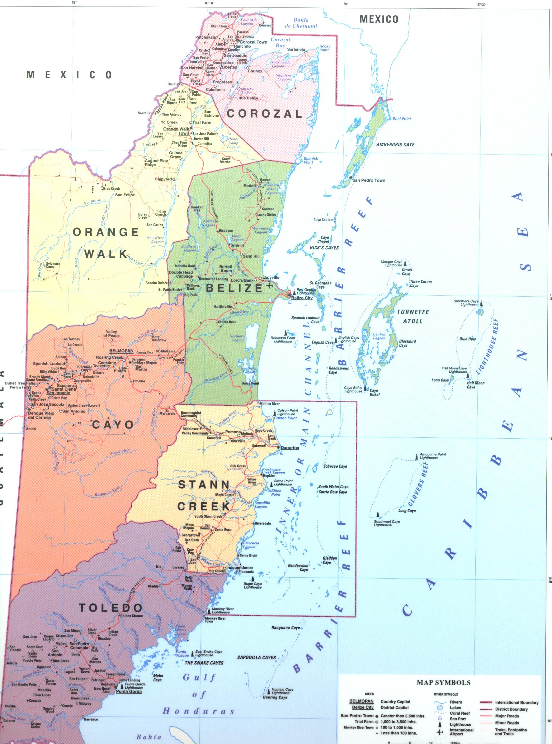
Districts of Belize
 |
|---|
|
|
Belize is divided into six districts, those six are, Corozal, Orange Walk, Belize (District) Cayo, Stann Creek, and Toledo
List[edit]

| District | Capital | Area[1] | Population (2019)[2] |
Population (2010)[1] |
Change | Population density (2019) |
|---|---|---|---|---|---|---|
| Belize | Belize City | 4,310 km2 (1,663 sq mi) | 124,096 | 95,292 | +30.2% | 28.8/km2 (74.6/sq mi) |
| Cayo | San Ignacio | 5,200 km2 (2,006 sq mi) | 99,118 | 75,046 | +32.1% | 19.1/km2 (49.4/sq mi) |
| Corozal | Corozal Town | 1,860 km2 (718 sq mi) | 49,446 | 41,061 | +20.4% | 26.6/km2 (68.9/sq mi) |
| Orange Walk | Orange Walk Town | 4,600 km2 (1,790 sq mi) | 52,550 | 45,946 | +14.4% | 11.3/km2 (29.4/sq mi) |
| Stann Creek | Dangriga | 2,550 km2 (986 sq mi) | 44,720 | 34,324 | +30.3% | 17.5/km2 (45.4/sq mi) |
| Toledo | Punta Gorda | 4,410 km2 (1,704 sq mi) | 38,557 | 30,785 | +25.2% | 8.7/km2 (22.6/sq mi) |
See also[edit]
- Constituencies of Belize
- List of municipalities in Belize
- List of West Indian first-level country subdivisions
- ISO 3166-2:BZ
- Commonwealth Local Government Forum-Americas
References[edit]
- ^ a b Belize Population and Housing Census 2010: Country Report (PDF) (Report). Statistical Institute of Belize. 2013. p. 70. Archived from the original (PDF) on 27 January 2016. Retrieved 14 May 2016.
- ^ "Belize: Districts, Towns & Villages - Population Statistics, Maps, Charts, Weather and Web Information". www.citypopulation.de.
