Itumirim
This is an old revision of this page, as edited by Citation bot (talk | contribs) at 07:10, 23 August 2022 (Alter: title. | Use this bot. Report bugs. | Suggested by BrownHairedGirl | #UCB_webform 1023/3838). The present address (URL) is a permanent link to this revision, which may differ significantly from the current revision.
Itumirim | |
|---|---|
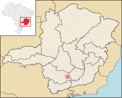
 Location in the state of Minas Gerais | |
| Coordinates: 21°19′1″S 44°52′15″W / 21.31694°S 44.87083°W / -21.31694; -44.87083 | |
| Country | |
| Region | Southeast |
| State | |
| Mesoregion | Campo das Vertentes |
| Population (2020 [1]) | |
| • Total | 6,000 |
| Time zone | UTC−3 (BRT) |
| Website | www |
Itumirim is a Brazilian municipality located in the state of Minas Gerais. The city belongs to the mesoregion of Campo das Vertentes and to the microregion of Lavras. As of 2020[update] it has a population of 6,000.
"Itumirim" is a term of Tupi origin meaning "little waterfall."[2][3] It became a municipality by the state Decree Law No. 1058 of December 31, 1943.[4]
See also
References
- ^ IBGE 2020
- ^ "Nomes das Cidades do Brasil". Archived from the original on 2013-10-26. Retrieved 2016-09-25.
- ^ "Curso de Tupi Antigo". Archived from the original on 2012-08-09. Retrieved 2012-09-10.
- ^ "Itumirim - Histórico" (PDF). biblioteca.ibge.gov.br. 2008. Retrieved 25 June 2012.
This geographical article relating to Minas Gerais is a stub. You can help Wikipedia by expanding it. |


