
MARTA rail
| MARTA rail | ||||||||||||||||||||||||||||||||||||||||||||||||||||||||||||||||||||||||||||||||||||||||||||||||||||||||||||||||||||||||||||||||||||||||||||||||||||||||||||||||||||||||||||||||||||||||||||||
|---|---|---|---|---|---|---|---|---|---|---|---|---|---|---|---|---|---|---|---|---|---|---|---|---|---|---|---|---|---|---|---|---|---|---|---|---|---|---|---|---|---|---|---|---|---|---|---|---|---|---|---|---|---|---|---|---|---|---|---|---|---|---|---|---|---|---|---|---|---|---|---|---|---|---|---|---|---|---|---|---|---|---|---|---|---|---|---|---|---|---|---|---|---|---|---|---|---|---|---|---|---|---|---|---|---|---|---|---|---|---|---|---|---|---|---|---|---|---|---|---|---|---|---|---|---|---|---|---|---|---|---|---|---|---|---|---|---|---|---|---|---|---|---|---|---|---|---|---|---|---|---|---|---|---|---|---|---|---|---|---|---|---|---|---|---|---|---|---|---|---|---|---|---|---|---|---|---|---|---|---|---|---|---|---|---|---|---|---|---|---|
 MARTA AnsaldoBreda CQ312 Gold train leaving College Park Station | ||||||||||||||||||||||||||||||||||||||||||||||||||||||||||||||||||||||||||||||||||||||||||||||||||||||||||||||||||||||||||||||||||||||||||||||||||||||||||||||||||||||||||||||||||||||||||||||
| Overview | ||||||||||||||||||||||||||||||||||||||||||||||||||||||||||||||||||||||||||||||||||||||||||||||||||||||||||||||||||||||||||||||||||||||||||||||||||||||||||||||||||||||||||||||||||||||||||||||
| Owner | Metropolitan Atlanta Rapid Transit Authority | |||||||||||||||||||||||||||||||||||||||||||||||||||||||||||||||||||||||||||||||||||||||||||||||||||||||||||||||||||||||||||||||||||||||||||||||||||||||||||||||||||||||||||||||||||||||||||||
| Locale | Atlanta, Fulton and DeKalb Counties, Georgia | |||||||||||||||||||||||||||||||||||||||||||||||||||||||||||||||||||||||||||||||||||||||||||||||||||||||||||||||||||||||||||||||||||||||||||||||||||||||||||||||||||||||||||||||||||||||||||||
| Transit type | Rapid transit | |||||||||||||||||||||||||||||||||||||||||||||||||||||||||||||||||||||||||||||||||||||||||||||||||||||||||||||||||||||||||||||||||||||||||||||||||||||||||||||||||||||||||||||||||||||||||||||
| Line number | ||||||||||||||||||||||||||||||||||||||||||||||||||||||||||||||||||||||||||||||||||||||||||||||||||||||||||||||||||||||||||||||||||||||||||||||||||||||||||||||||||||||||||||||||||||||||||||||
| Number of stations | 38 (Five Points, 11 North, 4 Northeast, 7 South, 9 East, 5 West, 1 Proctor Creek) | |||||||||||||||||||||||||||||||||||||||||||||||||||||||||||||||||||||||||||||||||||||||||||||||||||||||||||||||||||||||||||||||||||||||||||||||||||||||||||||||||||||||||||||||||||||||||||||
| Daily ridership | 90,500 (weekdays, Q3 2024)[1] | |||||||||||||||||||||||||||||||||||||||||||||||||||||||||||||||||||||||||||||||||||||||||||||||||||||||||||||||||||||||||||||||||||||||||||||||||||||||||||||||||||||||||||||||||||||||||||||
| Annual ridership | 31,110,300 (2023)[2] | |||||||||||||||||||||||||||||||||||||||||||||||||||||||||||||||||||||||||||||||||||||||||||||||||||||||||||||||||||||||||||||||||||||||||||||||||||||||||||||||||||||||||||||||||||||||||||||
| Operation | ||||||||||||||||||||||||||||||||||||||||||||||||||||||||||||||||||||||||||||||||||||||||||||||||||||||||||||||||||||||||||||||||||||||||||||||||||||||||||||||||||||||||||||||||||||||||||||||
| Began operation |
| |||||||||||||||||||||||||||||||||||||||||||||||||||||||||||||||||||||||||||||||||||||||||||||||||||||||||||||||||||||||||||||||||||||||||||||||||||||||||||||||||||||||||||||||||||||||||||||
| Character | Elevated, underground, at-grade | |||||||||||||||||||||||||||||||||||||||||||||||||||||||||||||||||||||||||||||||||||||||||||||||||||||||||||||||||||||||||||||||||||||||||||||||||||||||||||||||||||||||||||||||||||||||||||||
| Technical | ||||||||||||||||||||||||||||||||||||||||||||||||||||||||||||||||||||||||||||||||||||||||||||||||||||||||||||||||||||||||||||||||||||||||||||||||||||||||||||||||||||||||||||||||||||||||||||||
| System length | 48 mi (77 km) | |||||||||||||||||||||||||||||||||||||||||||||||||||||||||||||||||||||||||||||||||||||||||||||||||||||||||||||||||||||||||||||||||||||||||||||||||||||||||||||||||||||||||||||||||||||||||||||
| Track gauge | 4 ft 8+1⁄2 in (1,435 mm) standard gauge | |||||||||||||||||||||||||||||||||||||||||||||||||||||||||||||||||||||||||||||||||||||||||||||||||||||||||||||||||||||||||||||||||||||||||||||||||||||||||||||||||||||||||||||||||||||||||||||
| Electrification | Third rail, 750 V DC | |||||||||||||||||||||||||||||||||||||||||||||||||||||||||||||||||||||||||||||||||||||||||||||||||||||||||||||||||||||||||||||||||||||||||||||||||||||||||||||||||||||||||||||||||||||||||||||
| ||||||||||||||||||||||||||||||||||||||||||||||||||||||||||||||||||||||||||||||||||||||||||||||||||||||||||||||||||||||||||||||||||||||||||||||||||||||||||||||||||||||||||||||||||||||||||||||

.svg)
The MARTA rail network, a component of the MARTA transit system in Metro Atlanta, has four service lines: the Red, Gold, Blue, and Green lines. The Red and Gold lines mainly run along the North-Northeast corridor, and the Blue and Green Lines run along the West-East corridor. The two corridors connect at the Five Points station, which is the only station where transfers are possible between all four lines. In 2023, the system had a ridership of 31,110,300, or about 90,500 per weekday as of the third quarter of 2024.
Rail system
[edit]All trains are identified by their destinations, and an automated announcement system announces train destinations, bus and other transit connections, and landmarks that are at or near each rail station.
Each station also has a secondary designation that provides the cardinal direction (typically north, south, east, or west) and relative distance from the central Five Points station. For instance, Lindbergh Center is the sixth station from Five Points traveling north, and has the secondary designation (N6). Northeast of Lindbergh Center on the Gold Line, stations are designated with NE while continuing the numbering, so Lenox is (NE7). Similarly, Bankhead is on a branch from the main east-west trunk and is designated (P4),[3] a legacy of the original Proctor Creek name for the Green Line.[4]
During daytime hours, trains on the Red and Gold lines service the entire north-south trunk line and split north of Lindbergh Center (N6). All MARTA trains are identified with a destination on electronic LCD signs on the front and sides of the train and on each car. After 9pm, the Red Line is short-turned and runs as a shuttle between North Springs (N11) and Lindbergh Center (N6), connecting to the Gold Line at Lindbergh Center.[5] The connection is scheduled, with southbound Red trains arriving at Lindbergh Center just before Gold trains continuing southbound, and in reverse, northbound Gold trains arrive at Lindbergh just before Red trains leave northbound.
Blue and Green lines service the east-west trunk line together between Ashby (W3) and Edgewood–Candler Park (E4). At Ashby, Blue Line service continues to H.E. Holmes (W5) while Green Line trains divert to Bankhead Station (P4). Green Line service terminates at Edgewood–Candler Park, while the Blue Line continues east to Indian Creek. After 9pm, Green Line service is short-turned and operates as a shuttle between Bankhead (P4) and Vine City (stop W2). On weekends before 9pm, Green Line service is short-turned at King Memorial (stop E2).[5]
Older system maps used orange to denote the North-South line and blue for the East-West line, including the Northeast and Proctor Creek branches.[6] Lines were identified by the direction of travel and/or terminals.[4][7] MARTA switched to a color-based route naming system in October 2009, so the Proctor Creek or Bankhead-Edgewood line became the Green Line, for example.[8] The former Northeast line that served Doraville, known as the "heart of Atlanta's Asian community", was initially named the Yellow Line, which Asian-Americans found derogatory.[9] It was renamed to the Gold Line in 2010 in response to the complaints.[10]
Many suburban stations offer designated free daily and paid long term parking in MARTA-operated park and ride lots.[11] These stations also have designated kiss and ride passenger drop off parking spaces closest to the stations' entrances.
Operation
[edit]The MARTA rail system operates between approximately 4:45 a.m. and 1 a.m. Monday through Friday, and 6 a.m. to 1 a.m. Saturdays and Sundays.[12]
| Period | Headway (min.) | |
|---|---|---|
| Weekday | Daytime (6 AM – 7 PM) |
10 |
| (non-rush) | 12 | |
| Nights (9 PM+) |
20 | |
| Weekends | 20 | |
Due to the COVID-19 pandemic in Atlanta, train headways were reduced to 15 minute intervals between trains during most weekday hours and 20 minutes at other times.[14] In August 2023, MARTA announced that frequencies would increase to every 12 minutes on all rail lines between 6 a.m. and 9 a.m. and 2:30 p.m. and 7:30 p.m. Following the increase, headways would be every 6 minutes along the interlined portion of the network.[15] In December 2024, they announced that frequencies would increase again back to their pre-pandemic headways of every 10 minutes between 6 a.m. and 9 a.m. and 3 p.m. and 7 p.m and every 12 minutes during off-peak hours on weekdays.[13]
| Period | Headway (min.) | ||
|---|---|---|---|
| 1979–2005 | 2005–2020 | ||
| Weekday | Rush (6–9 AM & 3–7 PM) |
8 | 10 |
| Non-rush | 12 | ||
| Nights (9 PM+) |
15 | 20 | |
| Weekends | 10/15 | 20 | |
Originally, MARTA operated trains every eight minutes during the day on weekdays on each route. When two routes operated on the same tracks, the effective headway was cut in half, and the North-South Line operated on a combined four-minute headway between Lindbergh Center and Airport stations on the trunk. On Saturdays, it was every ten minutes (five minutes combined on the North-South Line trunk), and on Sundays it was every 15 minutes (7.5 minutes on the North-South Line trunk). At night, trains operated every 15 minutes.[16]
After budget cuts in 2005 affected the rail system, headways were increased by 25–50% to 10 minutes weekdays during rush hour and 12 minutes during midday, and 20 minutes nightly and weekends. For combined service, headways decrease to 5 minutes during rush hour and 6 minutes during midday and 10 minutes on the weekends during the day. All rail lines operate 20 minutes during late night (8:30pm weekdays, 8:50pm weekends) as the Red Line was short-turned and only ran from North Springs to Lindbergh Center; likewise the Green Line was short turned and operated from Bankhead to Vine City. Due to ongoing rail system maintenance, weekend headways were variable and could range from the normal 20 minutes to as much as 24 minutes, with the Green and Red lines being truncated in up to 80% of weekends in 2024.[17] During weekends in the latter case, headways along the shared lines will increase from 10 minutes to 20 minutes.[18]
Stations
[edit]- † denotes a terminal station
- Until 1994, the NE codes were designated as N
| Station | Code | Lines | Jurisdiction | Structure | Opened | Entries/ (2013)[19] |
Ref. |
|---|---|---|---|---|---|---|---|
| Airport† | S7 | College Park | Elevated | June 18, 1988 | 9,173 | [20] | |
| Arts Center | N5 | Atlanta | Underground | December 18, 1982 | 6,605 | [21] | |
| Ashby | W3 | Atlanta | Underground | December 22, 1979 | 1,791 | [22] | |
| Avondale | E7 | Decatur | At-grade | June 30, 1979 | 4,327 | [23] | |
| Bankhead† | P4 | Atlanta | Elevated | December 12, 1992 | 1,903 | [24] | |
| Brookhaven/ |
NE8 | Brookhaven | Elevated | December 15, 1984 | 2,357 | [25] | |
| Buckhead | N7 | Atlanta | At-grade | June 8, 1996 | 2,643 | [26] | |
| Chamblee | NE9 | Chamblee | Elevated | December 19, 1987 | 3,785 | [27] | |
| Civic Center | N2 | Atlanta | Underground, elevated | December 4, 1981 | 2,692 | [21] | |
| College Park | S6 | College Park | Open-cut | June 18, 1988 | 9,026 | [20] | |
| Decatur | E6 | Decatur | Underground | June 30, 1979 | 3,821 | [23] | |
| GWCC/ |
W1 | Atlanta | At grade | December 22, 1979 | 2,107 | [22] | |
| Doraville† | NE10 | Doraville | Elevated | December 12, 1992 | 5,521 | [24] | |
| Dunwoody | N9 | Dunwoody | Elevated | June 8, 1996 | 3,545 | [26] | |
| East Lake | E5 | Atlanta/ |
At-grade | June 30, 1979 | 1,241 | [23] | |
| East Point | S5 | East Point | Open-cut | August 16, 1986 | 4,571 | [28] | |
| Edgewood/ |
E4 | Atlanta | Elevated | June 30, 1979 | 1,143 | [23] | |
| Five Points* | 0 | Atlanta | Underground | December 4, 1981 | 19,447 | [23] | |
| At-grade | December 22, 1979 | ||||||
| Garnett | S1 | Atlanta | Elevated | December 4, 1981 | 1,516 | [21] | |
| Georgia State | E1 | Atlanta | Elevated | June 30, 1979 | 4,055 | [23] | |
| H. E. Holmes† | W5 | Atlanta | Elevated | December 22, 1979 | 6,480 | [22] | |
| Indian Creek† | E9 | Unincorporated DeKalb County | At-grade | June 26, 1993 | 5,612 | [29] | |
| Inman Park/ |
E3 | Atlanta | At-grade | June 30, 1979 | 2,525 | [23] | |
| Kensington | E8 | Unincorporated DeKalb County | At-grade | June 26, 1993 | 5,950 | [29] | |
| King Memorial | E2 | Atlanta | Elevated | June 30, 1979 | 1,517 | [23] | |
| Lakewood/ |
S4 | Atlanta / East Point | Embankment | December 15, 1984 | 2,207 | [25] | |
| Lenox | NE7 | Atlanta | Underground | December 15, 1984 | 3,284 | [25] | |
| Lindbergh Center | N6 | Atlanta | Open-cut | December 15, 1984 | 8,604 | [25] | |
| Medical Center | N8 | Sandy Springs | At-grade | June 8, 1996 | 1,629 | [26] | |
| Midtown | N4 | Atlanta | Underground | December 18, 1982 | 5,664 | [21] | |
| North Avenue | N3 | Atlanta | Underground | December 4, 1981 | 5,045 | [21] | |
| North Springs† | N11 | Sandy Springs | Elevated | December 16, 2000 | 6,436 | [30] | |
| Oakland City | S3 | Atlanta | Embankment | December 15, 1984 | 4,432 | [25] | |
| Peachtree Center | N1 | Atlanta | Underground | September 11, 1982 | 7,453 | [21] | |
| Sandy Springs | N10 | Sandy Springs | Underground | December 16, 2000 | 2,322 | [30] | |
| Vine City | W2 | Atlanta | At-grade | December 22, 1979 | 821 | [22] | |
| West End | S2 | Atlanta | Elevated | September 11, 1982 | 7,056 | [21] | |
| West Lake | W4 | Atlanta | At-grade | December 22, 1979 | 1,378 | [22] |
Rolling stock
[edit]MARTA currently operates a total of 312 married pair rail cars which can operate at speeds of up to 70 miles per hour (110 km/h). The trains are powered by an electrified third rail and can be operated in any combination from two to eight rail cars,[31] with six cars being the normal length for the Blue, Red and Gold rail lines, and two cars for the Green line (due to the shorter platform at Bankhead).
| Type | Manufacturer | Image | Fleet # | Years | Quantity built | Constructed | In service | Traction motors | Notes |
|---|---|---|---|---|---|---|---|---|---|
| CQ310 | Société Franco-Belge | 
|
101–200 | 1979–1981 | 98 | 1976–1980 | 94 | Adtranz/Bombardier MITRAC 1508C[a] | 111/112 converted to a work unit. 101 and 102 unpaired with unknown fate. 103/104 scrapped after 2019 derailment. |
| — | 501–520 | 20 | 0 | All single units. Cars retired in 2006 and stored at Avondale Yard until 2023. Currently in the process of disposal in preparation for delivery of CQ400 pilot cars. Units 509 and 510 preserved by the Southeastern Railway Museum[32] and the Trolley Museum of New York,[33] respectively. Some of the cars were dumped into the Atlantic Ocean for use as an artificial reef. [34] | |||||
| CQ311 | Hitachi | 
|
201–320 | 1984–1988 | 120 | 1982–1985 | 118 | All units received life extension work from Kinki Sharyo.[35] 2 units scrapped after damage from an incident. | |
| CQ312 | AnsaldoBreda[36] | 
|
601–664, 667–702 | 2001–2005 | 100 | 1998–2000 | 98[37] | Ordered from Breda before creation of AnsaldoBreda. Cars 665/666 purposely numbered 701/702 due to negative connotations with 666. Units 601/602 were retired in 2023 due to mechanical issues and were reefed later that year in December.[38][39] | |
| CQ400 | Stadler Rail | 
|
TBA | 2025– | 254 on order + 100 options[40] | 2020–present | 0 | TBA | Currently on order. Scheduled to enter service in 2025. Will gradually replace all current rail cars. |
In 2002, Alstom was contracted by MARTA to overhaul 98 CQ310 cars and all 120 CQ311 cars as part of a $246m refurbishment contract.[41] The rehabilitated cars feature upgraded passenger amenities and upgraded propulsion and train control hardware. The first rehabilitated cars began service on March 12, 2006. The rehabilitation was completed on February 23, 2009.[42]
In 2011, Alstom was awarded an additional $117 million 5-year contract with MARTA to upgrade its train control and SCADA systems.[43] The new technology is designed to provide MARTA's rail team with more efficient operations, better communication between trains and stations, enhanced monitoring capabilities, quicker response times, and reduced maintenance costs.[44] Included in the project is an upgrade for all 318 rail cars to install an enhanced Fault Identification and Monitoring System (FIMS) and full color driver's display built by Quester Tangent.[45] The new systems passed "mini fleet" testing in 2015.
On December 1, 2017, MARTA posted a notice of intent to award a $146 million contract for the "Rail Car Life Extension Program" to Kinki Sharyo International LLC. On January 26, 2018, Kinki Sharyo signed the $146 million rail car refurbishment contract. The work starts with 118 cars, with 94 more options.[46][47]
On March 29, 2019, Stadler Rail was awarded the contract to manufacture up to 354 new CQ400 rail cars for MARTA. These cars, which will enter into service in 2025, will replace the entire fleet of CQ310, CQ311, and CQ312 trains and provide expansion to the rail fleet.[48][49][50]
Historical timeline
[edit]This is a list of key dates which led to the formation of the MARTA stations along the established rapid rail lines.[51]
- June 30, 1979 – MARTA's first line, the East Line, began operating between Avondale and Georgia State. It also marked the start of MARTA's combined bus and rail service.
- December 22, 1979 – MARTA's second line, the West Line, began operating between Hightower (H.E. Holmes) and Five Points Station.
- December 4, 1981 - Garnett, Civic Center, North Avenue, and Five Points (north-south platform) stations began service. The North Line was introduced.
- September 11, 1982 – the Peachtree Center and West End stations, along the North Line began service.
- December 18, 1982 – the Arts Center and Midtown stations began service.
- December 15, 1984 – five new stations opened: Lindbergh Center, Lenox, Brookhaven, Oakland City and Lakewood/Fort McPherson. The South Line was introduced.
- August 16, 1986 – the East Point Station opened, extending the South Line by about two miles.
- December 19, 1987 - the Chamblee Station began service and served as the temporary end of the Northeast Line.
- June 18, 1988 – the Airport Station opens, and becomes the southern terminus of the North-South Line.
- December 12, 1992 – The Bankhead Station/Proctor Creek Line went into service.
- December 29, 1992 – The Doraville Station opens and becomes the northern terminus of the Northeast Line.
- June 26, 1993 – MARTA extended East Line services through Kensington to Indian Creek Station – the first time the rail line went beyond the I-285 perimeter.
- June 8, 1996 – MARTA extended North Line services through Buckhead, Medical Center and Dunwoody Stations.
- 1999 – MARTA announced a partnership with BellSouth to create the Lindbergh Transit Oriented Development (TOD), a live, work and play community built around a rail station and the largest multi-use development of its kind in the United States at the time.
- December 16, 2000 – MARTA opened two new rail stations – Sandy Springs and North Springs – on the North Line.
- October 1, 2009 – MARTA renames its lines based on colors instead of directions.
- February 2010 – MARTA agrees to rename the Yellow Line as the Gold Line in response to outcry from members of the Doraville Asian community.[52]
- March 25, 2024 – Atlanta mayor Andre Dickens announces plans for four new infill stations, including one at Murphy Crossing on the Westside of the BeltLine.[53]
- April 11, 2024 – The locations of the remaining three infill stations are revealed to be at Krog Street/Hulsey Yard, Joseph E. Boone, and Armour Yards.[54]
Gallery
[edit]-
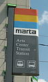 MARTA rail station sign at Arts Center
 -
 Southbound train at Civic Center (N2) Station
 -
 Peachtree Center (N1) Station
 -
 Decatur (E6) Station
 -
 MARTA kiss ride sign
 -
 MARTA rail car interior (CQ311)
 -
 Northbound train at Lindbergh Center


See also
[edit]Notes
[edit]- ^ 3-phase AC induction motors with PWM 2-level IGBT–VVVF inverters. Continuous rating is 150 hp (110 kW).
References
[edit]- ^ "Transit Ridership Report Third Quarter 2024" (PDF). American Public Transportation Association. November 20, 2024. Retrieved November 23, 2024.
- ^ "Transit Ridership Report Fourth Quarter 2023" (PDF). American Public Transportation Association. March 4, 2024. Retrieved September 5, 2024.
- ^ "MARTA Maps". Metropolitan Atlanta Rapid Transit Authority. Archived from the original on December 22, 2021. Retrieved March 10, 2022.
- ^ a b "MARTA Rail Map" (PDF). Metropolitan Atlanta Rapid Transit Authority. August 2008. Archived from the original (PDF) on March 19, 2009.
- ^ a b "Interior Rail Map" (PDF). Metropolitan Atlanta Rapid Transit Authority. 2019. Archived (PDF) from the original on March 16, 2022. Retrieved March 10, 2022.
- ^ "MARTA Rail Map" (PDF). Metropolitan Atlanta Rapid Transit Authority. 2000. Archived from the original (PDF) on August 19, 2000.
- ^ Hart, Ariel (October 2, 2009). "MARTA lines to be color-coded". The Atlanta Journal-Constitution. Archived from the original on March 10, 2022. Retrieved March 10, 2022.
- ^ "MARTA launches color-coded rail system". Metro Magazine. October 2, 2009. Archived from the original on January 26, 2021. Retrieved March 10, 2022.
- ^ Chapman, Dan (February 9, 2010). "MARTA 'yellow line' to Doraville angers some in Asian community". The Atlanta Journal-Constitution. Archived from the original on March 11, 2022. Retrieved March 11, 2022.
- ^ Hart, Ariel (February 12, 2010). "MARTA 'yellow' line to be renamed 'gold'". The Atlanta Journal-Constitution. Archived from the original on March 11, 2022. Retrieved March 11, 2022.
- ^ "Parking Availability & Fees". Metropolitan Atlanta Rapid Transit Authority. Archived from the original on March 11, 2022. Retrieved March 11, 2022.
- ^ a b "How to Ride". Metropolitan Atlanta Rapid Transit Authority. Archived from the original on March 11, 2022. Retrieved March 11, 2022.
- ^ a b "MARTA Service Changes". Metropolitan Atlanta Rapid Transit Authority. April 24, 2021. Archived from the original on December 12, 2024. Retrieved December 14, 2024.
- ^ "COVID-19 Service Modifications". Metropolitan Atlanta Rapid Transit Authority. April 24, 2021. Archived from the original on March 11, 2022. Retrieved March 11, 2022.
- ^ "MARTA". www.itsmarta.com. Retrieved November 6, 2023.
- ^ "MARTA - Riding MARTA". www.itsmarta.com. Archived from the original on March 31, 2001. Retrieved January 12, 2022.
- ^ Ip, Alex (November 1, 2024). "Atlanta Takes No Pride in MARTA's Weekend "Special Schedules"". The Xylom. Retrieved January 4, 2025.
- ^ "MARTA". Archived from the original on September 21, 2014. Retrieved September 18, 2014.
- ^ "2014 Transportation Fact Book" (PDF). Atlanta Regional Commission. Archived (PDF) from the original on February 10, 2015. Retrieved May 11, 2015.
- ^ a b Roughton, Jr., Bert (June 18, 1988). "Rail-to-air link completed with opening of airport station". The Atlanta Journal-Constitution. p. A1.
- ^ a b c d e f g Beasley, David; Kathey Alexander (February 23, 1992). "After two decades, MARTA's course uncertain". The Atlanta Journal-Constitution. p. A1.
- ^ a b c d e AP Reporters (December 21, 1979). "Atlanta Rapid rail opens second leg". The Rock Hill Herald. p. 14.
- ^ a b c d e f g h Hairston, Julie B. (June 30, 2004). "MARTA marks 25 years of trains: Next stop unknown". The Atlanta Journal-Constitution. p. B1.
- ^ a b Beasley, David (December 6, 1992). "MARTA trains to roll at Bankhead, Doraville". The Atlanta Journal-Constitution. p. E15.
- ^ a b c d e AJC Editorial Staff (May 16, 1985). "Atlanta's air, rail transportation among nation's best". The Atlanta Journal-Constitution. p. E5.
- ^ a b c Goldberg, David (June 8, 1996). "Suburban transit – North Line worth risk for MARTA". The Atlanta Journal-Constitution. p. E2.
- ^ Roughton, Jr., Bert (December 20, 1987). "MARTA officials open Chamblee rail station amid union protests". The Atlanta Journal-Constitution. p. B3.
- ^ Roughton, Jr., Bert (August 17, 1986). "East Point starts a new era – First MARTA train pulls in as city observes 99th year". The Atlanta Journal-Constitution. p. B1.
- ^ a b Beasley, David (June 25, 1993). "Transit expansion – MARTA on the move – New stations push rail system beyond the Perimeter". The Atlanta Journal-Constitution. p. D1.
- ^ a b Shelton, Stacy (December 18, 2000). "MARTA christens 2 new stations – North Fulton riders report few problems". The Atlanta Journal-Constitution. p. B1.
- ^ "Comprehensive Annual Financial Report" (PDF). Metropolitan Atlanta Rapid Transit Authority. June 30, 2006. Archived from the original (PDF) on September 29, 2007. Retrieved February 24, 2008.
- ^ "MARTA donates railcar to Southeastern Railway Museum". November 18, 2022. Archived from the original on November 18, 2022. Retrieved November 19, 2022.
- ^ "MARTA railcar joins Trolley Museum of New York collection". April 29, 2023.
- ^ "MARTA railcars sunk off Georgia coast to create new reef habitat". December 24, 2023.
- ^ "its MARTA › More › mnwk7...PDF MINUTES WORK SESSION OF THE BOARD OF DIRECTORS ... - Marta". Archived from the original on May 29, 2022. Retrieved February 3, 2020.
- ^ "Atlanta HRV" (PDF). AnsaldoBreda. 2007. Archived from the original (PDF) on October 6, 2007.
- ^ "Railcars to the Ocean". YouTube.
- ^ "MARTA Rails Around Atlanta". YouTube. Archived from the original on December 6, 2021.
- ^ "Hitachi Rail" (PDF). Ansaldobredainc.com.[permanent dead link]
- ^ Barrow, Keith (April 2019). "MARTA orders 127 trainsets from Stadler". Railway Age. Archived from the original on July 23, 2019. Retrieved November 12, 2019.
- ^ "Atlanta Metro Rail Project". Archived from the original on March 26, 2019. Retrieved March 26, 2019.
- ^ "Press Releases". Archived from the original on April 28, 2009.
- ^ "MARTA Signs Contract with Alstom Signaling, Inc. to Overhaul Its Aging Train Control and Rail Safety Systems". Metropolitan Atlanta Rapid Transit Authority. Archived from the original on March 4, 2016. Retrieved November 12, 2019.
- ^ "Alstom to Deliver High-Tech Rail Safety Upgrades for Atlanta's MARTA". Alstom. Archived from the original on June 14, 2018. Retrieved November 12, 2019.
- ^ "Project: Train Monitoring System for MARTA". Archived from the original on August 15, 2019. Retrieved November 12, 2019.
- ^ "Recently Awarded Contracts Marta". Martabid.itsmarta.com. January 26, 2018. Archived from the original on July 18, 2018. Retrieved July 30, 2018.
- ^ "Kinkisharyo International Inks $146M Rail Car Refurbishment Contract with Atlanta's MARTA" (PDF). Archived from the original (PDF) on April 1, 2018. Retrieved May 31, 2021.
- ^ Ltd, DVV Media International. "Stadler to supply up to 354 metro cars to Atlanta". Metro Report. Archived from the original on March 29, 2019. Retrieved March 29, 2019.
- ^ "Stadler Wins First Metro Contract in the US: 127 Trains for Atlanta". Railway News. March 29, 2019. Archived from the original on March 29, 2019. Retrieved March 29, 2019.
- ^ Fingert, Tyler (December 17, 2022). "MARTA gives customers glimpse of future railcars". FOX 5 Atlanta. Retrieved August 4, 2023.
- ^ Douglas Sams. [1] Archived 2023-02-15 at the Wayback Machine Atlanta Business Chronicle, June 6, 2008
- ^ "Atlanta's 'yellow' train line changed after outcry". Atlanta Journal-Constitution. Atlanta: Cox Media Group, Inc. February 11, 2010. Archived from the original on June 4, 2011. Retrieved February 12, 2010.
- ^ Hansen, Zachary (March 25, 2024). "Atlanta mayor announces 4 new MARTA rail stations, including near Beltline". The Atlanta Journal-Constitution. Cox Enterprises. Retrieved April 12, 2024.
- ^ Bunch, Riley (April 11, 2024). "Mayor Dickens announces locations of new Atlanta MARTA stations". The Atlanta Journal-Constitution. Cox Enterprises. Retrieved April 12, 2024.
| Red Line | |
|---|---|
| Gold Line | |
| Blue Line | |
| Green Line | |
| Atlanta Streetcar |
|
| Other | |