
Loppersum
Loppersum | |
|---|---|
 Defense tower of former Ewsum Castle | |
 Flag  Coat of arms | |
.svg) Location in Groningen | |
 Loppersum  Loppersum | |
| Coordinates: 53°20′N 6°45′E / 53.333°N 6.750°E | |
| Country | Netherlands |
| Province | Groningen |
| Municipality | Eemsdelta |
| Area | |
| • Total | 25.17 km2 (9.72 sq mi) |
| Elevation | 1 m (3 ft) |
| Population (2021)[1] | |
| • Total | 2,570 |
| • Density | 100/km2 (260/sq mi) |
| Time zone | UTC+1 (CET) |
| • Summer (DST) | UTC+2 (CEST) |
| Postcode | 9919[1] |
| Area code | 0596 |

Loppersum (Dutch pronunciation: [ˈlɔpərsʏm] ⓘ; Gronings: Loppersom [ˈlɔpɐsɔm]) is a village and former municipality in the province of Groningen in the northeast of the Netherlands.
Geography[edit]
Loppersum is located in the province of Groningen in the north of the Netherlands.
The former municipality was bordered by the municipalities of Eemsmond (north), Delfzijl (east), Appingedam (east), Slochteren (southeast), Ten Boer (south), and Bedum (southwest).
The population centres in the municipality were:
- Eekwerd
- Eekwerderdraai
- Eenum
- Fraamklap
- Garrelsweer
- Garsthuizen
- Hoeksmeer
- Honderd
- Huizinge
- Kolhol
- Leermens
- Loppersum
- Lutjerijp
- Lutjewijtwerd
- Merum
- Middelstum
- Oosterwijtwerd
- Startenhuizen
- Stedum
- Stork
- Toornwerd
- Westeremden
- Westerwijtwerd
- Wirdum
- Wirdumerdraai
- 't Zandt
- Zeerijp
- Zijldijk
Government[edit]
The second to last mayor of Loppersum was Albert Rodenboog of the Christian Democratic Appeal (CDA).[3] He was chosen as best local administrator by the professional magazine Binnenlands Bestuur in 2013.[4]
Monuments[edit]
The Petrus en Pauluskerk is a national heritage site (rijksmonument) in Loppersum.[5]
Of the borg of Ewsum in Middelstum a single defense tower remains today.[6]
Transportation[edit]
The Groningen–Delfzijl railway runs through the municipality from east to west with the railway stations of Stedum and Loppersum.[7]
Notable residents[edit]
- Titia van der Tuuk (1854 in 't Zandt – 1939) a Dutch feminist atheist and teetotal, vegetarian pacifist
- Johannes de Groot (1914 in Garrelsweer – 1972) a Dutch mathematician and topologist
- Jan Pesman (1931 in Stedum – 2014) a Dutch long-distance speed skater, bronze medallist at the 1960 Winter Olympics
- Haijo Apotheker (born 1950 in Loppersum) a Dutch politician
- Laurens W. Molenkamp (born 1956 in Garrelsweer) a Professor of physics, works on semiconductor structures and topological insulators
Gallery[edit]
-
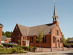 Garrelsweer, reformed church
 -
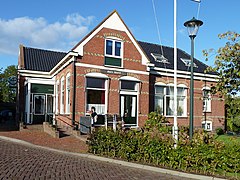 Leermens, dorpshuis
 -
 Middelstum, Kerkpad
 -
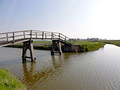 Bridge over the Godlinzermaar


References[edit]
- ^ a b c "Kerncijfers wijken en buurten 2021". Central Bureau of Statistics. Retrieved 7 April 2022.
two entries
- ^ "Postcodetool for 9919AH". Actueel Hoogtebestand Nederland (in Dutch). Het Waterschapshuis. Archived from the original on 21 September 2013. Retrieved 24 January 2014.
- ^ (in Dutch) College van B&W, Municipality of Loppersum. Retrieved 22 August 2015.
- ^ (in Dutch) "Burgemeester Rodenboog (Loppersum) verkozen tot bestuurder 2013", Dagblad van het Noorden, 2014. Retrieved 22 August 2015.
- ^ (in Dutch) Complex- of Monumentnummer: 26265 Archived 2014-03-07 at the Wayback Machine, Rijksdienst voor het Cultureel Erfgoed. Retrieved on 22 August 2015.
- ^ (in Dutch) Geschiedenis Borg Ewsum Archived 2015-08-13 at the Wayback Machine, Borgterrein Ewsum. Retrieved 22 August 2015.
- ^ (in Dutch) Overzicht van de spoorlijn Groningen-Delfzijl, Stationsweb. Retrieved 22 August 2015.
External links[edit]
 Media related to Loppersum (Groningen) at Wikimedia Commons
| International | |
|---|---|
| National | |