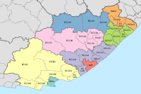
Matatiele Local Municipality
Template:Infobox South African municipality Matatiele Local Municipality is an administrative area in the Alfred Nzo District of Eastern Cape in South Africa.
The name is derived from the Sesotho language and it means "the ducks have flown", in an apparent reference to the abundance of waterfowl that even today inhabit the surrounding pools and marshes.[1]
Main places
The 2001 census divided the municipality into the following main places:[2]
| Place | Code | Area (km2) | Population | Most spoken language |
|---|---|---|---|---|
| Cedarville | 54901 | 12.19 | 2,064 | Xhosa |
| Harry Gwala Park | 54902 | 0.87 | 2,778 | Xhosa |
| Itsokolele | 54903 | 0.40 | 1,426 | Xhosa |
| Matatiele | 54904 | 6.74 | 5,214 | Xhosa |
| Mzingisi | 54905 | 0.15 | 434 | Xhosa |
| Remainder of the municipality | 54906 | 1,396.30 | 4,303 | Xhosa |
Politics
The municipal council consists of fifty-one members elected by mixed-member proportional representation. Twenty-six councillors are elected by first-past-the-post voting in twenty-six wards, while the remaining twenty-five are chosen from party lists so that the total number of party representatives is proportional to the number of votes received. In the election of 3 August 2016 the African National Congress (ANC) won a majority of thirty-eight seats on the council. The following table shows the results of the election.[3][4]
style="width: 2px; background-color: #006600;" data-sort-value="African National Congress" | style="width: 2px; background-color: #005BA6;" data-sort-value="Democratic Alliance (South Africa)" | style="width: 2px; background-color: #ffb543;" data-sort-value="African Independent Congress" | style="width: 2px; background-color: #852A2A;" data-sort-value="Economic Freedom Fighters" | style="width: 2px; background-color: #FFB300;" data-sort-value="United Democratic Movement" | style="width: 2px; background-color: #DCDCDC;" data-sort-value="Independent (politics)" | style="width: 2px; background-color: #007500;" data-sort-value="African People's Convention" | style="width: 2px; background-color: lightgrey;" data-sort-value="His Lordship to Save and Lead Party" || Party | Votes | Seats | ||||||
|---|---|---|---|---|---|---|---|---|
| Ward | List | Total | % | Ward | List | Total | ||
| ANC | 40,772 | 41,684 | 82,456 | 73.6 | 26 | 12 | 38 | |
| DA | 5,349 | 4,522 | 9,871 | 8.8 | 0 | 5 | 5 | |
| AIC | 4,068 | 3,918 | 7,986 | 7.1 | 0 | 4 | 4 | |
| EFF | 3,815 | 3,810 | 7,625 | 6.8 | 0 | 3 | 3 | |
| UDM | 631 | 1,536 | 2,167 | 1.9 | 0 | 1 | 1 | |
| Independent | 1,092 | – | 1,092 | 1.0 | 0 | – | 0 | |
| African People's Convention | 320 | 382 | 702 | 0.6 | 0 | 0 | 0 | |
| His Lordship to Save and Lead Party | 44 | 145 | 189 | 0.2 | 0 | 0 | 0 | |
| Total | 56,091 | 55,997 | 112,088 | 100.0 | 26 | 25 | 51 | |
| Spoilt votes | 1,734 | 1,837 | 3,571 | |||||
References
- ^ South African Languages - Place names
- ^ Lookup Tables - Statistics South Africa[permanent dead link]
- ^ "Results Summary – All Ballots: Matatiele" (PDF). Independent Electoral Commission. Retrieved 22 December 2016.
- ^ "Seat Calculation Detail: Matatiele" (PDF). Independent Electoral Commission. Retrieved 22 December 2016.

