Memorial Park station
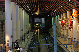
 Train enters the Memorial Park platform, 2005 | |||||||||||||
| General information | |||||||||||||
| Location | 125 East Holly Street Pasadena, California | ||||||||||||
| Coordinates | 34°08′51″N 118°08′52″W / 34.1476°N 118.1479°W | ||||||||||||
| Owned by | Los Angeles County Metropolitan Transportation Authority | ||||||||||||
| Platforms | 2 side platforms | ||||||||||||
| Tracks | 2 | ||||||||||||
| Connections | See Connections section | ||||||||||||
| Construction | |||||||||||||
| Structure type | Below-grade | ||||||||||||
| Bicycle facilities | Racks and lockers | ||||||||||||
| Accessible | Yes | ||||||||||||
| History | |||||||||||||
| Opened | June 26, 2003 | ||||||||||||
| Services | |||||||||||||
| |||||||||||||
| |||||||||||||
| |||||||||||||
Memorial Park station is a below-grade light rail station on the L Line of the Los Angeles Metro Rail system. It is located at Holly Street and at the end of Arroyo Parkway in Pasadena, California. The station is named after the nearby Memorial Park and is situated on the northern edge of Old Town Pasadena.
Memorial Park station was built in a trench beneath the Holly Street Village Apartments, which was constructed with the trench in 1994 in anticipation of a light rail station at this site. This station features station art called The First Artists in Southern California: A Short Story, created by artist John Valadez.[1]
Memorial Park station opened on July 26, 2003, as part of the original Gold Line, then known as the "Pasadena Metro Blue Line" project. This station and all the other original and Foothill Extension stations will be part of the A Line upon completion of the Regional Connector project in 2023.
It is one of the L Line stations near the Rose Parade route on Colorado Boulevard and is heavily used by people coming to see the parade.[2] The station is also located near the Rose Bowl Shuttle which stops at the Parsons Corporation headquarters building and offers service to most events at the stadium. During the 2028 Summer Olympics, the station will serve spectators traveling to and from the Rose Bowl.[3]
Service
Station layout
| G | Street level | Entrance/Exit |
| Platform | Northbound | ← |
| Island platform, doors will open on the left | ||
| Southbound | | |
Hours and frequency
Connections
As of February 20, 2022[update], the following connections are available:[4]
- Los Angeles Metro Bus: 177, 180, 256, 260, 501 (NoHo-Pasadena Express), 660
- Foothill Transit: 187, Rose Bowl Shuttle (service to events at Rose Bowl stadium)[5]
- LADOT Commuter Express: 549
- Pasadena Transit: 20, 40, 51, 52
- ArtCenter College of Design Shuttle (students/staff only)[6]
Future
This station will connect with North Hollywood–Pasadena Transit Line, a bus rapid transit line in the Metro Busway network in Los Angeles, California which will connect Pasadena and the North Hollywood Metro Station.[7]
Notable places nearby
The station is within walking distance of the following notable places:
- Armory Center for the Arts
- Fuller Theological Seminary
- Gamble House
- Memorial Park & Levitt Pavilion
- Norton Simon Museum
- Old Pasadena
- USC Pacific Asia Museum
- Pasadena City Hall
- Pasadena Civic Center District
- Pasadena Museum of History
- The Paseo
References
- ^ "The First Artists in Southern California: A Short Story". Metro Art. Retrieved March 28, 2021.
- ^ "Riding Metro on New Year's Day". Los Angeles County Metropolitan Transportation Authority. Archived from the original on August 21, 2021. Retrieved November 29, 2021.
- ^ http://la24-prod.s3.amazonaws.com/assets/pdf/LA2024-canditature-part2_english.pdf [bare URL PDF]
- ^ "L Line Timetable – Connections section" (PDF). Los Angeles County Metropolitan Transportation Authority. February 20, 2022. p. 2. Retrieved May 12, 2022.
- ^ "Rose Bowl Shuttle Service". Foothill Transit. August 28, 2021. Retrieved November 29, 2021.
- ^ "ArtCenter College of Design Shuttle Route" (PDF). Retrieved November 29, 2021.
- ^ "That Rapid Bus Line from North Hollywood to Pasadena is Officially Happening". MSN.

