Moenjo Daro Airport
Appearance
Mohanjo Daro Airport | |||||||||||
|---|---|---|---|---|---|---|---|---|---|---|---|
| Summary | |||||||||||
| Airport type | Public | ||||||||||
| Operator | Pakistan Civil Aviation Authority | ||||||||||
| Serves | Larkana | ||||||||||
| Location | Mohanjo-daro | ||||||||||
| Elevation AMSL | 154 ft / 47 m | ||||||||||
| Coordinates | 27°20′07″N 68°08′35″E / 27.33528°N 68.14306°E | ||||||||||
| Map | |||||||||||
| Runways | |||||||||||
| |||||||||||
| Statistics (2016-17[1]) | |||||||||||
| |||||||||||
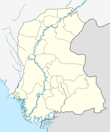
Moenjo Daro Airport (IATA: MJD, ICAO: OPMJ) is a domestic airport located at Mohenjo-daro, Sindh under the administration of Pakistan Civil Aviation Authority.[2] It is 28 km away from the city of Larkana.[3]
Formerly, it was the third busiest airport in Sindh.[4]
History
It was founded in 1967 during the tenure of Ayub Khan.[4] The airport was upgraded in 1973.[4]
In 1996, its runway and terminal buildings were extended.[5]
See also
References
- ^ "Statistical Data for Web site Major Traffic Flow Airport & Airline wise - Pakistan Civil Aviation Authority".
- ^ "Mohenjo-daro: An Amazingly Developed City | 2010 | JAXA Earth Observation Research Center (EORC)". www.eorc.jaxa.jp.
- ^ "Mohenjo Daro Airport, Larkana".
- ^ a b c "Heritage ignored: With no flights, Mohenjo Daro at risk of being forgotten". The Express Tribune. December 13, 2019.
- ^ "PCAA | Pakistan Civil Aviation Authority". www.caapakistan.com.pk.
External links

