Oleshky
You can help expand this article with text translated from the corresponding article in Ukrainian. (July 2022) Click [show] for important translation instructions.
|
Oleshky
Олешки | |
|---|---|
 | |
| Coordinates: 46°38′00″N 32°35′00″E / 46.63333°N 32.58333°E | |
| Country | |
| Oblast | Kherson Oblast |
| Raion | Kherson Raion |
| Occupied By | |
| Founded as a Settlement | 1784 |
| Founded as a Town | 1802 |
| Area | |
| • Total | 15.7 km2 (6.1 sq mi) |
| Population (2021) | |
| • Total | |
| • Density | 1,598/km2 (4,140/sq mi) |
| Postal code | 75100 |
| Area code | +380 5542 |
| Climate | Cfa |
| Website | https://oleshki-rada.gov.ua/ |
 | |
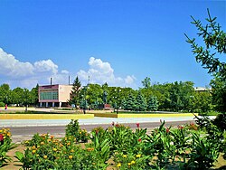
Oleshky (Ukrainian: Оле́шки, romanized: Oleshky, pronounced [oˈɫɛʃkɪ]) is a town in Kherson Raion, Kherson Oblast, southern Ukraine, located on the left bank of the Dnieper River with the town of Solontsi to the south. It is the oldest city of the oblast and one of the oldest in southern Ukraine. Oleshky hosts the administration of Oleshky urban hromada, one of the hromadas of Ukraine.[2] It had a population of 24,383. (2021 est.)[3]
Administrative status
Until 18 July 2020, Oleshky was the administrative center of Oleshky Raion. The raion was abolished in July 2020 as part of the administrative reform of Ukraine, which reduced the number of raions of Kherson Oblast to five. The area of Oleshky Raion was merged into Kherson Raion.[4][5]
Geography
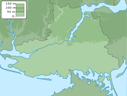
The town is located in the south of Ukraine. The Konka River goes through the town before falling into the Dnipro. The Oleshky Sands are located in a close proximity to the town.
History
The city of Oleshia has been known since the 11th century, when it was a part of Kyivan Rus, but the area itself has been known since antiquity.[6] Herodotus mentioned Scythian forests in the mouth of the Dnieper in the 5th century BCE, which were called "Oleshye" (from the Slavic word for forest) by the Slavs.[6] The town, which appeared later, took its name from the area, and the later form of the name (Oleshky) is also related.[6]
In 1711–1728, Oleshky was the capital of the Zaporizhian Host under the protection of the Crimean Khanate.[citation needed] In 1784, the settlement of Oleshky was established; by 1790, it became a part of the Kinburn palanka of the Black-Sea Cossacks.[citation needed] In 1802, the settlement was granted town status and became the seat of an uyezd in Taurida Governorate.[citation needed] In 1928, the town was given the name Tsiurupynsk after former Soviet Trade Minister and the chief of Gosplan Alexander Tsiurupa,[6] who was born in the town.
On 21 November, 2007, the town council adopted resolution No.296 to restore the name Oleshky. The town council deputies and district councils, as well as the local Cossacks, wrote a letter to then president Victor Yushchenko requesting that the petition be carried out.[7]
It was not until 19 May, 2016 that the Verkhovna Rada adopted the resolution to rename Tsiurupynsk as Oleshky and conform to the law prohibiting names of Communist origin after a 9-year campaign by the town's council and residents.[8]
On 24 February, 2022, Oleshky was occupied by Russian forces in the 2022 Russian invasion of Ukraine.[9] On 14 April, 2022, Russian forces removed the flag of Ukraine from the town hall and replaced it with a Russian flag.[10][11]
Gallery
-
Mineral water plant
-
Residential blocks in Oleshky
-
M14 highway passing through Oleshky
See also
References
Notes
- ^ "Part of Kherson region territory occupied by aggressor – Regional Administration". Interfax Ukraine. Kyiv. February 24, 2022. Archived from the original on February 24, 2022. Retrieved February 25, 2022.
- ^ "Олешковская городская громада" (in Russian). Портал об'єднаних громад України.
- ^ Чисельність наявного населення України на 1 січня 2021 [Number of Present Population of Ukraine, as of January 1, 2021] (PDF) (in Ukrainian and English). Kyiv: State Statistics Service of Ukraine.
- ^ "Про утворення та ліквідацію районів. Постанова Верховної Ради України № 807-ІХ". Голос України (in Ukrainian). July 18, 2020. Retrieved October 3, 2020.
- ^ "Нові райони: карти + склад" (in Ukrainian). Міністерство розвитку громад та територій України.
- ^ a b c d Pospelov, pp. 26–27
- ^ Цюрупинськ хочуть перейменувати. Депутати звернулися до Ющенка [They want to rename Tsiurupynsk. Town`s council deputies have applied to Yushchenko]. Unian. November 25, 2007. Retrieved August 7, 2015.
- ^ Рада перейменувала Дніпродзержинськ на Кам'янське [Rada renamed Dniprodzerzhynsk to Kamianske] (in Ukrainian). Українські Національні Новини. May 19, 2016. Archived from the original on May 19, 2016. Retrieved May 19, 2016.
{{cite news}}: CS1 maint: unfit URL (link) - ^ Херсонщина: від дій РФ загинуло 2 дітей, захоплено Олешки і переправу [Kherson region: Russian Federation actions have resulted the deaths of 2 children, Oleshky and crossing are captured]. Українська Правда (in Ukrainian). Retrieved February 26, 2022.
- ^ "УП. Стрічка".
- ^ https://ukranews.com/en/news/849847-invaders-raised-russian-flags-in-skadovsk-executive-committee-did-not-go-to-work [bare URL]
Sources
- Е. М. Поспелов (Ye. M. Pospelov). "Имена городов: вчера и сегодня (1917–1992). Топонимический словарь." (City Names: Yesterday and Today (1917–1992). Toponymic Dictionary.) Москва, "Русские словари", 1993.
External links
- Brief history profile (in Ukrainian)
- Information about the city council


