Peristerovrachoi
Appearance
The topic of this article may not meet Wikipedia's general notability guideline. (January 2022) |
Native name: Περιστερόβραχοι | |
|---|---|
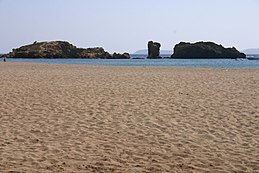
 The islets/rocks of Peristerovrachi. | |
 | |
| Geography | |
| Coordinates | 35°15′21″N 26°16′01″E / 35.25583°N 26.26694°E |
| Archipelago | Cretan Islands |
| Administration | |
Greece | |
| Region | Crete |
| Regional unit | Lasithi |
| Demographics | |
| Population | 0 (2001) |
Peristerovrachoi (Template:Lang-el, "pigeon rocks"), are uninhabited Greek islets/rocks, in the Aegean Sea, close to the eastern coast of Crete. Administratively they lie within the Itanos municipality of Lasithi.

