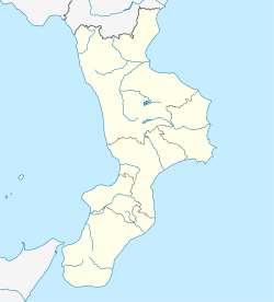
San Sosti
Appearance
This article needs additional citations for verification. (May 2014) |
San Sosti | |
|---|---|
| Comune di San Sosti | |
| Coordinates: 39°39′36″N 16°1′42″E / 39.66000°N 16.02833°E | |
| Country | Italy |
| Region | Calabria |
| Province | Cosenza (CS) |
| Frazioni | Macellara, Fravitta |
| Government | |
| • Mayor | Vincenzo De Marco |
| Area | |
| • Total | 43.55 km2 (16.81 sq mi) |
| Elevation | 355 m (1,165 ft) |
| Population (2011)[2] | |
| • Total | 2,126 |
| • Density | 49/km2 (130/sq mi) |
| Demonym | Sansostesi |
| Time zone | UTC+1 (CET) |
| • Summer (DST) | UTC+2 (CEST) |
| Postal code | 87010 |
| Dialing code | 0981 |
| Patron saint | St. Joseph |
| Saint day | March 19 |
| Website | Official website |
San Sosti (Calabrian: Santisuòsti; from Template:Lang-el) is a comune in the province of Cosenza, in Calabria, southern Italy.
History
A highly decorated bronze axe-head was discovered near San Sosti in 1846. This votive offering was later bought by the collector and goldsmith Alessandro Castellani, from whom it was eventually acquired by the British Museum in 1884.[3] On the axe is inscribed an important dedication in the Achaean dialect of Ancient Greek that can be dated to the sixth century BC.
In 1448, people from Albania migrated to San Sosti.
Main sights
- Sanctuary of Madonna del Pettoruto, founded in 1274 by the monks of the Abbey of Acquaformosa. It was rebuilt after the 1783 Calabrian earthquakes. It houses a 17th-century stone sculpture of a Madonna with Child
- The Abbey of San Sozonte (10th-11th centuries)
- The ruins of the Rocca, a 10th-century castle, which according to tradition was used by Hannibal during the Punic Wars.
References
- ^ "Superficie di Comuni Province e Regioni italiane al 9 ottobre 2011". Italian National Institute of Statistics. Retrieved 16 March 2019.
- ^ "Statistiche demografiche ISTAT". istat.it. Archived from the original on 2016-03-03. Retrieved 2014-05-14.
- ^ "British Museum - Bronze axe-head". British Museum. Archived from the original on 2015-10-18. Retrieved 2017-06-15.
External links
Wikimedia Commons has media related to San Sosti.
- Official website (in Italian)
- circolocalabrese.org (in Italian)
- unionevalli.it (in Italian)


