
Troodos Mountains
| Troodos | |
|---|---|
 Trees of Mount Olympus | |
| Highest point | |
| Peak | Mount Olympus |
| Elevation | 1,952 m (6,404 ft) |
| Naming | |
| Native name | |
| Geography | |
| Country | Cyprus |
Troodos (sometimes spelled Troödos; Greek: Τρόοδος [ˈtɾo.oðos]; Turkish: Trodos Dağları ['tɾo.dos]) is the largest mountain range in Cyprus, located in roughly the center of the island. Its highest peak is Mount Olympus (Greek: Όλυμπος), also known as Chionistra (Greek: Χιονίστρα), at 1,952 metres (6,404 ft), which hosts the Sun Valley and North Face ski areas with their five ski lifts.
The Troodos mountain range stretches across most of the western side of Cyprus. There are many mountain resorts, Byzantine monasteries, and churches on mountain peaks, and nestling in its valleys and mountains are villages clinging to terraced hills. The area has been known since antiquity for its mines, which for centuries supplied copper to the entire Mediterranean. In the Byzantine period it became a centre of Byzantine art, as churches and monasteries[1] were built in the mountains, away from the threatened coastline. The mountains are also home to RAF Troodos, a listening post for the NSA and GCHQ.[2]
The name Troodos probably comes from one of two sources: either τρία + ὁδός (tría + hodós), referring to the three roads that lead to the mountain, or τό + ὄρος + Ἄδος (to + oro + Ados), meaning the mountains of Adonis.[3][4]
Geology[edit]
_-_TIMEA.jpg)
The Troodos Mountains are known worldwide for their geology and the presence of an undisturbed ophiolite sequence, the Troodos Ophiolite.[5] These mountains slowly rose from the sea due to the collision of the African and European tectonic plates, a process that eventually formed the island of Cyprus. The slowing and near-cessation of this process left the rock formations nearly intact, while subsequent erosion uncovered the magma chamber underneath the mountain, allowing a viewing of intact rocks and petrified pillow lava formed millions of years ago, an excellent example of ophiolite stratigraphy. The observations of the Troodos ophiolite by Ian Graham Gass and co-workers was one of the key points that led to the theory of sea floor spreading. A detailed descriptive geological survey of Troodos was published in 1959.[6] It predates the modern theory of plate tectonics, but contains exhaustive descriptions of rocks and structures.
Climate[edit]
| Climate data for Prodromos in Troodos Mountains, elevation: 1380 m (Satellite view) | |||||||||||||
|---|---|---|---|---|---|---|---|---|---|---|---|---|---|
| Month | Jan | Feb | Mar | Apr | May | Jun | Jul | Aug | Sep | Oct | Nov | Dec | Year |
| Mean maximum °C (°F) | 13.3 (55.9) |
13.9 (57.0) |
18.5 (65.3) |
24.7 (76.5) |
27.9 (82.2) |
30.6 (87.1) |
32.2 (90.0) |
32.2 (90.0) |
30.2 (86.4) |
26.6 (79.9) |
20.1 (68.2) |
14.3 (57.7) |
23.7 (74.7) |
| Mean daily maximum °C (°F) | 6.3 (43.3) |
6.6 (43.9) |
10.3 (50.5) |
15.1 (59.2) |
20.5 (68.9) |
25.0 (77.0) |
28.1 (82.6) |
27.9 (82.2) |
24.4 (75.9) |
19.6 (67.3) |
12.8 (55.0) |
8.0 (46.4) |
17.1 (62.8) |
| Daily mean °C (°F) | 3.5 (38.3) |
3.5 (38.3) |
6.6 (43.9) |
10.7 (51.3) |
15.8 (60.4) |
20.1 (68.2) |
23.3 (73.9) |
23.1 (73.6) |
19.6 (67.3) |
15.4 (59.7) |
9.5 (49.1) |
5.3 (41.5) |
13.0 (55.4) |
| Mean daily minimum °C (°F) | 0.7 (33.3) |
0.3 (32.5) |
2.8 (37.0) |
6.3 (43.3) |
11.1 (52.0) |
15.2 (59.4) |
18.4 (65.1) |
18.2 (64.8) |
14.9 (58.8) |
11.3 (52.3) |
6.2 (43.2) |
2.5 (36.5) |
9.0 (48.2) |
| Mean minimum °C (°F) | −4.5 (23.9) |
−5.2 (22.6) |
−2.6 (27.3) |
0.5 (32.9) |
4.7 (40.5) |
9.2 (48.6) |
13.5 (56.3) |
14.0 (57.2) |
10.1 (50.2) |
5.4 (41.7) |
0.1 (32.2) |
−2.8 (27.0) |
3.5 (38.3) |
| Average precipitation mm (inches) | 133.4 (5.25) |
123.6 (4.87) |
82.3 (3.24) |
56.9 (2.24) |
26.0 (1.02) |
40.0 (1.57) |
12.1 (0.48) |
10.0 (0.39) |
9.5 (0.37) |
24.0 (0.94) |
102.5 (4.04) |
169.7 (6.68) |
790.1 (31.11) |
| Average precipitation days (≥ 1 mm) | 12.4 | 11.2 | 9.8 | 6.7 | 3.7 | 2.1 | 0.7 | 0.7 | 1.4 | 3.5 | 7.4 | 11.2 | 70.7 |
| Mean monthly sunshine hours | 130.2 | 150.8 | 195.3 | 231.0 | 275.9 | 315.0 | 328.6 | 310.0 | 255.0 | 220.1 | 165.0 | 136.4 | 2,713.3 |
| Source: Meteorological Service (Cyprus)[7] | |||||||||||||
Churches[edit]


The region is known for its many Byzantine churches and monasteries, richly decorated with murals, of which the Kykkos monastery is the richest and most famous. Nine churches and one monastery in Troodos together form a World Heritage Site, originally inscribed on the World Heritage List by UNESCO in 1985. The nine Byzantine churches are:
- Stavros tou Agiasmati
- Panagia tou Araka
- Timiou Stavrou at Pelendri
- Agios Nikolaos tis Stegis
- Panagia Podithou
- Assinou
- Agios Ioannis Lampadistis at Kalopanagiotis
- Panagia tou Moutoula
- Archangel Michael at Pedoulas
- Transfiguration of the Saviour Palaichori
-
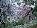 Church in spring

Selected villages[edit]

Gallery[edit]
-
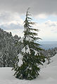 Young tree in Winter
 -
 Troodos Mountains
 -
 Lazanias village
 -
 Troodos black pines are 3,000 years old
 -
 Forests in Troodos Mountains
 -
 Pinus brutia, foothills of Troodos Mountains
 -
 River tributary in Troodos
 -
 Parakentro is a non-profit cultural centre in Lemythou village
 -
 Millomeris Waterfall, Platres
 -
 Milia Bridge, Platres
 -
 Tzielefos bridge
 -

-

-
 Kalidonia Waterfall, Platres
 -
 Part of Troodos Mountains
 -
 View of Farmakas region
 -
 Prodromos in winter
 -
 Road through the forest
 -
 Troodos Mountains in 1957

.jpg)


.jpg)

See also[edit]
References[edit]
- ^ "Cyprus Travel Series: Troodos Mountains". Expand Your Property World. 2017-11-23. Retrieved 2018-02-16.
- ^ Cora Currier; Henrik Moltke (January 29, 2016). "Spies in the sky". The Intercept.
- ^ "Places to visit - Troodos Cyprus". www.justaboutcyprus.com. Retrieved 2017-09-18.
- ^ "Snowy Mountains of Troodos - December at Olympos - Chionistra". www.cyprusalive.com. Retrieved 2017-09-18.
- ^ Papanikolaou, Dimitrios I. The Geology of Greece. Cham, Switzerland: Springer, 2021. p. 12. ISBN 978-3-030-60730-2
- ^ Wilson, R.A.M. The Geology of the Xeros-Troodos Area: Geological Survey Department, cyprus, Memoir No. 1. Nicosia, Cyprus: Government of Cyprus, Ministry of Agriculture and Natural Resources, 1959, reprinted 1971.
- ^ "Climatological and Meteorological Reports - Prodromos - 1991 - 2005" (PDF). Archived from the original (pdf) on 2016-03-27. Retrieved 2017-06-29.
External links[edit]
- Official Website of Troodos Region, by the Cyprus Tourism Organisation
- Troodos (General Area) Museums
- Panoramic virtual tour of the Troodos Mountains
- Kypros Net article on Troodos
- Awarded "EDEN – European Destinations of Excellence" non traditional tourist destination 2007
34°55′N 32°50′E / 34.917°N 32.833°E
| International | |
|---|---|
| National | |
| Geographic | |