
User:PimRijkee/Desk
Then I rais'd My voice and cried, 'Wide Afric, doth thy Sun
Lighten, thy hills enfold a City as fair
As those which starr'd the night o' the elder World?
Or is the rumour of thy Timbuctoo
A dream as frail as those of ancient Time?
- 6th stanza from the 1829 Chancellor's Gold Medal winning Tennyson poemTimbuctoo,[1] describing the city as a "rumour", a year after the confirmation of its existence by René Caillié.
Rulers of Timbuktu | ||||||||
900 — – 1000 — – 1100 — – 1200 — – 1300 — – 1400 — – 1500 — – 1600 — – 1700 — – 1800 — – 1900 — – 2000 — |
| |||||||

General[edit]
Despite its illustrious history, modern-day Timbuktu is an impoverished town, poor to Mali’s Thirld World standards as well.
Despite this, the population has grown an average 5.7% per year from 29,732 in 1998 to 54,453 in 2009.[4] As capital of the seventh Malian region, Tombouctou region, Timbuktu seats the current governer, Colonel Mamadou Mangara, who took over from Colonel Mamadou Togola in 2008 – Mangara answers, as does each of the regional governors, to the Ministry of Territorial Administration & Local Communities .[2]
Current issues include dealing with both droughts and floods, the latter caused by an insufficient drainage system that fails to transport direct rainwater from the city centre. One such event damaged World Heritage property, killing two and injuring one. [3]
When the Tuareg rebellion ended in 1996 under the Konaré administration, 3,000 weapens were burned in a ceremony dubbed the ‘Flame of Peace’ on March 29, 2007 – to commemorate the ceremony, a monument was built.[4] An annual world music festival, the Festival au Désert, to celebrate the peace treaty, is held near the city in January.[citation needed]
Etymology[edit]
The Myanmarese name of Ayeyarwady (formerly transliterated as Irrawaddy) is derived from the ancient name of the river Ravi, Airavati, in the Punjab region, but through its Pali, rather than its Sanskrit form.[5]. Airavati in turn is the name of the elephant mount of Indra, a minor Indian goddess. Elephants were in Indian mythology often a symbol for water [6]
When transliterated literally from Myanmar spelling, the modern rivername comes down to Erawati. Due to the spreading of Buddhism in South-East Asia, some names in Myanmar[7], and to a lesser extent in other South-East Asian countries, are adaptations of Indian place names associated with Buddhism[8][9], e.g. Myawaddy (originated from Amaravati), Dvaravati, Ayuthia (originated from Ayoddhya or Ayujjha), Cambodia (originated from Kamboja). Erawati also belongs to this category. The name of the Irrawaddy is also the ancient name of the river Ravi in Panjab[10]". The ancient name was Airavati, in Sanskrit meaning:
- ira -any drinkable fluid; a draught (especially of milk),...food, refreshment, ..vat...granting drink or refreshment,...name of a river in Panjab now called Ravi..
- Airavata (fr.ira-vat), a descendant of Ira-vat;....,N. of Indra’s elephant...(i) the female of Indra’s elephant; N. of a river,...;lightning...."
This is incompatible with Erawati, as it does not start with the vowel e. When the ancient name of the Ravi is rendered in Romanised Pali though, it is Eravati, which is compatible with the modern transliteration of the rivername, Erawati. The above means that not influence by Arabic (via Wadi), or Sanskrit (via Airavati) but Pali (via Erawati) has determined the name of the Irrawaddy.
Physiography[edit]
The Ayeyarwaddy River bisects the country from north to south and empties through a nine-armed Irrawaddy Delta into the Indian Ocean: it arises by the confluence of the Nmai and Mali Rivers in Kachin State Kachin. Both the Nmai and Mali Rivers find their sources in the Himalaya glaciers of Northern Myanmar, in the vicinity of 28° N . The Easternmost branch of the two, Nmai river[11] , is the most volumous, but it is unnavigable because of the strong current. The smaller western Branch though, the Mali river, is navigable, despite a few rapids.
The town of Bhamo, about 150 miles (240km) south of the Mali and Nmai river confluence, is the northernmost city you can reach by boat around the year. During the wet season most of the river can't be used by boats. The city of Myitkinā however lies 30 miles south of the confluence and can be reached during the dry season.
Between Myitkyinā and Mandalay, the Irrawaddy flows through three well-marked defiles[12] :
- About 40 miles (65 km) downstream from Myitkyinā is the first defile
- Below Bhamo the river makes a sharp westward swing, leaving the Bhamo alluvial basin to cut through the limestone rocks of the second defile. This defile is about 300 feet (90 metres) wide at its narrowest and is flanked by vertical cliffs about 200 to 300 feet (60 to 90 metres) high
- About 60 miles (100 km) north of Mandalay, at Mogok, the river enters the third defile. Between Katha and Mandalay, the course of the river is remarkably straight, flowing almost due south, except near Kabwet[13], where a sheet of lava has caused the river to bend sharply westward.
This sheet of lava is the Singu Plateau, a volcanic field from the Holocene. This field exists of magma from the fissure vents and cover an area of about 62 sq km. The plateau is also known as Letha Taung.[14]
Leaving this plateau at Kyaukmyaung [15], the river follows a broad, open course through the central dry zone[16] - the ancient cultural heartland[17] — where large areas consist of alluvium flats. From Mandalay (the former capital of the kingdom of Myanmar), the river makes an abrupt westward turn before curving southwest to unite with the Chindwin River, after which it continues in a southwestern direction. It is probable that the upper Irrawaddy originally flowed south from Mandalay, discharging its water through the present Sittoung River[18] to the Gulf of Martaban, and that its present westward course is geologically recent. Below its confluence with the Chindwin, the Irrawaddy continues to meander through the petroleum producing city of Yenangyaung, below which it flows generally southward. In its lower course, between Minbu and Prome, it flows through a narrow valley between forest-covered mountain ranges—the ridge of the Arakan (Rakhine) Mountains to the west and that of the Pegu Mountains to the east.
The delta of the Irrawaddy begins about 58 miles (93 km) above Hinthada (Henzada) and about 180 miles (290 km) from its curved base, which faces the Andaman Sea. The sides of the delta are formed by the southern extremities of the Pegu Mountains on the east and the Arakan Mountains on the west. The westernmost distributary of the delta is the Bassein (Pathein) River, while the easternmost stream is the Yangon River, on the left bank of which stands Myanmar’s capital city, Yangon (Rangoon). Because the Yangon River is only a minor channel, the flow of water is insufficient to prevent Yangon Harbour from silting up, and dredging is necessary. The relief of the delta ’s landscape is low but not flat. The soils consist of fine silt, which is replenished continuously by fertile alluvium carried downstream by the river. As a result of heavy rainfall and the motion and sediment load of the river, the delta surface extends into the Andaman Sea at a rate of about 165 feet (50 metres) per year. It is thougt that the river's current flow, to the west of Mandalay is geologically recent.[19][20]. Below its confluence with the Chindwin river, the Irrawaddy's course flows through the densely populated dry area near the city of Yenangyaung, generally southward. In its lower course, between Minbu and Prome, it flows through a narrow valley between forest-covered mountain ranges—the ridge of the (Rakan) Mountains[21][22] to the west and that of the Bago (Pegu) Mountains to the east[23][24].
The Irrawaddy Delta[edit]
The delta of the Irrawaddy begins about 58 miles (93 km) above Hinthada (Henzada) and about 180 miles (290 km) from its curved base, which faces the Andaman Sea. The westernmost distributary of the delta is the Pathein (Bassein) River, while the easternmost stream is the Yangon River, on the left bank of which stands Myanmar’s capital city, Yangon (Rangoon). Because the Yangon River[25] is only a minor channel, the flow of water is insufficient to prevent Yangon Harbour from silting up, and dredging is necessary. The relief of the delta’s landscape is low but not flat[26]. The soils consist of fine silt, which is replenished continuously by fertile alluvium carried downstream by the river. As a result of heavy rainfall varying from 80 to 120 inches a year in the delta[27], and the motion and sediment load of the river[28], the delta surface extends into the Andaman Sea at a rate of about 165 feet (50 metres) per year[29]
Hydrography[edit]
The Economical Importance of the Irrawaddy[edit]
The main river ports on the Irrawaddy are, from north to south:
- Myitkyinā
- Bhamo
- Katha
- Mandalay
- Myingyan
- Chauk
- Yenangyaung
- Minbu
- Magwe
- Thayetmyo
- Prome
- Hinthada
- Yandoon
Of these cities, Mandalay, Chauk, Prome, and Hinthada have good landing facilities. The remaining ports have landing facilities for only one or two barges or lighters, with the vessels mooring alongside the riverbank in most places. Despite Mandalay’s position as the chief rail and highway focus in northern Myanmar, a considerable amount of passenger and goods traffic moves by river. The Chindwin valley has no railroad and relies heavily on river transport. Chauk, downstream from the confluence in the oil-field district, is a petroleum port. Like Mandalay to the north and Prome, about 140 miles (225 km) to the south, it is linked to Yangon by road and rail. Hinthada, near the apex of the delta, is the rail junction for lines leading to Kyangin and Bassein (Pathein). A ferry operates between Hinthada on the west bank and the railway station at Tharrawaw on the east bank.
Commercial transportation on the Irrawaddy is maintained for about 800 miles (1,300 km): from Hinthada to Bhamo (670 miles [1,080 km]) throughout the year but from Bhamo to Myitkyinā (125 miles [200 km]) for only seven months. More than 2,000 miles (3,200 km) of navigable waterways exist in the Irrawaddy delta. On the Chindwin River, transportation is carried on by steam or diesel vessels throughout the year up to Homalin—about 400 miles (640 km) from its confluence with the Irrawaddy. Seasonal navigation is carried on into Tamanthi, which is 57 river miles (92 km) above Homalin.
Food Transport[edit]
Because the Irrawaddy delta is one of the world’s major rice-growing areas[ref needed|let op zelfde als onder Nargis], rice is a major item of commerce on the river. Also transported are other foodstuffs, petroleum, cotton, and local commodities. Teak logs—of which Myanmar is the world’s major exporter—are floated downstream as large rafts. In the delta region, the rice is carried in small boats to local markets, whence it is shipped to Yangon for export.
Cyclone Nargis[edit]
At May 3 2008, cyclone Nargis followed a devestating path through Myanmar[pad van de orkaan]. The Cyclone had an especially tremendous impact on the Irrawaddy Delta, vital to the coutry's food supply[ref needed|let op zelfde als onder Food Transport]. A [tsunami]], caused by the cyclone[ref needed], hit the vulnerable coast of the delta. The wave caused by the cyclone hit heights between 3 to 4 meter [ref needed], and was reinforced by strongly fluctuating tidal height along the coast [ref needed]. Another cause for the major damage done by the tsunami is the deforestation of the mangrove woods that were once abundant along the coastline [ref needed]. The deforrestation was due to the need of agricultural land for the Myanmarese people. The mangrove woods functioned as a buffer against tsunamis, but without it the very low delta coast - around 5000 km² Delta area lies below springtide level[30], and another 5000 km² is a mere 30 centimeter higher than sealevel.
Flora en Fauna[edit]
The Ayeyarwady river is home to a large diversity of animals, including about 43 fishspecies.[31]
The most well-known of these species is the Irrawaddy Dolphin (Orcaella brevirostris), a euryhaline species of Oceanic dolphin with a high and rounded forehead, lacking a beak. It is found in discontinuous sub-populations near sea coasts and in estuaries and rivers in parts of the Bay of Bengal and South-East Asia.
Winter visitors and passage migrants include Phalacrocorax carbo, a wide variety of Anatidae, Fulica atra, about 30 species of migratory shorebirds, Chlidonias hybrida, Hydroprogne caspia and the Brown-headed Gull (Larus brunnicephalus), which is very common. One of the most numerous wintering shorebird is the Lesser Sand Plover (Charadrius mongolus), which occurs in flocks of many thousands along the outer coast of the delta. The Wood Sandpiper (Tringa glareola) is also abundant.
In the late 19th century, the Spot-billed Pelican (Pelecanus philippensis) nested in huge numbers in south Burma. One colony on the Sittang plain to the east of the delta was described in November 1877 as covering 100 square miles and containing millions of birds. Immense colonies still bred in the area in 1910, but the birds had disappeared completely by 1939. Small numbers were regularly reported in the delta in the 1940s, but no breeding sites were located. No pelicans have been recorded in recent years, and it may well be that the species is now extinct in Myanmar.[32]
Several species of large mammal occur in the delta, but their populations are small and scattered, with the possible exceptions of the Malayan Sambar (Cervus unicolor equinus), Hog Deer (C. porcinus) and Wild Boar (Sus scrofa), which have been reported from all Reserved Forests. Asian Elephants (Elephas maximus) are said to occur in Kadonkani, Meinmahla and Pyindaye Reserved Forests, but the total population in 1982 was only about 15 individuals. Other species reported to be present include the Leopard, Bengal Tiger, Wild Dog and otters (Panthera pardus, P. tigris, Cuon alpinus and Lutra species).[33]
The estuarine crocodile (Crocodylus porosus) can be found in the Southern part of the river delta. The species was formerly abundant in coastal regions of Myanmar, but is now known principally from the lower Ayeyarwady Delta. Population numbers have decreased because of a combination of commercial skin hunting, habitat loss, drowning in fishing nets and over-collection of living animals to supply crocodile farms.[34]
Despite recent declines in the Sea Turtle populations, Five species are known to nest in Myanmar at well known island and mainland beaches known as turtle-banks. These are the Olive Ridley (Lepidochelys olivacea), loggerhead (Caretta caretta), green (Chelonia mydas), hawksbill (Eretmochelys imbricata), and leatherback(Dermochelys coriacea) marine turtles.[35]
Mentions in Modern Culture[edit]
- In Juli 2001, Robbie Williams released the album 'Sing When You Are Winning'. The fifth single of the album is 'Road to Mandalay'[36].
- In 1926 the movie 'Road to Mandalay' was released, a thriller written and directed [ref needed] by Tod Browning. Originally published in black and white and without sound, only an incomplete version of the movie still existsts.[37].
- In 1995 the Australian made-for-TV movie 'Singapore Sling: Road to Mandalay' was released, starring John Waters and Josephine Byrnes[38]. The movie takes place in South-East Asia, and is classified as as adventure.
- In 1991 the Ken Russell documentary 'Road to Mandalay' was released.[39]. This production isn't actually about the Irrawaddy River, but about the feeling of adventure the river is said to evoke[ref needed]. Russell uses this feeling to describe the situation and events in the town where he lives, Southampton.
- The Irrawaddy Publishing Group (IPG, based in Chiang Mai, Thailand) manages a magazine called 'The Irrawaddy'[40] (in its current form since 1999) and a website, with independent journalism about Myanmar & South-East Asia. In 1993, the IPG has been founded by Myanmaran journalists living in Thailand.
Gallery[edit]
-
 The new Ayeyarwady Bridge (Yadanabon) at Sagaing, Ava Bridge behind
 -
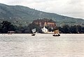
 River Irrawaddy with Mandalay Hill on the east bank
 -
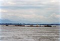
 Travelling on the great river
 -
 Traditional rivercraft on the Irrawaddy
 -
 An island village on the Irrawaddy stays above water on stilts during the monsoons
 -
 Bamboo rafts by the Irrawaddy
 -
 Market on the west bank at Mingun
 -
 Buffalo pulling logs from the Irrawaddy at Mandalay
 -
 The great river at Mingun
 -
 Bamboo raft sailing down the Irrawaddy
 -
 Woman sailing in small boat along the west bank at Mingun


Notes & References[edit]
- ^ Friedlander, Ed. "Enjoying "Timbuctoo" by Alfred Tennyson". Retrieved 27 November 2010.
{{cite web}}: Cite has empty unknown parameter:|coauthors=(help); Unknown parameter|align=ignored (help) - ^ "Floods Damage Ancient Timbuktu". BBC News Africa. BBC Worldwide. 9 September 2003. Retrieved 24 February 2011.
{{cite web}}: Cite has empty unknown parameter:|coauthors=(help) - ^ Harding, Andrew (30 November 2009). "Ancient Documents Reveal Legacy of Timbuktu". World News America. BBC Worldwide. Retrieved 24 February 2011.
{{cite web}}: Cite has empty unknown parameter:|coauthors=(help) - ^ Cite error: The named reference
populationwas invoked but never defined (see the help page). - ^ Irrawaddy etymology
- ^ California State University, Chico - The Symbolism of Elephants in Indian Culture
- ^ Wikipedia page on Greater India, India's influence on Burma
- ^ Wikipedia page about Sanskrit
- ^ http://www.myanmar.gov.mm/Perspective/persp1999/2-99/aye.htm Paragraph 10, influence of Indian culture on South-East Asia
- ^ [1]
- ^ Document over de floradiversiteit in Noord-Kachin, in het stroomgebied van de Nmai. Studies on Floradiversity of North-eastern Kachin Myanmar Section of Sino-himalaya (Nmai Hka-Than Lwin Water Division) - Ma Kalayar Lu, Myitkyina University afdeling Botanie, 28-8-06. Geraadpleegd d.d. 6-12-2008.
- ^ Encyclopedia Britannica Online topic: Physical features » Physiography, paragraph 3. Retrieved d.d. 5-12-2008
- ^ Kabwet, Myanmar: topografische & klimatografische informatie over Kabwet
- ^ Global Volcanism Program - vulkanologic ranking.
- ^ Location of Kyaukmyaung in Google Maps geocode
- ^ "All areas with P/PET ratio less than 0.65" according to the definition of the Convention on Biological Diversity, retrieved d.d. 16-12
- ^ Thomas Streissguth, Myanmar in pictures, Twenty-First Century Books, 2007. ISBN: 0822571463. Retrieved d.d. 16-12.
- ^ Gewijzigde riviernamen in Myanmar
- ^ Gewijzigde riviernamen in Myanmar voor informatie over veranderingen in de spellingswijze van plaats/riviernamen in Myanmar, 2e alinea. Geraadpleegd d.d. 5/12
- ^ "It is probable that the] upper Irrawaddy originally flowed south from Mandalay, discharging its water through the present Sittang River to the Gulf of Martaban, and that its present westward course is geologically recent" - Encyclopedia Britannica Online hoofdstuk Physical features » Physiography, alinea 3 geraadpleegd d.d. 5/12
- ^ Rakhine State op Travel Myanmar
- ^ Rakhine Mountain Range on The Free Dictionary Encyclopedia
- ^ Article about the Bago Mountains on Encyclopedia Britannica Online.
- ^ Basic information about the Bago Division on the site of the Myanmarese Government
- ^ Information about sediment dynamics in the Yangon River at the site of National Center for Biotechnology Information. Retrieved d.d. 17/12/2008
- ^ Profile of the Irrawaddy Delta from Henzhada to the river mouth, in feet
- ^ Map on the rainfall in Myanmar, retrieved d.d. 17-12-2008.
- ^ A detailed documentation of sediment dynamics can be found in The Journal of Geology
- ^ Encyclopedia Britannica Online Physiography, alinea 4. Retrieved d.d. 17-12-2008.
- ^ The Asian Regional Centre for Biodiversity Conservation (ARCBC) about surface & surface usage in the Irrawaddy Delta
- ^ List of fish species in the Ayeyarwady from [www.fishbase.org Fishbase.org], retrieved d.d. July 28, 2009.
- ^ BirdLife Species Factsheet on the range of breeding Spot-Billed Pelican populations, retrieved d.d. August 8, 2009
- ^ http://www.arcbc.org.ph/wetlands/myanmar/mmr_irrdel.htm Irrawaddy Delta Fauna] on [Asian Regional Centre for Biodiversity Conservation], retrieved d.d. August 8, 2009.
- ^ A population survey of the estuarine crocodile in the Ayeyarwady Delta, Oryx Volume 34 Issue 4, Pages 317 - 324. Retrieved d.d. August 8, 2009.
- ^ http://www.seaturtle.org/mtn/archives/mtn88/mtn88p10.shtml Sea Turtles in Myanmar: Past and Present, Marine Turtle Newsletter] 88:10-11 from Seaturtle.org, retrieved d.d. August 8, 2009.
- ^ Amazon retrieved d.d. 1-12-2008, musicvideo on Youtube
- ^ Page in the International Movie Database, retrieved d.d. 2-12-2008
- ^ Page in the International Movie Database, retrieved d.d. 1-12-2008
- ^ Page in the International Movie Database, retrieved d.d. 2-12-2008
- ^ frontpage of the Irrawaddy
Categorie:Rivier in Myanmar en:Ayeyarwady River
Extra Links Added for Research[edit]
- List of all species endemic to Myanmar
- Precipation in basin
- 3 pages on Irrawaddy ecology
- Scanned books
- Irrawaddy fish species
- Irrawaddy etymology
- Biodiversity Irrawaddy delta
- Rivers
- Myanmar
- Irrawaddy Delta hydrography
- Irrawaddy freshwater swamp forests
- [5]
- Enormous document about the Irrawaddy
- Water resources in Myanmar
To do list[edit]
- Flora & Fauna
Adding geographic coordinates- Rewriting references Harvard style
- Contributaries
Updating infobox- bruggen -> Laatstgenoemde plaats is ook waar de rivier wordt overbrugd door de Bala Min Htin brug.[1][2]
- Mingun Paya
- Problems with arsene in the sediment?
- ^ www.myanmar.gov.mm/NLM-2004/Jul04/enlm/Juy28_rg2: bezoek van Lt-Gen Thein Sein (Ministerie van Vrede en Ontwikkeling) en Lt-Gen Ye Myint (Ministerie van Defensie) aan de Bala Min Htin brug
- ^ Locatie van de Bala Min Htin brug in op satellietfoto.