Zakagori: Difference between revisions
Appearance
Content deleted Content added
No edit summary |
|||
| Line 1: | Line 1: | ||
{{Infobox settlement |
{{Infobox settlement |
||
|official_name = Zakagori |
|official_name = Zakagori |
||
| |
|native_name = ზაქაგორი |
||
|image_skyline = Georgia, Truso Valley - Village Zakagori and environs (photo by Nino Narozauli, 2007).jpg |
|image_skyline = Georgia, Truso Valley - Village Zakagori and environs (photo by Nino Narozauli, 2007).jpg |
||
|image_caption = Village of Zakagori |
|image_caption = Village of Zakagori |
||
|imagesize = 250px |
|imagesize = 250px |
||
|pushpin_map |
|pushpin_map = Georgia Mtskheta-Mtianeti#Georgia (country) |
||
|mapsize = 280px |
|mapsize = 280px |
||
|map_caption = Location of Zakagori in Georgia |
|map_caption = Location of Zakagori in Georgia |
||
| Line 28: | Line 28: | ||
|timezone_DST = <!-- No DST in Georgia since 2005 --> |
|timezone_DST = <!-- No DST in Georgia since 2005 --> |
||
|utc_offset_DST = |
|utc_offset_DST = |
||
|coordinates = {{ |
|coordinates = {{WikidataCoord|display=it}} |
||
|elevation_m = 2243 |
|elevation_m = 2243 |
||
|website = |
|website = |
||
|footnotes = |
|footnotes = |
||
| pushpin_relief = y |
|||
| module ={{Infobox mapframe |wikidata=yes |zoom=17|frame-height=260 | stroke-width=1 |coord={{WikidataCoord|display=i}}}} |
|||
}} |
}} |
||
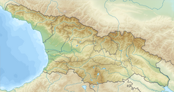
'''Zakagori''' ({{lang-ka|ზაკაგორი}}; {{lang-os|Четойтыхъæу}}, ''Ĉetojtyqæw'') is a village in the historical region of [[Khevi]], north-eastern [[Georgia (country)|Georgia]]. It is located on the left bank of the river [[Suatisi River|Suatisi]]. Administratively, it is part of the [[Kazbegi Municipality]] in [[Mtskheta-Mtianeti]]. Distance to the municipality center [[Stepantsminda]] is 29.5 km. |
'''Zakagori''' ({{lang-ka|ზაქაგორი}} or {{lang-ka|ზაკაგორი}}; {{lang-os|Четойтыхъæу}}, ''Ĉetojtyqæw'') is a village in the historical region of [[Khevi]], north-eastern [[Georgia (country)|Georgia]]. It is located on the left bank of the river [[Suatisi River|Suatisi]]. Administratively, it is part of the [[Kazbegi Municipality]] in [[Mtskheta-Mtianeti]]. Distance to the municipality center [[Stepantsminda]] is 29.5 km. |
||
== Sources == |
== Sources == |
||
Revision as of 15:10, 29 June 2022
Zakagori
ზაქაგორი | |
|---|---|
 Village of Zakagori | |
| Coordinates: 42°36′42″N 44°22′26″E / 42.61167°N 44.37389°E | |
| Country | |
| Mkhare | Mtskheta-Mtianeti |
| Municipality | Kazbegi |
| Community | Kobi |
| Elevation | 2,243 m (7,359 ft) |
| Population (2014)[1] | |
| • Total | 0 |
| Time zone | UTC+4 (Georgian Time) |
 | |
Zakagori (Georgian: ზაქაგორი or Georgian: ზაკაგორი; Template:Lang-os, Ĉetojtyqæw) is a village in the historical region of Khevi, north-eastern Georgia. It is located on the left bank of the river Suatisi. Administratively, it is part of the Kazbegi Municipality in Mtskheta-Mtianeti. Distance to the municipality center Stepantsminda is 29.5 km.
Sources
- Georgian Soviet Encyclopedia
- Google Earth
References
- ^ "Population Census 2014". www.geostat.ge. National Statistics Office of Georgia. November 2014. Retrieved 28 June 2021.


