
Darłowo: Difference between revisions
No edit summary |
|||
| Line 41: | Line 41: | ||
Already in the 11th century a fortified place named Dirlov or Dirlovo existed at the place where the river [[Wieprza]] enters the Baltic Sea. |
Already in the 11th century a fortified place named Dirlov or Dirlovo existed at the place where the river [[Wieprza]] enters the Baltic Sea. |
||
The town of Rügenwalde was probably founded in 1270 by [[Wizlaw II of Rügen|Wizlaw II]] of the [[Danish]] [[Principality of Rügen]], at that time also ruler of the [[Lands of Schlawe and Stolp]]. The first mention of Rügenwalde is in a document of February 5, 1271.<ref>Manfred Vollack, Ernst Hubert Michaelis, Heimatkreisausschuss Schlawe, Heimatkreisausschuss Schlawe, ''Der Kreis Schlawe: Ein pommersches Heimatbuch'', Husum Druck- und Verlagsgesellschaft, 1986, p.698, ISBN 3880423377</ref> The settlement decayed<ref name="Buchholz"/><ref>Rembert Unterstell, Klio in Pommern - Die Geschichte der pommerschen Historiographie 1815 bis 1945, Böhlau, 1996, p.81, ISBN 3412144959</ref>. According to a Polish encyclopedia, the town had been destroyed in 1183.{{cn}} In a chronic of 1632, M. Merian stated that it had been destroyed |
The town of Rügenwalde was probably founded in 1270 by [[Wizlaw II of Rügen|Wizlaw II]] of the [[Danish]] [[Principality of Rügen]], at that time also ruler of the [[Lands of Schlawe and Stolp]]. The first mention of Rügenwalde is in a document of February 5, 1271.<ref>Manfred Vollack, Ernst Hubert Michaelis, Heimatkreisausschuss Schlawe, Heimatkreisausschuss Schlawe, ''Der Kreis Schlawe: Ein pommersches Heimatbuch'', Husum Druck- und Verlagsgesellschaft, 1986, p.698, ISBN 3880423377</ref> The settlement decayed.<ref name="Buchholz"/><ref>Rembert Unterstell, Klio in Pommern - Die Geschichte der pommerschen Historiographie 1815 bis 1945, Böhlau, 1996, p.81, ISBN 3412144959</ref>. According to a Polish encyclopedia, the town had been destroyed in 1183.{{cn}} In a chronic of 1632, M. Merian stated that it had been destroyed by purpose by Bogislaw of Pomerania.<ref>M. Merian's chronic of 1632 has been reproduced in part in: ''Der Kreis Schlawe - Ein pommersches Heimatbuch'' (M. Vollack, ed.), Vol. II: ''Die Städte und Landgemeinden'', Husum 1989, ISBN 3-88042-337-7, pp. 683-684. </ref> Rügenwalde was built new and in May 21, 1312, the town was granted [[Lübeck law]] under the administration of the noble brothers John, Peter, and Lawrence<ref>In the "Handfeste" document the brothers call themselves: "Petrus dei gracia comes de Nuwenburg et domines Johannes et Laurentius, felicis memoriae dominis Suensones filii"; in another document of Oct 9, 1313 they call themselves "Petrus, Jasco et Laurencius germani, dicti de Nuwenborch"; cites from ''Scriptores Rerum Prussicarum: Die Geschichtsquellen der Preussischen Vorzeit bis zum Untergange der Ordensherrschaft''[http://books.google.de/books?id=YX8OAAAAYAAJ&pg=PA701&dq=r%C3%BCgenwalde+stadtrecht&client=firefox-a#PPA700,M1]</ref> of the [[Swenzones]] <ref>Eberhard Völker, Pommern und Ostbrandenburger, 2000, p.37, ISBN 3784427561</ref>, vassals of the [[Margraviate of Brandenburg|Brandenburg margraves]] since 1307<ref>Ellinor von Puttkamer: ''Die Swenzonen und das Land Schlawe'', in: ''Der Kreis Schlawe - Ein pommersches Heimatbuch'' (M. Vollack, ed.), Vol. II, loc. cit., pp. 545-550.</ref><ref>Neil Wilson, Tom Parkinson, Richard Watkins, Polen, Lonely Planet, 2006, p.433, ISBN 3829715595</ref><ref>Radosław Gaziński, Paweł Gut, Maciej Szukała, Peter Oliver Loew, Archiwum Państwowe w Szczecinie, Poland Naczelna Dyrekcja Archiwów Państwowych, Archiwum Państwowe w Szczecinie, Poland, Naczelna Dyrekcja Archiwów Państwowych, Staatsarchiv Stettin- Wegweiser durch die Bestände bis zum Jahr 1945, Oldenbourg Wissenschaftsverlag, 2004, p.336 [http://books.google.de/books?id=7ZmTZrs8dBEC&pg=PA336&dq=brandenburg+schlawe&client=firefox-a]</ref>. The Askanians had already been prior to 1307 under control of the Lands of Schlawe and Stolp<ref>Martin Wehrmann: ''Geschichte von Pommern'', Gotha 1904/1906, 1st edition, Vol. I, pp. 122-123.</ref><ref>Karl Rosenow: ''Herzogschloss und Fürstengruft'', Rügenwalde: Mewes, 1925 or later, p. 9. </ref>, from where they undertook in 1308 a campaign against Gdansk<ref>Jan M Piskorski, Pommern im Wandel der Zeit, 1999, p.68, ISBN 839061848: rough translation: "In 1308 the Brandenburgians subdued the areas of Stolp, Schlawe, and Danzig. Despite their eviction from Danzig by the Teutonic knights, they stayed in charge of the mouths of the Wipper and Stolpe rivers."</ref><ref name="Buchholz">Werner Buchholz, Pommern, Siedler, 1999, pp.77-80, ISBN 3886802728</ref><ref>Ingo Materna, Wolfgang Ribbe, Kurt Adamy, Brandenburgische Geschichte, Akademie Verlag, 1995, p.133, ISBN 3050025085</ref><ref>Hans-Friedrich Rosenfeld, Hellmut Rosenfeld, Deutsche Kultur im Spätmittelalter 1250-1500, 1978, p.49, ISBN 3799707131</ref>. |
||
The town passed to the [[Duchy of Pomerania]] in 1347<ref>Werner Buchholz, Pommern, Siedler, 1999, p.105, ISBN 3886802728</ref>, at that time ruled by the brothers [[Bogislaw V, Duke of Pomerania|Bogislaw V]], [[Wartislaw V]], and [[Barnim IV, Duke of Pomerania|Barnim IV]] of the [[House of Pomerania]] dynasty. Bogislaw, son-in-law of king [[Casimir III of Poland]], would become ruler of the area after the partition of Pomerania-Wolgast in 1368. This part duchy was known as [[Pomerania-Stolp]]. |
The town passed to the [[Duchy of Pomerania]] in 1347<ref>Werner Buchholz, Pommern, Siedler, 1999, p.105, ISBN 3886802728</ref>, at that time ruled by the brothers [[Bogislaw V, Duke of Pomerania|Bogislaw V]], [[Wartislaw V]], and [[Barnim IV, Duke of Pomerania|Barnim IV]] of the [[House of Pomerania]] dynasty. Bogislaw, son-in-law of king [[Casimir III of Poland]], would become ruler of the area after the partition of Pomerania-Wolgast in 1368. This part duchy was known as [[Pomerania-Stolp]]. |
||
In 1352 the construction of the castle began, and cooperation with |
In 1352 the construction of the castle began, and cooperation with [[Hansa]] was initiated, with the town becoming a full member of the [[Hanseatic League]] in 1412. In 1382 [[Eric of Pomerania]], later the king of [[Norway]], [[Denmark]] and [[Sweden]], was born in the town. After losing his thrones, he returned to his birthplace and began to expand his duchy. After his death in 1459 he was burried in St. Mary's Church. |
||
After Eric's death the town was ruled by duke [[Eric II of Pomerania-Wolgast]].<ref>Gustav Kratz: ''Die Städte der Provinz Pommern'', Vaduz: Sändig Reprint Verlag, 1996 (unchanged reprint of the edition of 1886), p. 332.</ref> |
After Eric's death the town was ruled by duke [[Eric II of Pomerania-Wolgast]].<ref>Gustav Kratz: ''Die Städte der Provinz Pommern'', Vaduz: Sändig Reprint Verlag, 1996 (unchanged reprint of the edition of 1886), p. 332.</ref> |
||
Another significant ruler was [[Bogislaw X, Duke of Pomerania|Bogislaw X]] (1454-1523). Under his administration the trade and prosperity in the area of |
Another significant ruler was [[Bogislaw X, Duke of Pomerania|Bogislaw X]] (1454-1523). Under his administration the trade and prosperity in the area of Darłowo grew, as international trade relations were extended, also with Poland. |
||
In 1497 and 1552 the habour of the town, known in German as Rügenwaldermünde, and parts of the town were hit by great storms. Ships which had |
In 1497 and 1552 the habour of the town, known in German as Rügenwaldermünde, and parts of the town were hit by great storms. Ships which had got out of control were seen drifting in the vicinity of the town and of the neighbouring village of Sukow. In 1589, 1624, 1648, 1679 and 1722 fires damaged the town. The first lighthouse was built around the year 1715. |
||
After the death of the last [[Dukes of Pomerania|Pomeranian Duke]] [[Bogislaw XIV, Duke of Pomerania|Bogislaw XIV]] in 1637, the end of the contemporary [[Thirty Years' War]] in 1648 and the subsequent partition of the [[Duchy of Pomerania]] between |
After the death of the last [[Dukes of Pomerania|Pomeranian Duke]] [[Bogislaw XIV, Duke of Pomerania|Bogislaw XIV]] in 1637, the end of the contemporary [[Thirty Years' War]] in 1648 and the subsequent partition of the [[Duchy of Pomerania]] between the [[Swedish Empire]] and [[Brandenburg-Prussia]] in the [[Peace of Westphalia]] and the [[Treaty of Stettin (1653)]], Brandenburg included [[Farther Pomerania]] with Rügenwalde in [[Province of Pomerania (1653-1815)|her Pomeranian province]]. The harbour of Rügenwaldermünde was destroyed during the Thirty Years' War by [[Holy Roman Empire|imperial troops]], and was reconstructed by order of King [[Frederick II of Prussia]] not before 1772. |
||
During the [[Napoleonic Wars]] some of its inhabitants, in particular ship owners and businessmen, profited from smuggling British goods to the continent. In 1871 the town, along with [[Prussia]], became a part of the newly constitued [[German Empire]]. A railway reached the town in 1878. 289 inhabitants died throughout [[World War I]]. |
During the [[Napoleonic Wars]] some of its inhabitants, in particular ship owners and businessmen, profited from smuggling British goods to the continent. In 1871 the town, along with [[Prussia]], became a part of the newly constitued [[German Empire]]. A railway reached the town in 1878. 289 inhabitants died throughout [[World War I]]. |
||
In last democratic elections March 5, 1933, 58.13% (Germany 44%) valid votes for [[NSDAP]] (data for the county) . |
|||
Before the outbreak of World War I the town had about 6,000 inhabitants, before the outbreak of World War II about 8000. As a town in the middle of Farther Pomerania, it had a population of German native language, with a negligible number of exceptions.<ref>In 1905 the total Province of Pomerania had 1.684.326 inhabitants, among them 14.162 with Polish native language (near to the border of [[West Prussia]] or [[ |
Before the outbreak of World War I the town had about 6,000 inhabitants, before the outbreak of World War II about 8000. As a town in the middle of Farther Pomerania, it had a population of German native language, with a negligible number of exceptions.<ref>In 1905 the total Province of Pomerania had 1.684.326 inhabitants, among them 14.162 with Polish native language (near to the border of [[West Prussia]] or [[Pomeralia]]) and 320 with Kashubian native langugage (at Lake Leba and at Lake Garde), cf. ''Meyers Großes Konversationslexikon'', 6th edition, Vol. 16, Leipzig/Wien: Bibliographisches Institut, 1909, p. 134</ref>. During World War II an important firing range operated near the town, on which some of the largest guns in history were tested: [[Schwerer Gustav]] and [[Mörser Karl]]. [[Adolf Hitler]] came to the town a number of times to observe these tests. In early 1945 some families had tried to escape by ships in the framework of the [[Operation Hannibal]] before [[Red Army|Soviet Troops]] reached the town on March 7, 1945. Most of the citizens had remained in the town or returned again after their escape had failed. |
||
Following the [[Oder-Neisse line|post-war boundary changes]], Rügenwalde became [[Poland|Polish]]. Its [[Flight and expulsion of Germans from Poland after World War II|German population was expelled]]<ref>Manfred Vollack (ed.): ''Der Kreis Schlawe'', Vol. I: ''Der Kreis als Ganzes'', Vol. II: ''Die Städte und Landgemeinden'', Husum 1986/1989.</ref> <ref>[[Alfred-Maurice de Zayas]]: ''A Terrible Revenge: The Ethnic Cleansings of the Eastern European Germans 1944-1950'', New York: St. Martin's Press, 1994.</ref> <ref>[[Alfred-Maurice de Zayas]]: ''Die Nemesis von Potsdam - Die Anglo-Amerikaner und die Vertreibung der Deutschen'', 14th enlarged edition, Munich: Herbig, 2005, ISBN 3-7766-2454-X.</ref> and the town was populated with [[Poles]] and [[Ukraine|Ukrainians]] in 1946/47, who mostly came from regions East of the [[Curzon Line]] {{Fact|date=December 2008}}. After World War II the town was given the Polish name Dyrłów, and later Darłów, before changing to the current name. |
Following the [[Oder-Neisse line|post-war boundary changes]], Rügenwalde became [[Poland|Polish]]. Its [[Flight and expulsion of Germans from Poland after World War II|German population was expelled]]<ref>Manfred Vollack (ed.): ''Der Kreis Schlawe'', Vol. I: ''Der Kreis als Ganzes'', Vol. II: ''Die Städte und Landgemeinden'', Husum 1986/1989.</ref> <ref>[[Alfred-Maurice de Zayas]]: ''A Terrible Revenge: The Ethnic Cleansings of the Eastern European Germans 1944-1950'', New York: St. Martin's Press, 1994.</ref> <ref>[[Alfred-Maurice de Zayas]]: ''Die Nemesis von Potsdam - Die Anglo-Amerikaner und die Vertreibung der Deutschen'', 14th enlarged edition, Munich: Herbig, 2005, ISBN 3-7766-2454-X.</ref> and the town was populated with [[Poles]] and [[Ukraine|Ukrainians]] in 1946/47, who mostly came from regions East of the [[Curzon Line]] {{Fact|date=December 2008}}. After World War II the town was given the Polish name Dyrłów, and later Darłów, before changing to the current name. |
||
Today the city is well known in Poland as a summer resort. |
Today the city is well known in Poland as a summer resort. Has the only on Polish coast aquapark with desalted sea water. |
||
==Main Sights== |
==Main Sights== |
||
The whole area of the Old Town in Darłowo is under preservation. Darłowo has maintained the unique medieval |
The whole area of the Old Town in Darłowo is under preservation. Darłowo has maintained the unique medieval urban planning with the main square in the middle of the town. During medieval times the town had walls and several gates; only one gate has survived in a fairly original shape. |
||
* Castle of Dukes of [[House of Pomerania]]- today a Regional Museum. The castle is built in gothic style on a base plan resembling a square; its tower is 24 meters high. This is the only castle of such characteristic on the |
* Castle of Dukes of [[House of Pomerania]]- today a Regional Museum. The castle is built in gothic style on a base plan resembling a square; its tower is 24 meters high. This is the only castle of such characteristic on the Polish seacoast. |
||
* [[Blessed Virgin Mary]] Church (original German name: ''Marienkirche'') - basilica built in |
* [[Blessed Virgin Mary]] Church (original German name: ''Marienkirche'') - basilica built in gothic style in 1321, with sarcophagues of Dukes of Pomerania: Erik I, Elisabeth (wife of last Duke of Pomerania Bogislaw XIV, died in 1653) |
||
* [[Gertrude the Great|Saint Gertrude]] Church (original German name: ''Gertrudkirche'') - built in |
* [[Gertrude the Great|Saint Gertrude]] Church (original German name: ''Gertrudkirche'') - built in scandinavian style, first mentioned in 1497 |
||
* [[Saint George]] Church (original German name: ''Georgskirche'') - built in Gothic style outside of the city walls |
* [[Saint George]] Church (original German name: ''Georgskirche'') - built in Gothic style outside of the city walls |
||
* High Gate - also known as Stone Gate (original German names: ''Hohes Tor'' or ''Steintor'') - built in the XIV century, a remainder of the city walls. |
* High Gate - also known as Stone Gate (original German names: ''Hohes Tor'' or ''Steintor'') - built in the XIV century, a remainder of the city walls. |
||
| Line 82: | Line 82: | ||
==Trivia== |
==Trivia== |
||
The |
The German name ''Rügenwalde'' was best known in Germany for the production of the [[Rügenwalder Teewurst]] in the town; after [[World War II]] the production was restarted in [[West Germany]] under the old name. |
||
== Population == |
== Population == |
||
| Line 130: | Line 130: | ||
{{Sławno County}} |
{{Sławno County}} |
||
[[Category:Cities and towns in West Pomeranian Voivodeship|Darlowo]] |
|||
[[de:Darłowo]] |
[[de:Darłowo]] |
||
Revision as of 17:08, 18 December 2008
Darłowo | |
|---|---|
 Coat of arms | |
| Country | |
| Voivodeship | West Pomeranian |
| County | Sławno |
| Gmina | Darłowo (urban gmina) |
| Area | |
| • Total | 19.93 km2 (7.70 sq mi) |
| Highest elevation | 5 m (16 ft) |
| Lowest elevation | 1 m (3 ft) |
| Population (2006) | |
| • Total | 14,380 |
| • Density | 720/km2 (1,900/sq mi) |
| Postal code | 76-150 and 76-153 |
| Website | http://www.darlowo.pl/ |
Darłowo [Polish pronunciation: [d] ] (in full The Royal City of Darłowo: Polish: Królewskie Miasto Darłowo, German: Rügenwalde) is a town at the south coast of the Baltic Sea in Middle Pomerania, north-western Poland with 14,931 inhabitants (2006). Located in Sławno County in West Pomeranian Voivodeship since 1999, it was previously a town in Koszalin Voivodeship (1950–1998).

History
Numerous archeological findings reveal that, after the ice which had covered North-Eastern Europe had molten and the Ice-age had ended at about 8.000 B.C., settlers of the Stone Age first populated the region.[1] Remainders of Celtic culture and Germanic culture, as well as of Baltic culture, influenced by contacts with Rome's merchants, were found in the area. Several Roman coins with portaits of Roman Emperors were found around Rügenwalde[citation needed], today Darłowo.
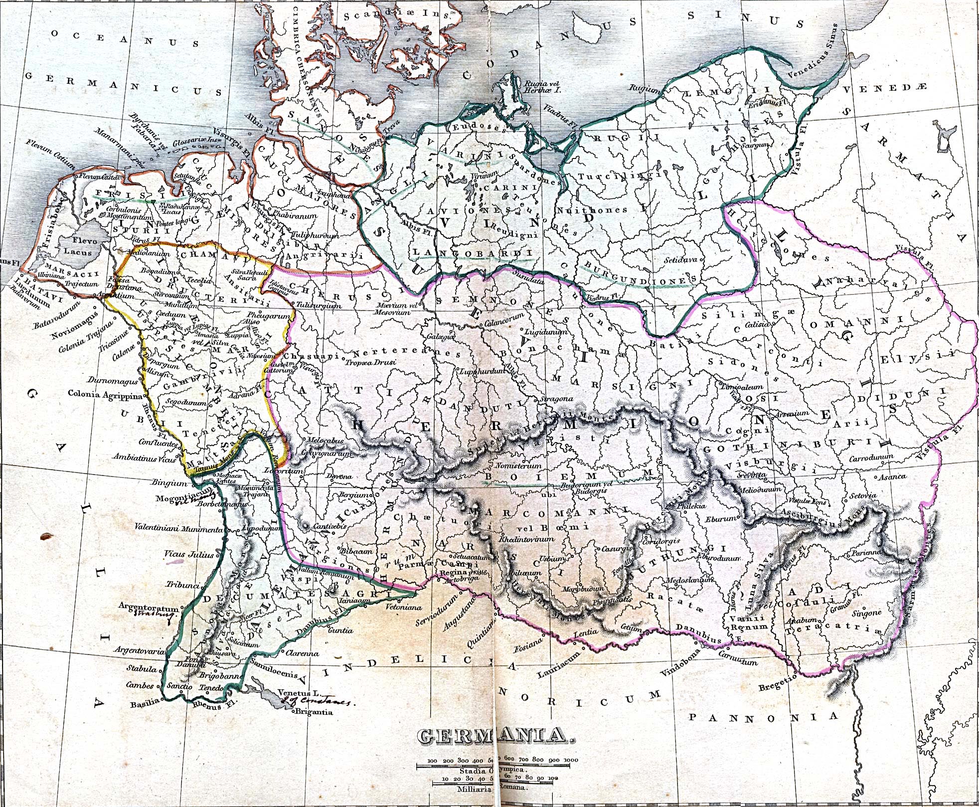
On Ptolemy's chart of Germania Magna a settlement of the Rugians called Rugium is listed in the vicinity (at the river Grabow).
Already in the 11th century a fortified place named Dirlov or Dirlovo existed at the place where the river Wieprza enters the Baltic Sea.
The town of Rügenwalde was probably founded in 1270 by Wizlaw II of the Danish Principality of Rügen, at that time also ruler of the Lands of Schlawe and Stolp. The first mention of Rügenwalde is in a document of February 5, 1271.[2] The settlement decayed.[3][4]. According to a Polish encyclopedia, the town had been destroyed in 1183.[citation needed] In a chronic of 1632, M. Merian stated that it had been destroyed by purpose by Bogislaw of Pomerania.[5] Rügenwalde was built new and in May 21, 1312, the town was granted Lübeck law under the administration of the noble brothers John, Peter, and Lawrence[6] of the Swenzones [7], vassals of the Brandenburg margraves since 1307[8][9][10]. The Askanians had already been prior to 1307 under control of the Lands of Schlawe and Stolp[11][12], from where they undertook in 1308 a campaign against Gdansk[13][3][14][15].
The town passed to the Duchy of Pomerania in 1347[16], at that time ruled by the brothers Bogislaw V, Wartislaw V, and Barnim IV of the House of Pomerania dynasty. Bogislaw, son-in-law of king Casimir III of Poland, would become ruler of the area after the partition of Pomerania-Wolgast in 1368. This part duchy was known as Pomerania-Stolp.
In 1352 the construction of the castle began, and cooperation with Hansa was initiated, with the town becoming a full member of the Hanseatic League in 1412. In 1382 Eric of Pomerania, later the king of Norway, Denmark and Sweden, was born in the town. After losing his thrones, he returned to his birthplace and began to expand his duchy. After his death in 1459 he was burried in St. Mary's Church.
After Eric's death the town was ruled by duke Eric II of Pomerania-Wolgast.[17]
Another significant ruler was Bogislaw X (1454-1523). Under his administration the trade and prosperity in the area of Darłowo grew, as international trade relations were extended, also with Poland.
In 1497 and 1552 the habour of the town, known in German as Rügenwaldermünde, and parts of the town were hit by great storms. Ships which had got out of control were seen drifting in the vicinity of the town and of the neighbouring village of Sukow. In 1589, 1624, 1648, 1679 and 1722 fires damaged the town. The first lighthouse was built around the year 1715.
After the death of the last Pomeranian Duke Bogislaw XIV in 1637, the end of the contemporary Thirty Years' War in 1648 and the subsequent partition of the Duchy of Pomerania between the Swedish Empire and Brandenburg-Prussia in the Peace of Westphalia and the Treaty of Stettin (1653), Brandenburg included Farther Pomerania with Rügenwalde in her Pomeranian province. The harbour of Rügenwaldermünde was destroyed during the Thirty Years' War by imperial troops, and was reconstructed by order of King Frederick II of Prussia not before 1772.
During the Napoleonic Wars some of its inhabitants, in particular ship owners and businessmen, profited from smuggling British goods to the continent. In 1871 the town, along with Prussia, became a part of the newly constitued German Empire. A railway reached the town in 1878. 289 inhabitants died throughout World War I.
In last democratic elections March 5, 1933, 58.13% (Germany 44%) valid votes for NSDAP (data for the county) .
Before the outbreak of World War I the town had about 6,000 inhabitants, before the outbreak of World War II about 8000. As a town in the middle of Farther Pomerania, it had a population of German native language, with a negligible number of exceptions.[18]. During World War II an important firing range operated near the town, on which some of the largest guns in history were tested: Schwerer Gustav and Mörser Karl. Adolf Hitler came to the town a number of times to observe these tests. In early 1945 some families had tried to escape by ships in the framework of the Operation Hannibal before Soviet Troops reached the town on March 7, 1945. Most of the citizens had remained in the town or returned again after their escape had failed.
Following the post-war boundary changes, Rügenwalde became Polish. Its German population was expelled[19] [20] [21] and the town was populated with Poles and Ukrainians in 1946/47, who mostly came from regions East of the Curzon Line [citation needed]. After World War II the town was given the Polish name Dyrłów, and later Darłów, before changing to the current name.
Today the city is well known in Poland as a summer resort. Has the only on Polish coast aquapark with desalted sea water.
Main Sights
The whole area of the Old Town in Darłowo is under preservation. Darłowo has maintained the unique medieval urban planning with the main square in the middle of the town. During medieval times the town had walls and several gates; only one gate has survived in a fairly original shape.
- Castle of Dukes of House of Pomerania- today a Regional Museum. The castle is built in gothic style on a base plan resembling a square; its tower is 24 meters high. This is the only castle of such characteristic on the Polish seacoast.
- Blessed Virgin Mary Church (original German name: Marienkirche) - basilica built in gothic style in 1321, with sarcophagues of Dukes of Pomerania: Erik I, Elisabeth (wife of last Duke of Pomerania Bogislaw XIV, died in 1653)
- Saint Gertrude Church (original German name: Gertrudkirche) - built in scandinavian style, first mentioned in 1497
- Saint George Church (original German name: Georgskirche) - built in Gothic style outside of the city walls
- High Gate - also known as Stone Gate (original German names: Hohes Tor or Steintor) - built in the XIV century, a remainder of the city walls.
- Lighthouse - built in the XIX century, 20 meters high


Trivia
The German name Rügenwalde was best known in Germany for the production of the Rügenwalder Teewurst in the town; after World War II the production was restarted in West Germany under the old name.
Population
1782: 2 255
1812: 3 136
1852: 5 060
1875: 5 174
1890: 5 296 (including 27 Catholics, 102 Jews)
1910: 5 978
1939: 8 392 [22]
1960: 9 200
1970: 11 300
1975: 12 900
1980: 13 400
2000: 15 600
See also
References
- ^ As an example, near to the village of Schlawin, 10 kilometers away from the town, a 8.5 cm long axe with a shaft hole, made from diorite, has been found, cf. 40. Jahresbericht der pommerschen Gesellschaft für Geschichte und Altertumskunde, 1877/1878, p. 463.
- ^ Manfred Vollack, Ernst Hubert Michaelis, Heimatkreisausschuss Schlawe, Heimatkreisausschuss Schlawe, Der Kreis Schlawe: Ein pommersches Heimatbuch, Husum Druck- und Verlagsgesellschaft, 1986, p.698, ISBN 3880423377
- ^ a b Werner Buchholz, Pommern, Siedler, 1999, pp.77-80, ISBN 3886802728
- ^ Rembert Unterstell, Klio in Pommern - Die Geschichte der pommerschen Historiographie 1815 bis 1945, Böhlau, 1996, p.81, ISBN 3412144959
- ^ M. Merian's chronic of 1632 has been reproduced in part in: Der Kreis Schlawe - Ein pommersches Heimatbuch (M. Vollack, ed.), Vol. II: Die Städte und Landgemeinden, Husum 1989, ISBN 3-88042-337-7, pp. 683-684.
- ^ In the "Handfeste" document the brothers call themselves: "Petrus dei gracia comes de Nuwenburg et domines Johannes et Laurentius, felicis memoriae dominis Suensones filii"; in another document of Oct 9, 1313 they call themselves "Petrus, Jasco et Laurencius germani, dicti de Nuwenborch"; cites from Scriptores Rerum Prussicarum: Die Geschichtsquellen der Preussischen Vorzeit bis zum Untergange der Ordensherrschaft[1]
- ^ Eberhard Völker, Pommern und Ostbrandenburger, 2000, p.37, ISBN 3784427561
- ^ Ellinor von Puttkamer: Die Swenzonen und das Land Schlawe, in: Der Kreis Schlawe - Ein pommersches Heimatbuch (M. Vollack, ed.), Vol. II, loc. cit., pp. 545-550.
- ^ Neil Wilson, Tom Parkinson, Richard Watkins, Polen, Lonely Planet, 2006, p.433, ISBN 3829715595
- ^ Radosław Gaziński, Paweł Gut, Maciej Szukała, Peter Oliver Loew, Archiwum Państwowe w Szczecinie, Poland Naczelna Dyrekcja Archiwów Państwowych, Archiwum Państwowe w Szczecinie, Poland, Naczelna Dyrekcja Archiwów Państwowych, Staatsarchiv Stettin- Wegweiser durch die Bestände bis zum Jahr 1945, Oldenbourg Wissenschaftsverlag, 2004, p.336 [2]
- ^ Martin Wehrmann: Geschichte von Pommern, Gotha 1904/1906, 1st edition, Vol. I, pp. 122-123.
- ^ Karl Rosenow: Herzogschloss und Fürstengruft, Rügenwalde: Mewes, 1925 or later, p. 9.
- ^ Jan M Piskorski, Pommern im Wandel der Zeit, 1999, p.68, ISBN 839061848: rough translation: "In 1308 the Brandenburgians subdued the areas of Stolp, Schlawe, and Danzig. Despite their eviction from Danzig by the Teutonic knights, they stayed in charge of the mouths of the Wipper and Stolpe rivers."
- ^ Ingo Materna, Wolfgang Ribbe, Kurt Adamy, Brandenburgische Geschichte, Akademie Verlag, 1995, p.133, ISBN 3050025085
- ^ Hans-Friedrich Rosenfeld, Hellmut Rosenfeld, Deutsche Kultur im Spätmittelalter 1250-1500, 1978, p.49, ISBN 3799707131
- ^ Werner Buchholz, Pommern, Siedler, 1999, p.105, ISBN 3886802728
- ^ Gustav Kratz: Die Städte der Provinz Pommern, Vaduz: Sändig Reprint Verlag, 1996 (unchanged reprint of the edition of 1886), p. 332.
- ^ In 1905 the total Province of Pomerania had 1.684.326 inhabitants, among them 14.162 with Polish native language (near to the border of West Prussia or Pomeralia) and 320 with Kashubian native langugage (at Lake Leba and at Lake Garde), cf. Meyers Großes Konversationslexikon, 6th edition, Vol. 16, Leipzig/Wien: Bibliographisches Institut, 1909, p. 134
- ^ Manfred Vollack (ed.): Der Kreis Schlawe, Vol. I: Der Kreis als Ganzes, Vol. II: Die Städte und Landgemeinden, Husum 1986/1989.
- ^ Alfred-Maurice de Zayas: A Terrible Revenge: The Ethnic Cleansings of the Eastern European Germans 1944-1950, New York: St. Martin's Press, 1994.
- ^ Alfred-Maurice de Zayas: Die Nemesis von Potsdam - Die Anglo-Amerikaner und die Vertreibung der Deutschen, 14th enlarged edition, Munich: Herbig, 2005, ISBN 3-7766-2454-X.
- ^ Carlheinz Rosenow: Aus der Heimat Rügenwalde (Kreis Schlawe - Pommern) - Jahrbuch 1987. Glücksstadt 1987 (German)
Further reading
- Gustav Kratz: Die Städte der Provinz Pommern - Abriß ihrer Geschichte, zumeist nach Urkunden, Vaduz: Sändig Reprint Verlag, 1996, ISBN 3253027341 (unchanged reprint of the edition of 1886, original edition also available as digitized file from http://books.google.de), pp. 327-338.
- Manfred Vollack (ed.): Der Kreis Schlawe - Ein pommersches Heimatbuch, Husum: Husum Druck und Verlagsgesellschaft, 1986/1989, Vol. I: Der Kreis als Ganzes, ISBN 3-88042-239-7, Vol. II: Die Städte und Landgemeinden, ISBN 3-88042-337-7 (The book contains several articles concerning the town of Rügenwalde, which had been written prior to World War II. Included is also a more recent article by Ellinor von Puttkamer on the Swenzones.)
- „Darłowo zarys dziejów” [Darłowo's Brief History] – L. Walkiewicz and M. Żukowski (pl)
- „Z dziejów portu nad Wieprzą” [From History of the Harbor on Wieprz River]– L. Walkiewicz (pl)
- „Darłowo” Józef Staśko Zarząd Główny Polskiego Towarzystwa Krajoznawczego, 1948
- „200 miast wraca do Polski” Władysław Jan Grabski, Wydawnictwo Zachodnie 1947
External links
- Map of 1842 with Rugium in Germania Magna
- Portal Darłowo (pl)
- Forum Darłowo (pl)
- City Map Darłowo (pl)
- Official site of International Military Meeting Darłowo
- German detailed map 1:25 000 dated 1897 from Archiwum Map Zachodniej Polski (Archive of Maps of Western Poland)
- Aquapark with desalted sea water
- German historical site
54°25′N 16°25′E / 54.417°N 16.417°E
| Urban gminas |  | |
|---|---|---|
| Rural gminas | ||