
Stafford, Virginia: Difference between revisions
Staffordme (talk | contribs) No edit summary Tag: categories removed |
Reverted to revision 433515283 by ElCartero: copied from Stafford County, Virginia, another wiki article. (TW) |
||
| Line 1: | Line 1: | ||
{{Infobox settlement |
|||
Stafford County is a county located in the Commonwealth of Virginia, a U.S. state. As of the 2000 census, the population was 92,446, increasing to 128,961 in 2010.[1] Its county seat is Stafford[2]. In 2006, and again in 2009, Stafford was ranked as the 11th highest income county in America by Forbes Magazine. U.S. Route 1, Interstate 95, and Virginia Railway Express commuter railway serve the county. |
|||
|name = Stafford County |
|||
|official_name = |
|||
|settlement_type = [[Unincorporated area|Unincorporated community]] |
|||
|nickname = |
|||
|motto = |
|||
<!-- Images --> |
|||
This county is part of the Washington Metropolitan Area. |
|||
|image_skyline = |
|||
|imagesize = |
|||
|image_caption = |
|||
|image_flag = |
|||
|image_seal = |
|||
<!-- Maps --> |
|||
Contents [hide] |
|||
|pushpin_map = Virginia |
|||
1 History |
|||
|pushpin_label_position = left<!-- the position of the pushpin label: left, right, top, bottom, none --> |
|||
2 Geography |
|||
|pushpin_map_caption = Location within the state of Virginia |
|||
2.1 Adjacent counties and independent city |
|||
|pushpin_mapsize = |
|||
3 Government and politics |
|||
|image_map = |
|||
4 Demographics |
|||
|map_caption = Location within Stafford county |
|||
5 Points of interest |
|||
|image_map1 = |
|||
5.1 Local newspapers |
|||
|mapsize1 = |
|||
6 Localities |
|||
|map_caption1 = |
|||
6.1 Geographical |
|||
6.2 Transportation |
|||
6.3 Zip Codes |
|||
7 Education |
|||
7.1 Colleges |
|||
7.2 High Schools |
|||
7.3 Middle Schools |
|||
7.4 Elementary Schools |
|||
8 Major bodies of water |
|||
9 See also |
|||
10 References |
|||
11 External links |
|||
[edit] HistoryFor thousands of years, various cultures of indigenous peoples succeeded each other in their territories along the Potomac River and its tributaries. By the time of English colonization, there were 32 Algonquian-speaking American Indian tribes in the present-day coastal Tidewater Virginia area, including those of the Patawomeck and numerous tribes that were part of the Powhatan Confederacy. The former small tribe, still centered in Stafford County, was recognized by the state of Virginia in 2010. |
|||
<!-- Location --> |
|||
The American Indians' first recorded encounter with Europeans in this area was in 1608, with John Smith of the Jamestown settlement. During a time of recurring tension between the early English colonists and local American Indians, the colonists kidnapped Pocahontas, daughter of the Powhatan, paramount chief of the confederacy.[3] This occurred in the eastern part of Stafford County, from where they took her to a secondary English settlement, known as Henricus (or Henrico Town). While held there, Pocahontas converted to Christianity and married English settler John Rolfe in April 1614.[4][5] |
|||
|subdivision_type = [[List of countries|Country]] |
|||
|subdivision_name = {{Flag|United States}} |
|||
|subdivision_type1 = [[Political divisions of the United States|State]] |
|||
|subdivision_name1 = {{Flag|Virginia}} |
|||
|subdivision_type2 = [[List of counties in Virginia|County]] |
|||
|subdivision_name2 = [[Stafford County, Virginia|Stafford]] |
|||
|government_footnotes = |
|||
The English colonial government of Virginia imposed its own order on the land and peoples. In 1664 it established Stafford County from territory previously part of Westmoreland County.[6] It was named after Staffordshire, England. As originally delineated, Stafford County included a much larger area than its current borders, and in fact encompassed what would later become Arlington, Fairfax, and Prince William, and the City of Alexandria.[6] It is part of the area now considered Northern Virginia. George Washington spent much of his childhood in the lower part of the county on his family's home, Ferry Farm, along the Rappahannock River across from Fredericksburg. Colonial Forge High School was built on a tract of land owned in colonial times by his father Augustine Washington.[7] George Mason, another Founding Father of the nation, also spent his formative years in Stafford.[8] |
|||
|government_type = |
|||
|leader_title = |
|||
|leader_name = |
|||
|leader_title1 = |
|||
|leader_name1 = |
|||
|established_title = |
|||
|established_date = |
|||
<!-- Area --> |
|||
Aquia Church, built in 1757 near Garrisonville, Virginia, is unusual among local structures for having been designed on the plan of a Greek cross. It has been designated a National Historic Landmark. The Episcopal church continues to be active today.[9] |
|||
|unit_pref = Imperial |
|||
|area_footnotes = |
|||
|area_magnitude = |
|||
|area_total_km2 = 717.4 |
|||
|area_land_km2 = |
|||
|area_water_km2 = |
|||
<!-- Population --> |
|||
Stafford County industry and resources were important to the colony and early nation. During the Revolutionary War, the Stafford iron works furnished arms for the colonial rebel soldiers.[10] Aquia Creek sandstone, quarried from Government Island, was used to build the White House and the U.S. Capitol.[11] |
|||
|population_as_of = [[United States Census, 2010|2010]] |
|||
|population_footnotes = |
|||
|population_total = 128961 |
|||
|population_density_km2 = auto |
|||
<!-- General information --> |
|||
During the American Civil War, the county was part of the battlegrounds, occupied by more than 100,000 troops for several years. The Battle of Aquia Creek took place in the Aquia Harbour area. Both the Union Army and Confederate Army struggled to control the strategic Potomac Creek Bridge at various times during the war. |
|||
|timezone = [[Eastern Time Zone|Eastern (EST)]] |
|||
|utc_offset = -5 |
|||
|timezone_DST = EDT |
|||
|utc_offset_DST = -4 |
|||
|elevation_footnotes = |
|||
|elevation_ft = <!-- --> |
|||
|coordinates_display = inline,title |
|||
|coordinates_type = region:US_type:city |
|||
|latd = 38|latm = 25 |lats = 19|latNS = N |
|||
|longd = 77|longm = 24|longs = 30|longEW = W |
|||
<!-- Area/postal codes & others --> |
|||
Falmouth, a town bordering Fredericksburg, was the home of late-19th century artist Gari Melchers, whose house, Belmont, still stands. |
|||
|postal_code_type = [[ZIP code]]s |
|||
|postal_code = |
|||
|area_code = |
|||
|blank_name = [[Federal Information Processing Standard|FIPS code]] |
|||
|blank_info = |
|||
|blank1_name = [[Geographic Names Information System|GNIS]] feature ID |
|||
|blank1_info = |
|||
|website = {{url|http://co.stafford.va.us/|Official website for the County}} |
|||
|footnotes = |
|||
}} |
|||
'''Stafford''' is a [[census-designated place]] (CDP; listed as '''Stafford Courthouse''') in and the [[county seat]] of [[Stafford County, Virginia|Stafford County]] in the northern part of the [[U.S. state]] of [[Virginia]].{{GR|6}} The population as of the [[United States Census, 2010|2010 Census]] was 4,320.<ref>[http://mcdc.missouri.edu/webrepts/pl94trends/Virginia_stplace2.html Virginia Trend Report 2: State and Complete Places (Sub-state 2010 Census Data).] Missouri Census Data Center. Accessed 2011-06-08.</ref> It lies {{convert|10|mi|km|0}} north of [[Fredericksburg, Virginia|Fredericksburg]], approximately {{convert|40|mi|km|0}} south of metropolitan [[Washington, D.C.]], and about {{convert|60|mi|km|0}} north of [[Richmond, Virginia|Richmond]], the state capital (Connor, 2003). The [[Marine Corps Base Quantico]] is located north of the community. [[U.S. Highway 1]], [[Interstate 95 in Virginia|Interstate 95]], and [[Virginia Railway Express]] commuter trains pass through Stafford. Like the rest of the metropolitan area, including central Maryland, modern Stafford has been shaped by its proximity to the nation's capital. It is largely populated by professionals working in the federal civil service, the U.S. military, or for one of the many private companies which contract to provide services to the federal government. |
|||
Stafford County today is considered part of the Washington, D.C. metropolitan area. Many residents commute to work in Washington and its environs north on Interstate Highway 95, U.S. Route 1, and Virginia Railway Express. |
|||
==High schools== |
|||
In the early morning hours of May 9, 2008, a tornado touched down in the southern part of the county, severely damaging about 140 suburban homes.[12] The county was also severely affected by the massive blizzards of December 2009 and February 2010. The county seat Stafford received almost 2 feet of snow both times. In December 2009, it received some of the heaviest snow in the D.C. metropolitan area, with 25.4 inches of snow, and 19.3 inches in February 2010. |
|||
* [[Brooke Point High School]] |
|||
* [[Colonial Forge High School]] |
|||
* [[Mountain View High School (Virginia)|Mountain View High School]] |
|||
* [[North Stafford High School]] |
|||
* [[Stafford Senior High School]] |
|||
==Historical sites== |
|||
[edit] GeographyAccording to the U.S. Census Bureau, the county has a total area of 280 square miles (725 km²), of which 270 square miles (700 km²) is land and 10 square miles (25 km²) (3.43%) is water. The Potomac River flows along part of the eastern border of the county, while the Rappahannock River runs along the extent of the county's southern border. Aquia Creek empties into the tidal segment of the Potomac River at Brent Point in Stafford County. |
|||
* [[Ferry Farm]] — [[George Washington]]'s boyhood home |
|||
* [[Gari Melchers Home|Belmont Estate]] — the house of American artist [[Gari Melchers]] (1860–1932), a museum of his personal effects<ref>[http://www.garimelchers.org/ Gari Melchers website].</ref> |
|||
* Government Island - Site of the quarry for [[Aquia Creek Sandstone]] that was used to build parts of the White House and Capitol building<ref>http://www.doi.gov/ocl/2002/hres261.htm</ref>. (Not to be confused with [[Governors Island]] in New York City) |
|||
* [[Aquia Church]] (1751-1755), [[National Historic Landmark]] |
|||
==References== |
|||
[edit] Adjacent counties and independent cityFauquier County - northwest |
|||
{{reflist}} |
|||
Prince William County - north |
|||
Charles County, Maryland - east |
|||
King George County - southeast |
|||
Caroline County - south |
|||
Fredericksburg, Virginia - southwest |
|||
Spotsylvania County - southwest |
|||
Culpeper County - west |
|||
[edit] Government and politicsThe county is divided into seven magisterial districts: George Washington, Hartwood, Falmouth, Griffis-Widewater, Aquia, Garrisonville, and Rockhill. The magisterial districts each elect one supervisor to the Board of Supervisors which governs Stafford County. The County operates under the county form of the County Executive system of government, with an elected Board of Supervisors. The Board then appoints a professional, nonpartisan County Executive to manage government agencies. |
|||
==External links== |
|||
Stafford County is represented by Congressman Rob Wittman in the U.S. House of Representatives. Stafford is represented by William J. Howell in the Virginia House of Delegates. Delegate Bill Howell also serves as the Speaker of the House of Delegates. |
|||
{{Commons|Category:Stafford County, Virginia|Stafford, Virginia}} |
|||
*[http://co.stafford.va.us/ Official website for the County] |
|||
*[http://www.pen.k12.va.us/Div/Stafford/ Stafford County Public Schools] |
|||
*[http://www.mysouthstafford.com South Stafford community website] |
|||
{{Stafford County, Virginia}} |
|||
Position Name Affiliation First Election District |
|||
Supervisor Cord Sterling Republican 2007 Rockhill |
|||
Supervisor Paul Milde Republican 2005 Aquia |
|||
Supervisor Mark Dudenhefer Republican 2005 Garrisonville |
|||
Supervisor Gary Snellings Republican 2009 (also served 2001-2005) Hartwood |
|||
Supervisor Susan Stimpson Republican 2009 Falmouth |
|||
Supervisor Harry Crisp Democrat 2007 George Washington |
|||
Supervisor Bob Woodson Democrat 2007 Griffis-Widewater |
|||
[edit] DemographicsHistorical populations |
|||
Census Pop. %± |
|||
1790 9,588 — |
|||
1800 9,971 4.0% |
|||
1810 9,830 −1.4% |
|||
1820 9,517 −3.2% |
|||
1830 9,362 −1.6% |
|||
1840 8,454 −9.7% |
|||
1850 8,044 −4.8% |
|||
1860 8,555 6.4% |
|||
1870 6,420 −25.0% |
|||
1880 7,211 12.3% |
|||
1890 7,362 2.1% |
|||
1900 8,097 10.0% |
|||
1910 8,070 −0.3% |
|||
1920 8,104 0.4% |
|||
1930 8,050 −0.7% |
|||
1940 9,548 18.6% |
|||
1950 11,902 24.7% |
|||
1960 16,876 41.8% |
|||
1970 24,587 45.7% |
|||
1980 40,470 64.6% |
|||
1990 61,236 51.3% |
|||
2000 92,446 51.0% |
|||
2010 128,961 39.5% |
|||
As of the census[13] of 2005, there were 117,874 people, 38,237 households, and 24,481 families residing in the county. The population density was 342 people per square mile (132/km²). There were 31,405 housing units at an average density of 116 per square mile (45/km²). The racial makeup of the county was 79.00% White, 15.6% African American, 0.45% 2.1% Asian, 0.10% Pacific Islander, 1.21% from other races, and 2.47% from two or more races. 5.5% of the population were Hispanic or Latino of any race. |
|||
[[Category:Populated places in Stafford County, Virginia]] |
|||
By 2005 Stafford County's population was 72.8% non-Hispanic whites. African-Americans were 16.1% of the total population. Native Americans were 0.4% of the county total. Asians 2.3%. Native Hawai'ians and other Pacific islanders 0.2%, thus making Stafford County one of the high percentage NHPI population counties in the country. Latinos were 6.4% of the population, above the percentage of Latinos in all of Virginia, but far below Stafford County's northern neighbors. |
|||
[[Category:Unincorporated communities in Virginia]] |
|||
[[Category:County seats in Virginia]] |
|||
[[nl:Stafford (Virginia)]] |
|||
As of 2000 there were 38,187 households out of which 46.90% had children under the age of 18 living with them, 68.00% were married couples living together, 9.30% had a female householder with no husband present, and 18.90% were non-families. 13.80% of all households were made up of individuals and 3.40% had someone living alone who was 65 years of age or older. The average household size was 3.01 and the average family size was 3.32. |
|||
[[vo:Stafford (Virginia)]] |
|||
In the county, the population was spread out with 31.60% under the age of 18, 7.80% from 18 to 24, 33.70% from 25 to 44, 21.10% from 45 to 64, and 5.90% who were 65 years of age or older. The median age was 33 years. For every 100 females there were 101.10 males. For every 100 females age 18 and over, there were 99.50 males. |
|||
The median income for a household in the county was $75,546, and the median income for a family was $78,575 (these figures had risen to $85,793 and $95,433 respectively as of a 2007 estimate[14]). Males had a median income of $47,080 versus $31,469 for females. The per capita income for the county was $24,762. About 2.40% of families and 3.50% of the population were below the poverty line, including 3.30% of those under age 18 and 5.30% of those age 65 or over. |
|||
[edit] Points of interest |
|||
Chatham ManorFerry Farm |
|||
Belmont |
|||
Aquia Church |
|||
Chatham Manor |
|||
White Oak Church |
|||
Aquia Park |
|||
[edit] Local newspapersThe Free Lance–Star |
|||
The Stafford County Sun |
|||
The Washington Post |
|||
[edit] Localities[edit] GeographicalAquia Harbour |
|||
Falmouth |
|||
Garrisonville |
|||
Stafford |
|||
Hartwood |
|||
Brooke |
|||
Mountain View |
|||
Ruby |
|||
White Oak |
|||
Hampton Oaks |
|||
Austin Ridge |
|||
[edit] TransportationStafford Regional Airport |
|||
Stafford Regional AirportI-95 |
|||
U.S. 1 |
|||
Leeland (VRE station) |
|||
Brooke (VRE station) |
|||
D.C. Metro |
|||
[edit] Zip Codes22405, 22406, 22554, 22555, 22556 |
|||
[edit] Education[edit] CollegesUniversity of Mary Washington |
|||
Germanna Community College |
|||
Strayer University |
|||
[edit] High SchoolsBrooke Point High School |
|||
Colonial Forge High School |
|||
Mountain View High School (Virginia) |
|||
North Stafford High School |
|||
Stafford Senior High School |
|||
[edit] Middle SchoolsT. Benton Gayle Middle School |
|||
Edward E. Drew Middle School |
|||
Stafford Middle |
|||
Dixon-Smith Middle School |
|||
Rodney Thompson Middle |
|||
A.G. Wright Middle |
|||
H.H. Poole Middle |
|||
Shirley C. Heim Middle |
|||
[edit] Elementary SchoolsConway Elementary |
|||
Falmouth Elementary |
|||
Ferry Farm Elementary |
|||
Grafton Village Elementary |
|||
Garrisonville Elementary |
|||
Hartwood Elementary |
|||
Kate Waller Barrett Elementary |
|||
Anthony Burns Elementary |
|||
Margaret Brent Elementary |
|||
Anne E. Moncure Elementary |
|||
Park Ridge Elementary |
|||
Rockhill Elementary |
|||
Rocky Run Elementary |
|||
Garrisonville Elementary |
|||
Stafford Elementary |
|||
Hampton Oaks Elementary |
|||
Widewater Elementary |
|||
Winding Creek Elementary |
|||
[edit] Major bodies of waterRappahannock River |
|||
Potomac River |
|||
Aquia Creek |
|||
[edit] See alsoNational Register of Historic Places listings in Stafford County, Virginia |
|||
[edit] References^ [1]. 2010 U.S. Census Data: Virginia. Retrieved February 16, 2011 |
|||
^ "Find a County". National Association of Counties. http://www.naco.org/Counties/Pages/FindACounty.aspx. Retrieved 2011-06-07. |
|||
^ Marlborough Point |
|||
^ John Rolfe Highway Marker |
|||
^ Kidnapping of Pocahontas Highway Marker or Pocahontas Highway Marker |
|||
^ a b New Papyrus Publishing Company's On-Line Catalog: Stafford County Virginia |
|||
^ "Colonial Forge School Improvement Plan Report". Colonial Forge High School (See page 4). http://www.cfhs.org/SACS_Draft_05_06.pdf. Retrieved 2007-09-04. |
|||
^ Connor Jr., Albert Z. (2003). A History of Our Own, Virginia Beach: The Donning Company Publishers. |
|||
^ Information about historical churches, including the Aquia Episcopal Church, Simply Fredericksburg |
|||
^ DeOnne C. Scott, Stafford County (VA): Images of America, Amazon.com |
|||
^ http://www.staffordcountysun.com/servlet/Satellite?pagename=SCS/MGArticle/SCS_BasicArticle&c=MGArticle&cid=1128768195420 |
|||
^ Laris, Michael; Davis, Aaron C. (May 10, 2008). "Area in 'a Daze' After Tornadoes". The Washington Post. http://www.washingtonpost.com/wp-dyn/content/article/2008/05/09/AR2008050900062.html. Retrieved 2008-05-10. |
|||
^ "American FactFinder". United States Census Bureau. http://factfinder.census.gov. Retrieved 2008-01-31. |
|||
^ Stafford County, Virginia - Fact Sheet - American FactFinder |
|||
[edit] External links Wikimedia Commons has media related to: Stafford County, Virginia |
|||
Stafford County, Virginia - Official Site |
|||
GoStaffordVA.com - Stafford County Economic Development and Tourism |
|||
Rappahannock United Way |
|||
South Stafford Community Website |
|||
Stafford County Public Schools |
|||
Fauquier County Prince William County |
|||
Culpeper County Charles County, Maryland |
|||
Stafford County, Virginia |
|||
Spotsylvania County and City of Fredericksburg Caroline County King George County |
|||
[hide]v · d · e Commonwealth of Virginia |
|||
Richmond (capital) |
|||
Topics Climate · Colleges and universities · Colony · Congressional Districts · Culture · Delegations · Demographics · Economy · Education · Environment · Furniture · Geography · Government · Governors · History · Historic Landmarks · Magisterial Districts · Homes · Music · People · Police · Politics · Rights · Rivers · School divisions · Scouting · Slogan · Sports teams · State Fair · State parks · Symbols · Towns · Transportation · Tribes · Visitor Attractions |
|||
Regions Allegheny Mountains · Atlantic Coastal Plain · Blue Ridge · Chesapeake Bay · Cumberland Mountains · Delmarva Peninsula · Eastern Shore · Hampton Roads · Middle Peninsula · Northern Neck · Northern Virginia · Piedmont · Ridge-and-Valley Appalachians · Shenandoah Valley · South Hampton Roads · Southside · Southwest Virginia · Tennessee Valley · Tidewater · Tri-Cities · Virginia Peninsula |
|||
Metro areas Blacksburg-Christiansburg-Radford · Bluefield · Bristol · Charlottesville · Culpeper · Danville · Fredericksburg · Harrisonburg · Lynchburg · Martinsville · Richmond · Roanoke · Staunton · Hampton Roads · Washington-Arlington-Alexandria · Waynesboro · Winchester |
|||
Counties Accomack · Albemarle · Alleghany · Amelia · Amherst · Appomattox · Arlington · Augusta · Bath · Bedford · Bland · Botetourt · Brunswick · Buchanan · Buckingham · Campbell · Caroline · Carroll · Charles City · Charlotte · Chesterfield · Clarke · Craig · Culpeper · Cumberland · Dickenson · Dinwiddie · Essex · Fairfax · Fauquier · Floyd · Fluvanna · Franklin · Frederick · Giles · Gloucester · Goochland · Grayson · Greene · Greensville · Halifax · Hanover · Henrico · Henry · Highland · Isle of Wight · James City · King and Queen · King George · King William · Lancaster · Lee · Loudoun · Louisa · Lunenburg · Madison · Mathews · Mecklenburg · Middlesex · Montgomery · Nelson · New Kent · Northampton · Northumberland · Nottoway · Orange · Page · Patrick · Pittsylvania · Powhatan · Prince Edward · Prince George · Prince William · Pulaski · Rappahannock · Richmond · Roanoke · Rockbridge · Rockingham · Russell · Scott · Shenandoah · Smyth · Southampton · Spotsylvania · Stafford · Surry · Sussex · Tazewell · Warren · Washington · Westmoreland · Wise · Wythe · York |
|||
Independent |
|||
cities Alexandria · Bedford · Bristol · Buena Vista · Charlottesville · Chesapeake · Colonial Heights · Covington · Danville · Emporia · Fairfax · Falls Church · Franklin · Fredericksburg · Galax · Hampton · Harrisonburg · Hopewell · Lexington · Lynchburg · Manassas · Manassas Park · Martinsville · Newport News · Norfolk · Norton · Petersburg · Poquoson · Portsmouth · Radford · Richmond · Roanoke · Salem · Staunton · Suffolk · Virginia Beach · Waynesboro · Williamsburg · Winchester |
|||
Coordinates: 38°25′N 77°27′W / 38.41°N 77.45°W / 38.41; -77.45 |
|||
Retrieved from "http://en.wikipedia.org/wiki/Stafford_County,_Virginia" |
|||
Categories: Virginia counties | Stafford County, Virginia | 1664 establishments | Potomac River counties | Washington metropolitan area |
|||
Personal toolsLog in / create account NamespacesArticle Discussion VariantsViewsRead Edit View history ActionsSearch NavigationMain page Contents Featured content Current events Random article Donate to Wikipedia InteractionHelp About Wikipedia Community portal Recent changes Contact Wikipedia ToolboxWhat links here Related changes Upload file Special pages Permanent link Cite this page Print/exportCreate a bookDownload as PDFPrintable versionLanguagesالعربية Deutsch Español Français ইমার ঠার/বিষ্ণুপ্রিয়া মণিপুরী Italiano Kernowek Nederlands Norsk (bokmål) Plattdüütsch Polski Português Svenska Tiếng Việt 中文 This page was last modified on 10 June 2011 at 17:39. |
|||
Text is available under the Creative Commons Attribution-ShareAlike License; additional terms may apply. See Terms of Use for details. |
|||
Wikipedia® is a registered trademark of the Wikimedia Foundation, Inc., a non-profit organization. |
|||
Contact us |
|||
Privacy policy About Wikipedia Disclaimers |
|||
Revision as of 04:46, 13 June 2011
Stafford County | |
|---|---|
| Country | |
| State | |
| County | Stafford |
| Area | |
| • Total | 277.0 sq mi (717.4 km2) |
| Population (2010) | |
| • Total | 128,961 |
| • Density | 470/sq mi (180/km2) |
| Time zone | UTC-5 (Eastern (EST)) |
| • Summer (DST) | UTC-4 (EDT) |
| Website | Official website for the County |
Stafford is a census-designated place (CDP; listed as Stafford Courthouse) in and the county seat of Stafford County in the northern part of the U.S. state of Virginia.Template:GR The population as of the 2010 Census was 4,320.[1] It lies 10 miles (16 km) north of Fredericksburg, approximately 40 miles (64 km) south of metropolitan Washington, D.C., and about 60 miles (97 km) north of Richmond, the state capital (Connor, 2003). The Marine Corps Base Quantico is located north of the community. U.S. Highway 1, Interstate 95, and Virginia Railway Express commuter trains pass through Stafford. Like the rest of the metropolitan area, including central Maryland, modern Stafford has been shaped by its proximity to the nation's capital. It is largely populated by professionals working in the federal civil service, the U.S. military, or for one of the many private companies which contract to provide services to the federal government.
High schools
- Brooke Point High School
- Colonial Forge High School
- Mountain View High School
- North Stafford High School
- Stafford Senior High School
Historical sites
- Ferry Farm — George Washington's boyhood home
- Belmont Estate — the house of American artist Gari Melchers (1860–1932), a museum of his personal effects[2]
- Government Island - Site of the quarry for Aquia Creek Sandstone that was used to build parts of the White House and Capitol building[3]. (Not to be confused with Governors Island in New York City)
- Aquia Church (1751-1755), National Historic Landmark
References
- ^ Virginia Trend Report 2: State and Complete Places (Sub-state 2010 Census Data). Missouri Census Data Center. Accessed 2011-06-08.
- ^ Gari Melchers website.
- ^ http://www.doi.gov/ocl/2002/hres261.htm
External links
Municipalities and communities of Stafford County, Virginia, United States | ||
|---|---|---|
| CDPs | 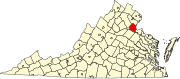 | |
| Unincorporated communities |
| |
| Footnotes | ‡This populated place also has portions in an adjacent county or counties | |